October 24, 2013
Day 21 - Fukushima
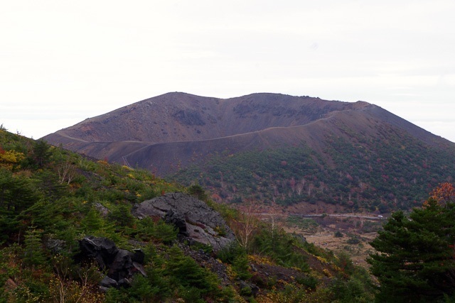
Mount Azuma (��ȎR) is a roughly 2000 meter tall volcanic mountain range northeast of Mount Bandai, along the border of Fukushima and Yamagata prefectures. It offers attractive hiking trails up to its various peaks and across breathtaking volcanic landscapes that present craters, marshlands and ponds.
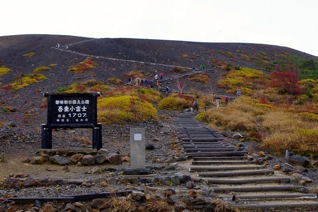
Mount Azuma's most popular hiking trails are located in the east of the mountain range. In particular, the Azuma-Kofuji peak (1707 meters), a perfectly shaped miniature edition of Mount Fuji, is the star attraction and draws many climbers from spring to autumn each year.
|
|
|
Fukushima
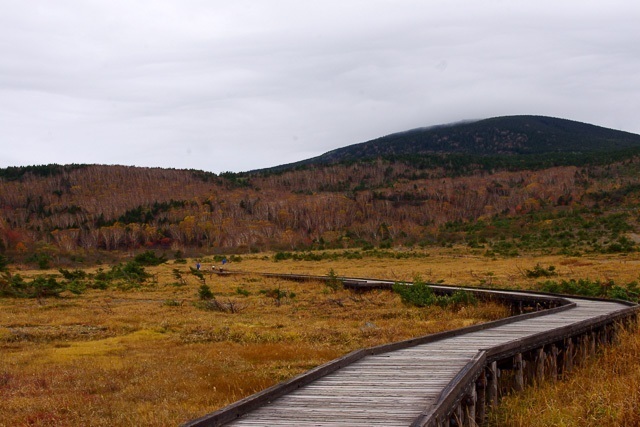 Jododaira bog Jododaira bog
This morning I woke up nice and early and had a good breakfast - although no toast - at Kirakuya ryokan and then drove with Sugimoto-san to the mountains, about an hour away from the village in which I�fm staying.
Fukushima prefecture is actually absolutely stunning. Obviously, in the Western world when you hear �gFukushima�h you instinctively cringe a bit and the last thing on anyone�fs mind is the natural beauties of this area. But yet, it�fs really beautiful. Huge forests, ski-slopes, tons of fields... It�fs really stunning.
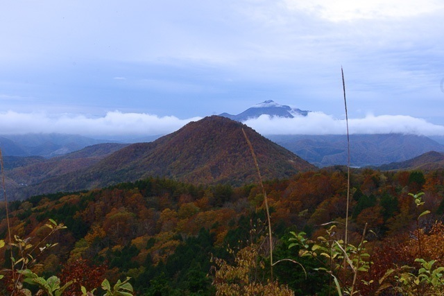 Fukushima's stunning mountains Fukushima's stunning mountains
So we drove up to about 1700m. passing beautiful autumn forests, mist drowning us from time to time, and we got to Jododaira rest house, where we parked and from there started our 4 hour walk.
First, we walked through a big bog, truly stunning because everything in it was golden or bright red. From there we went up a mountain and walked around Kamanuma, a small lake, through big grassy (or bamboo) plains that were strangely similar to those of Ireland - and sadly we also had a bit of an Irish day on the weather front. It�fs actually been raining non stop since yesterday afternoon.
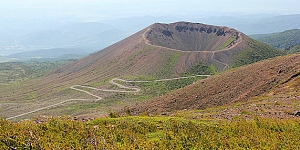
 Azuma-Kofuji crater Azuma-Kofuji crater
From there we headed back down again, on very slippery paths. So slippery in fact that I fell and hurt my ankle, but I�fm sure it�fll be fine by tomorrow.
Then we headed to the real highlight of the walk, Azuma-Kofuji crater a nearly perfectly round crater. Unfortunately the wind was very strong so we didn�ft walk all around it, but we got a fair glimpse of it, and of the beautiful valleys surrounding it.
 The path to the crater The path to the crater
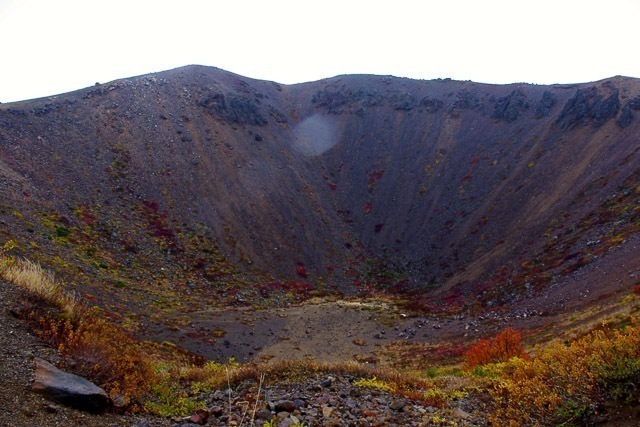 and inside it and inside it
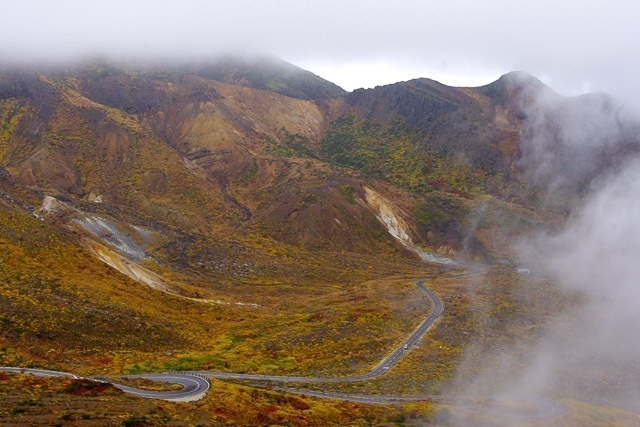 The beautiful surrounding valleys The beautiful surrounding valleys
After that, we had a lovely warm udon lunch at Jododaira rest house and headed back to town. Unfortunately since then I didn�ft do much more than rest and put ice on my ankle, although I did just come back from a great dinner here at Kirakuya ryokan and am now heading up to the 4th floor to try one of their private onsen baths.
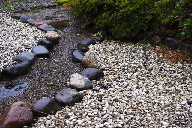 My little private garden at Kirakuya ryokan My little private garden at Kirakuya ryokan
|
Today's Walk: Through the volcanic landscapes of Mount Azuma
 Join this walk
Today's walk features fairly high altitude hiking trails, making two loops through the volcanic landscapes of the eastern Azuma mountain range. The journey goes past the beautiful Jododaira Marshlands, around the picturesque Kamanuma Pond, along nature trails that offer a plethora of mountain vegetation and brilliant scenery, and finally to the fascinating Azuma-Kofuji crater.
Join this walk
|
|
The deadline for answering the quiz question for day 21 has passed.
What is the toll fee for a regular car to drive along the Bandai Azuma Skyline?
|
0%
|
2100 yen
| |
|
44%
|
1570 yen
| |
|
3%
|
1050 yen
| |
|
0%
|
945 yen
| |
|
53%
|
None of the above
| |
|
The correct answer is: None of the above
Originally a toll road, the Bandai Auzma Skyline was turned toll free after the 3.11 earthquake and was re-classified as a regular road in July 2013. It can be used free of charge.
Current Standings: (after 30 days)
More about the quiz
|
|


|