Five years after the tsunami

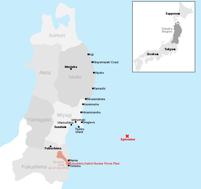
This is the tenth part of our open ended series to document the recovery of the tsunami-hit coast of northeastern Japan where nearly 20,000 people lost their lives, and entire towns were destroyed in the afternoon of March 11, 2011. Five years after the tsunami, we revisited some of the worst hit cities along the Sanriku Coast in Miyagi and Iwate Prefectures on May 25-26, 2016 and also drove down the coast of Fukushima Prefecture on May 27.
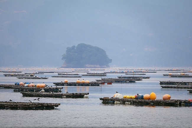
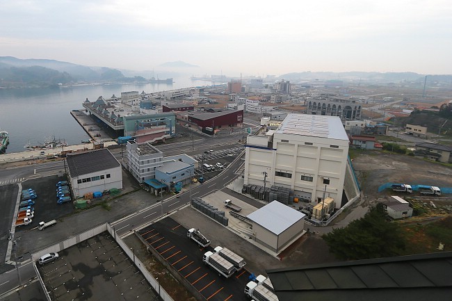
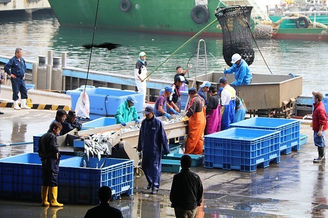
Five years after the big disaster, increasingly many new residential districts are being completed, allowing displaced people to move from their temporary housing into new permanent homes. The process of raising the elevation of several former city centers is also ongoing, and it will still take several more years until their former centers will reemerge. Because the creation of jobs is essential to keeping people in the area, the repair of fishing port facilities had been given top priority, and many fishing ports along the coast are now back in good shape and recovering relatively well.
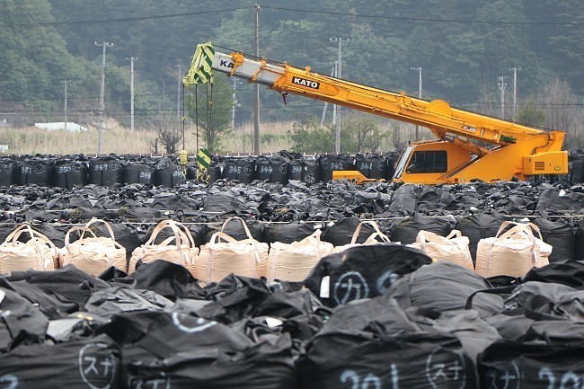
Further south in Fukushima Prefecture, it is possible to travel along the coast again. Evacuation orders are being lifted gradually for the municipalities most heavily affected by the nuclear accident, and by spring 2017, all areas except a narrow strip of particularly badly polluted land will be reopened for people to move back. Reconstruction and clean-up works are now underway inside the evacuation zone, but time appeared to have been at a stand-still for the past five years in some of the towns, creating an eerie atmosphere and bringing up memories from our first visit in April 2011.
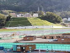
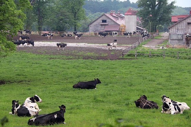
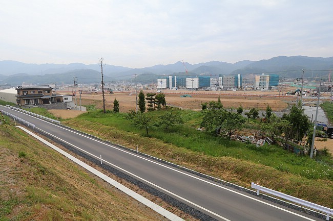
This time, we started our journey in Morioka where we made a quick visit to the Koiwai Farm before driving to the coastal town of Miyako. There we found the town's port facilities in good shape again and reconstruction works intensifying in the badly hit Kuwagasaki district.
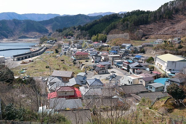
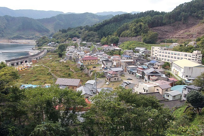
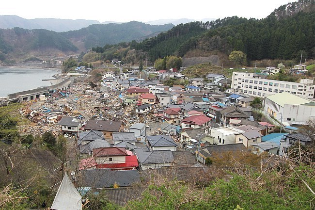
Compare: May 2016 - April 2015 - April 2014 - April 2012 - April 2011
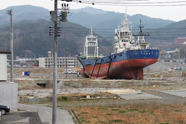
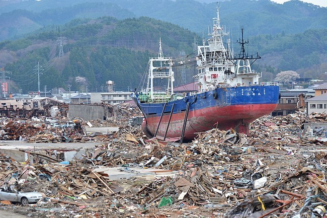
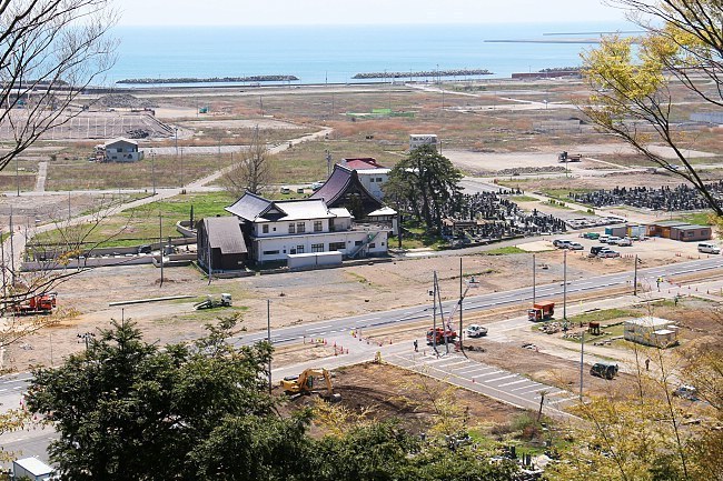
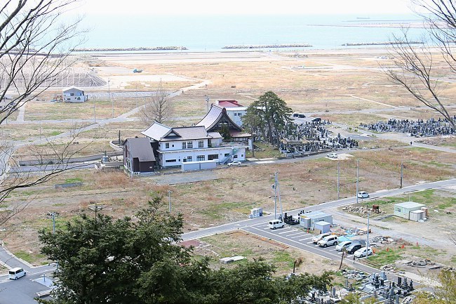
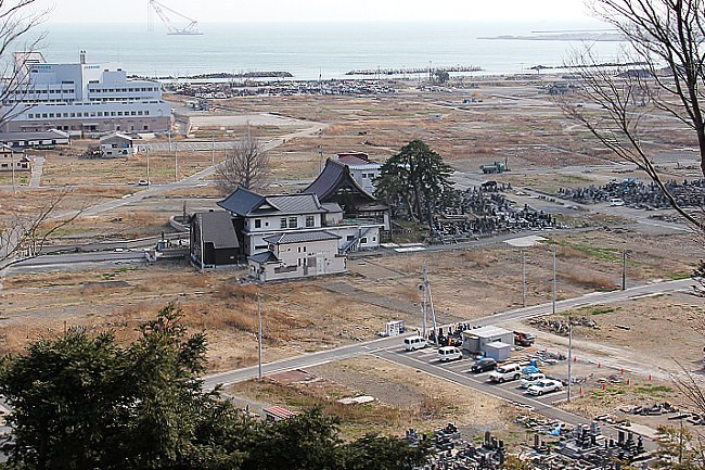
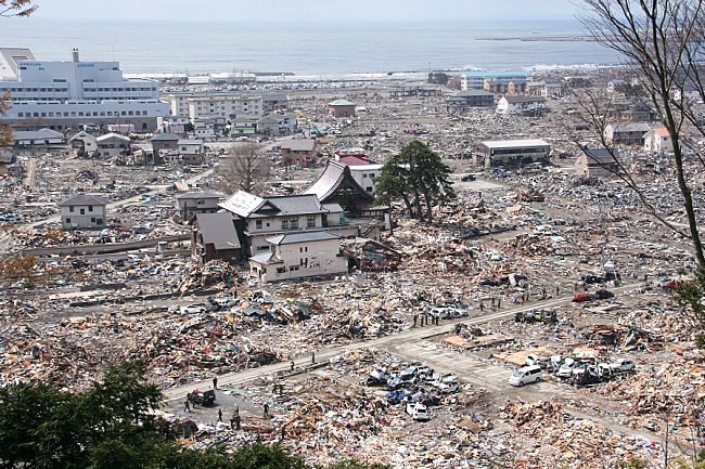
Compare: May 2016 - November 2015 - April 2014 - October 2013 - April 2011

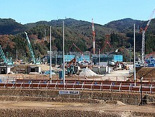
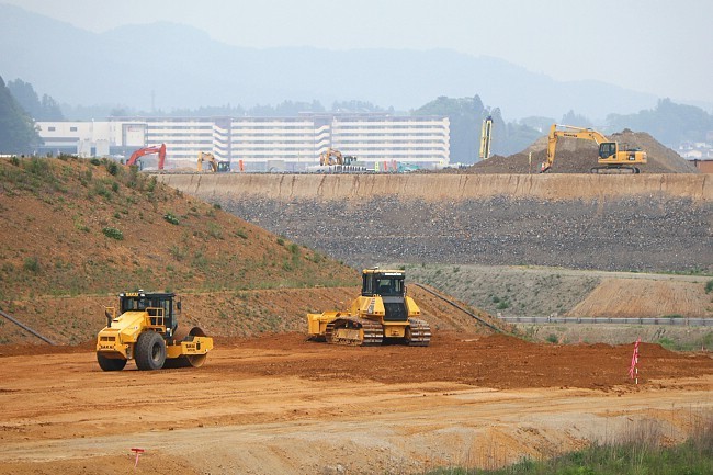
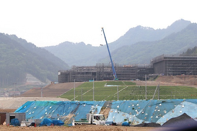
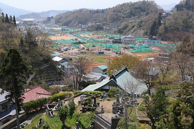
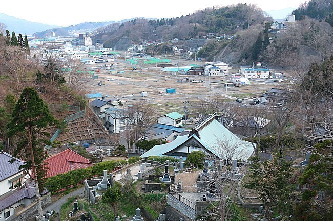
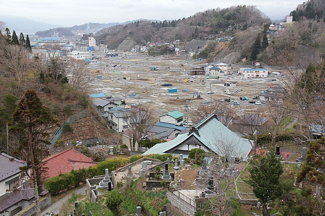
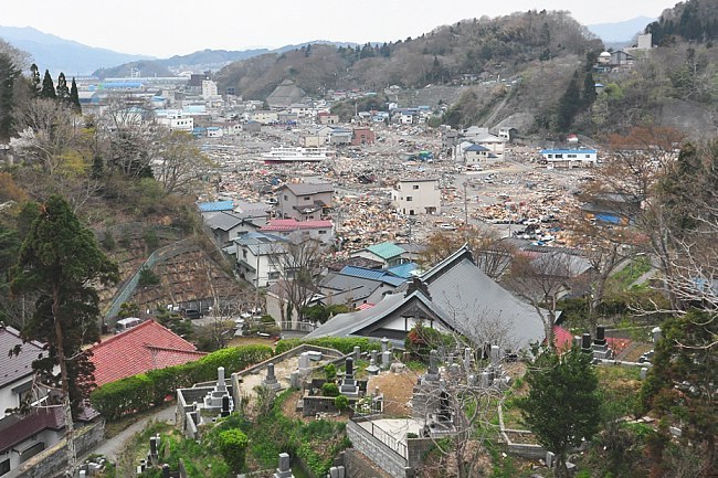
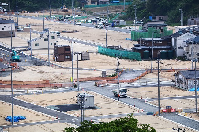
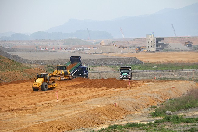
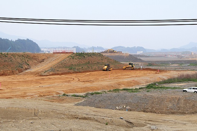
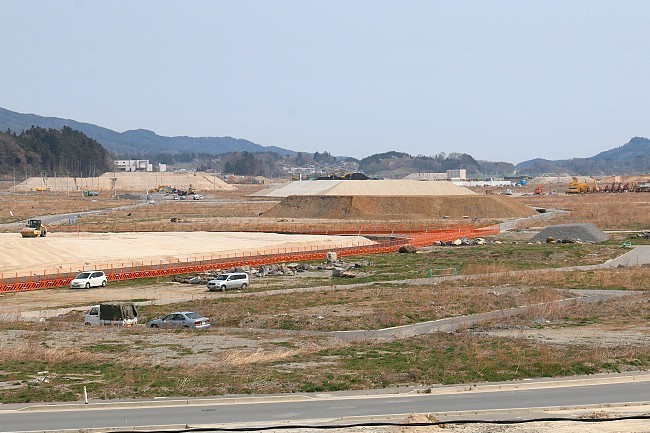
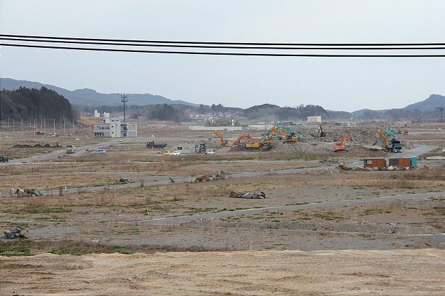
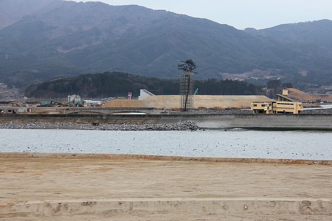
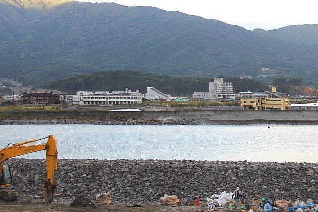
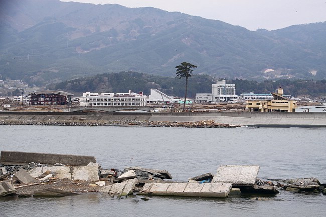
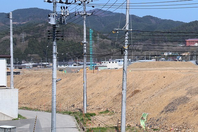
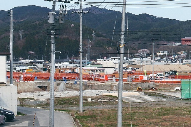
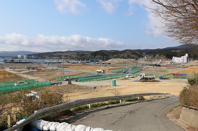
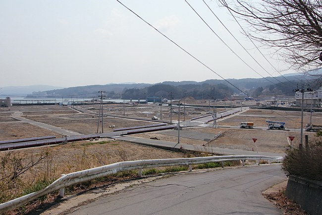
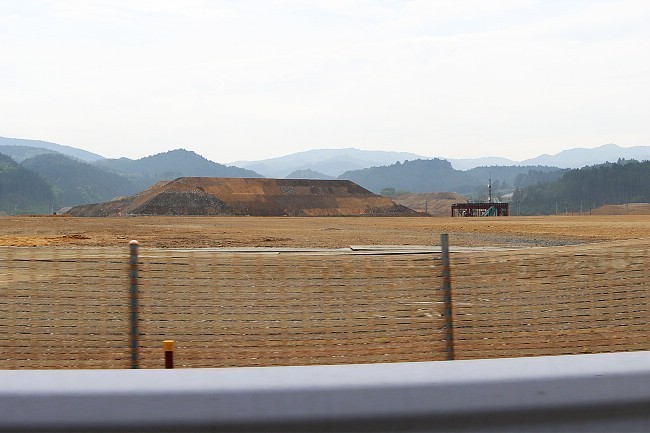
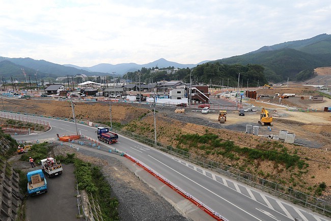
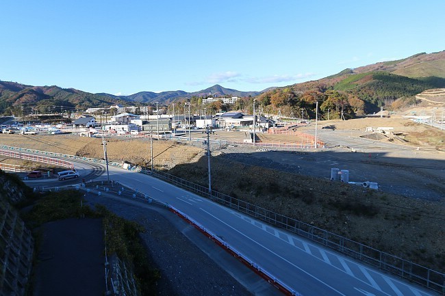
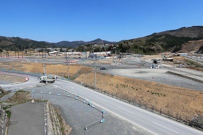
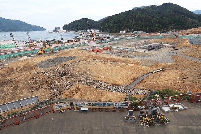
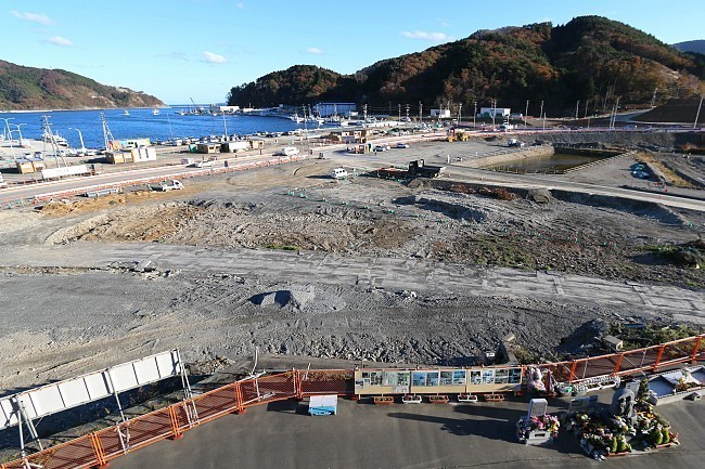
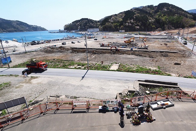
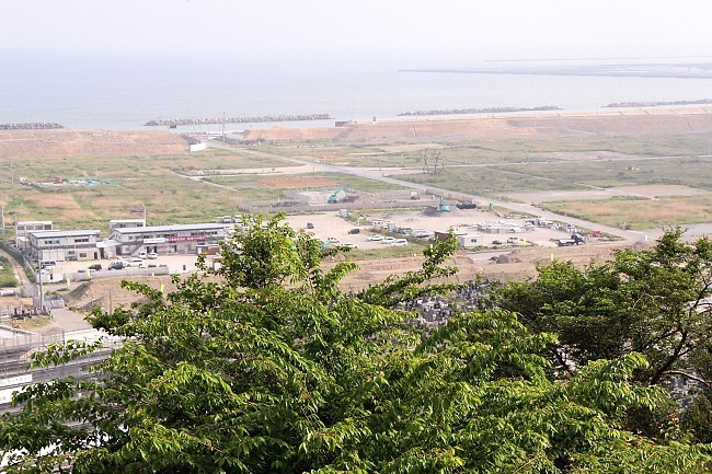
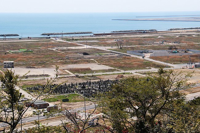
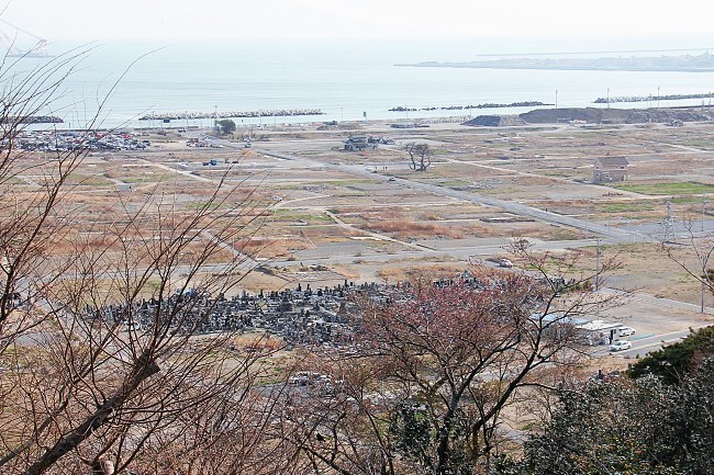
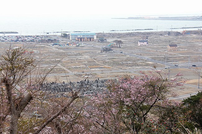
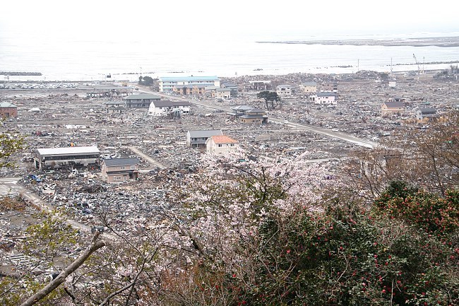
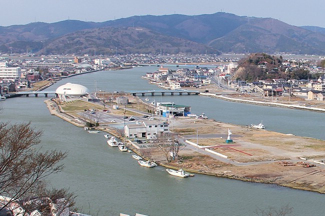
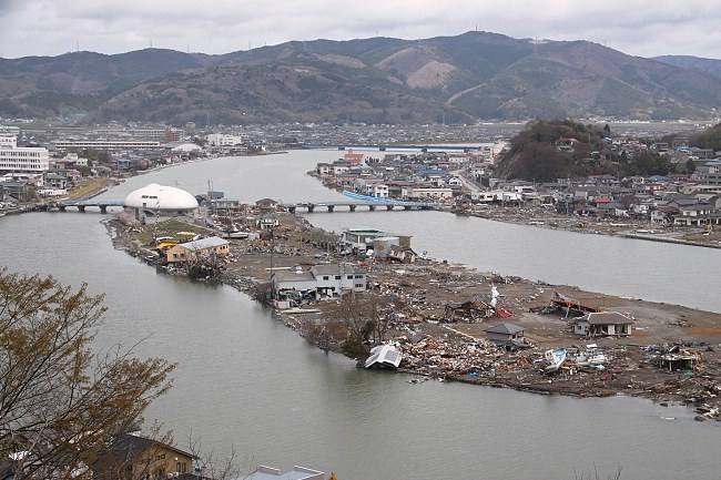
In Rikuzentakata, the seemingly endless work of raising the elevation of the former city center by several meters is still underway - now without the help of the giant conveyor belt system which has been dismantled in the meantime. Looking at the activity, it stunned me again how little the arrival of a single, large truck contributes to the enormous task.
Compare: May 2016 - April 2014 - April 2013 - April 2012
Compare: May 2016 - April 2013 - October 2012 - April 2011
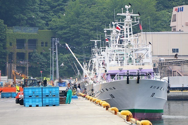
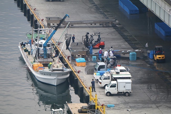
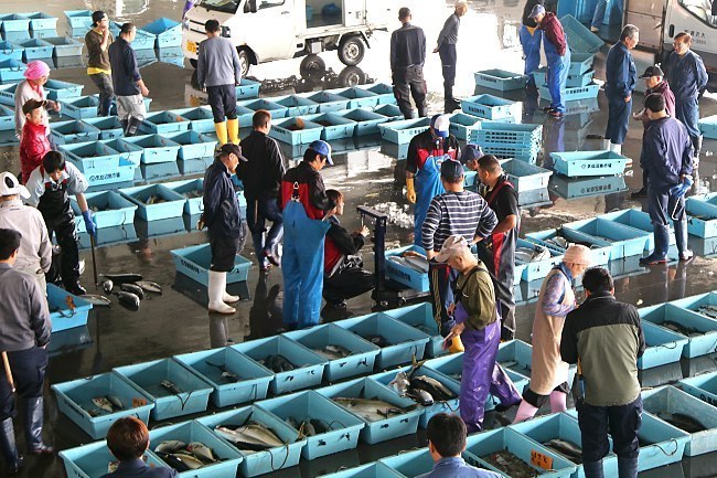
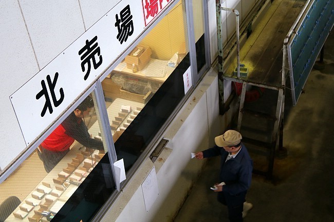
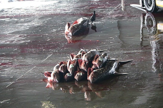
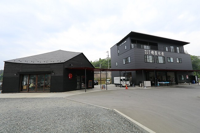
In Kesennuma we made a fascinating early-morning visit to the local fish market. Visitors can freely observe the action from a corridor on the second floor, and a kind volunteer guide approached us and explained us various interesting things about the market. Kesennuma is the most famous place in Japan for shark fins, and several sharks were among the fish sold at the market. The local industry prides itself in processing the sharks entirely (not just the fins) into various products.
Compare: May 2016 - April 2015 - April 2014 - April 2013 - April 2011
Afterwards, I enjoyed a cappuccino at K-Port, a cafe right next to the port of Kesennuma. The cafe was built by actor Watanabe Ken who is not a local of Kesennuma but visited the town with the intention of supporting the tsunami-hit coast. Several photos of Watanabe decorate the cafe, and visitors can also read the fax messages that the actor is transmitting almost daily. If your timing is perfect, he may even be standing behind the counter during his occasional visits to Kesennuma.

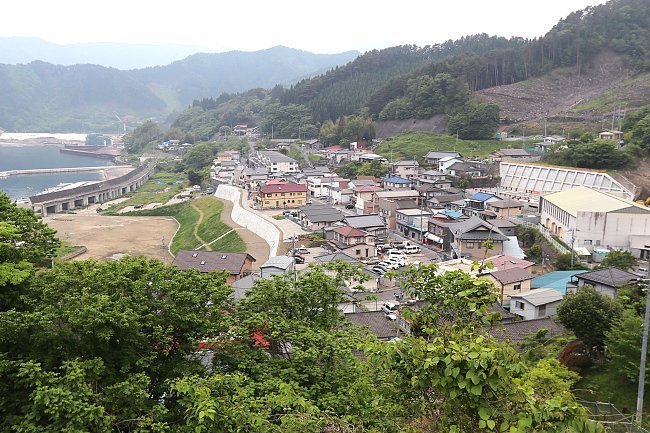
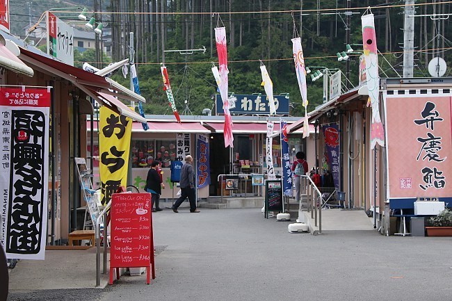
Minamisanriku's terrain and road network keep changing drastically with each visit. The Former Crisis Management Center is gradually disappearing in between the newly elevated terrain surrounding it. At the temporarily constructed Sun Sun Shopping Village we enjoyed an extraordinarily good seafood lunch in a packed restaurant.
Compare: May 2016 - April 2015 - April 2014 - April 2013 - April 2011

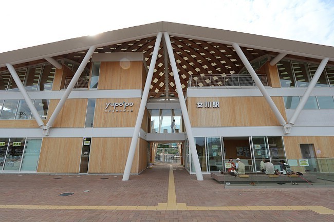
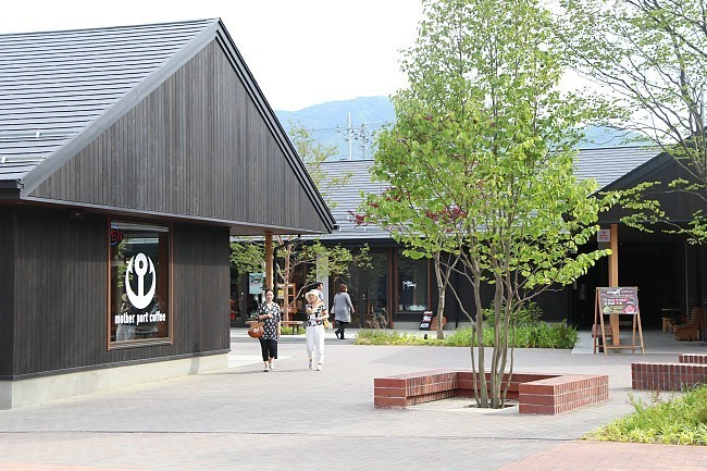
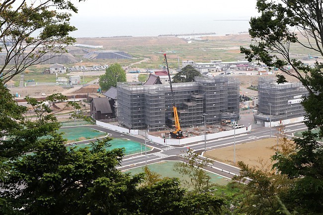
Onagawa is the first among the heavily hit coastal towns where a newly built town center is emerging. The 200 meter long mall leading to Onagawa Station was opened last December and offers pleasant shopping and dining opportunities.
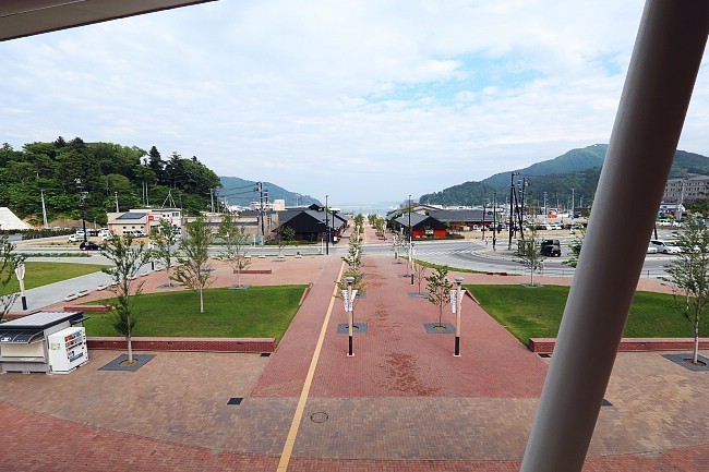
Compare: May 2016 - November 2015 - April 2015
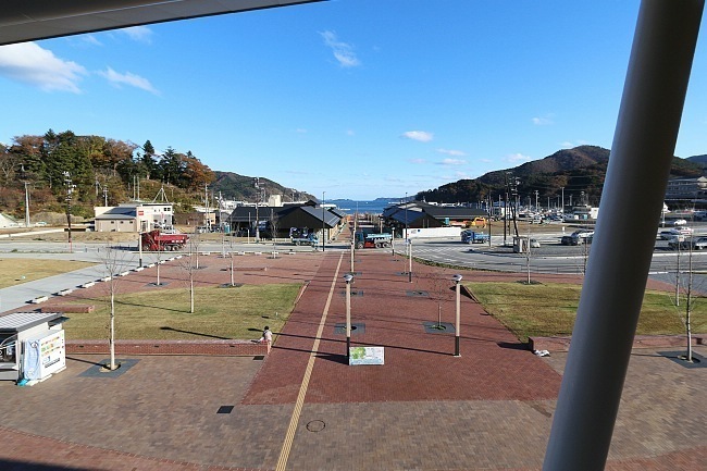
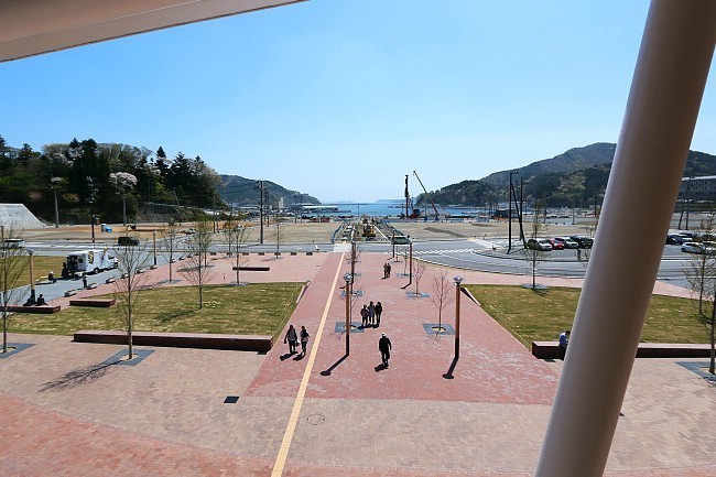
Compare: May 2016 - November 2015 - April 2015
Compare: May 2016 - November 2015 - April 2015
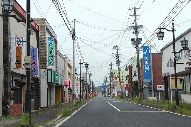
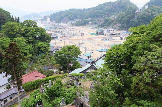
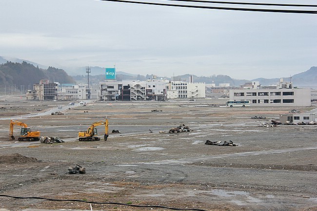
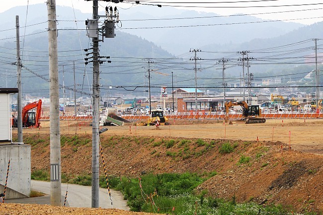
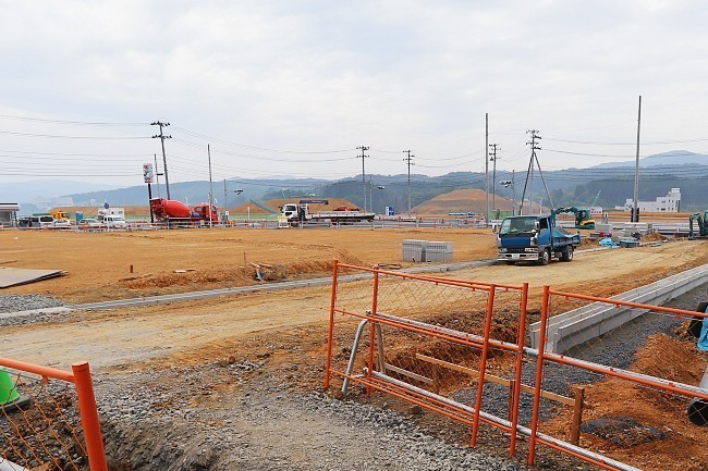
In nearby Ishinomaki, construction work has started in the most badly hit, coastal zone of the city where very little change had been visible for the previous three years.
Compare: May 2016 - April 2015 - April 2014 - April 2013 - April 2011
Compare: May 2016 - April 2015 - April 2013 - April 2012 - April 2011
Compare: May 2016 - April 2015 - April 2014 - April 2013 - April 2011
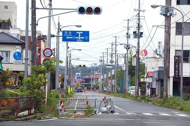
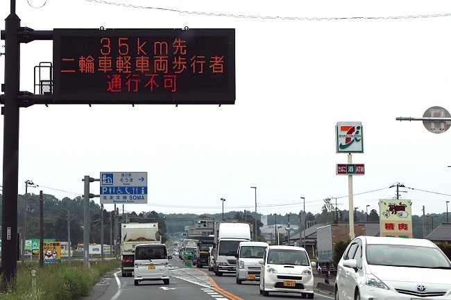
This time, we ventured south of Sendai, following the coast through Fukushima Prefecture to Iwaki. Unlike the Sanriku Coast, the coast south of Sendai is much less rugged and steep. Instead, it offers a lot more farm land, and the direct damage by the tsunami on the coastal towns was less destructive than further north. However, the area suffered tremendous damage from the nuclear accident at the Fukushima Daiichi Plant.
At the time of this writing, an approximately 25 kilometer wide evacuation zone was still in effect along the coast. Nevertheless, National Route 4 and the Joban Expressway, which lead through the evacuation zone, were fully opened in late 2014 and early 2015 respectively to allow for easier transportation along the coast.
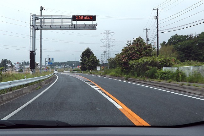
We drove along National Route 4 which approaches the crippled nuclear power plant to a distance of less than two kilometers. Signs in the vicinity displayed radiation levels of around three microsieverts/hour which is roughly four times lower than the radiation levels that travelers are exposed on board of an airplane at cruising altitude.

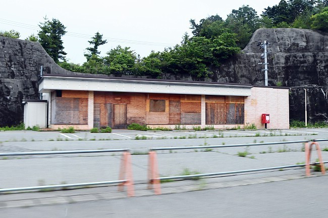
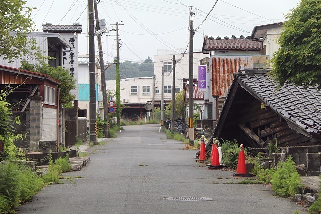
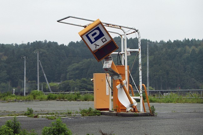
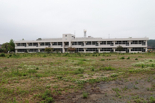
We visited the towns of Namie and Tomioka whose centers are still within the evacuation zone, but are freely accessible to the public (except for overnight stays). Thanks to the natural decrease in radioactivity and clean-up efforts, radiation levels in the towns have fallen to levels not much different from natural levels, and the evacuation order is expected to be fully lifted by next spring. Work is ongoing in restoring the area's infrastructure, but vegetation has taken over gardens and walkways, and many buildings damaged by the earthquake still remain in their dilapidated states.