Seven years after the tsunami

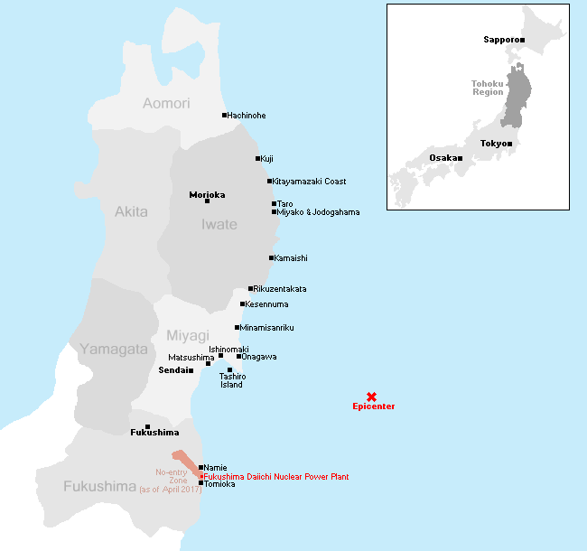
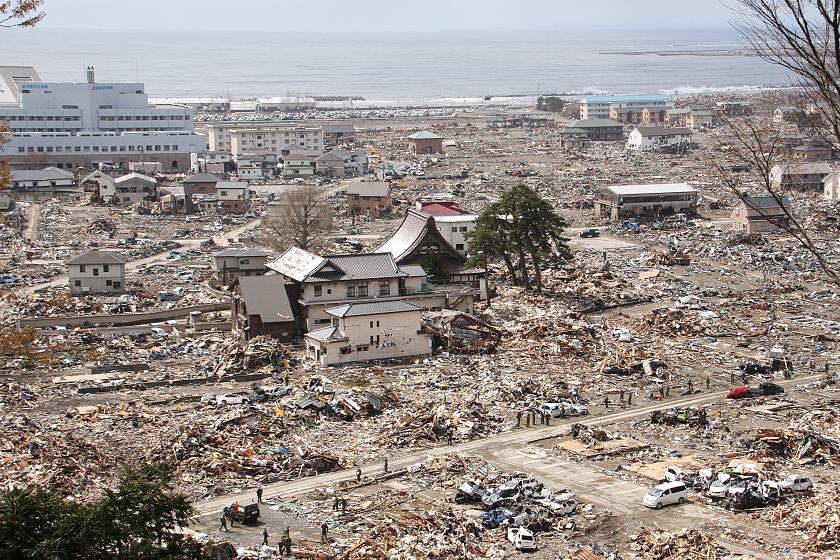
This is the 14th part of our open-ended series to document the recovery of the tsunami-hit coast of northeastern Japan where nearly 20,000 people lost their lives, and entire towns were destroyed in the afternoon of March 11, 2011. Seven years after the tsunami, we revisited some of the worst-hit cities along the Sanriku Coast in Miyagi and Iwate prefectures and also drove down the coast of Fukushima Prefecture on April 24-26, 2018.
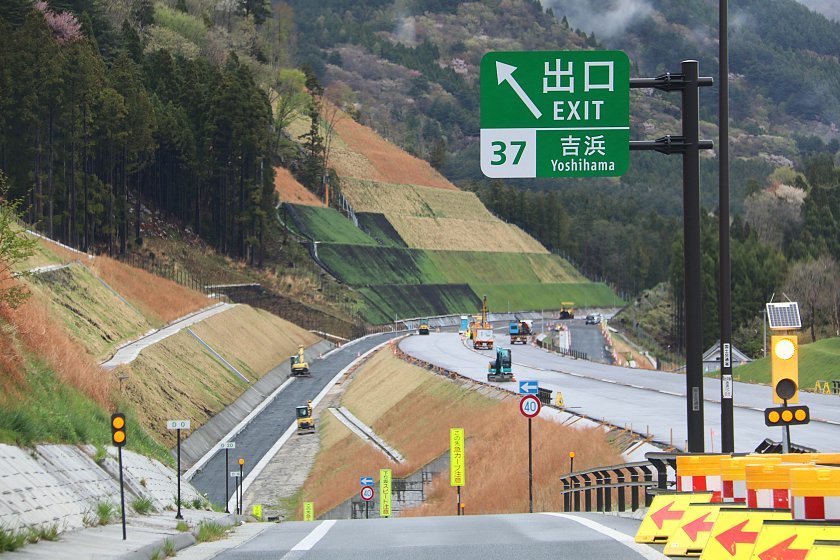
On our 3-day trip we witnessed much progress in the recovery efforts along the coast, as devastated town districts have been coming to life again and even the worst-hit city centers, whose ground levels have been raised by many meters over the past years, are nearing readiness for redevelopment. The progress can be felt particularly well by car travelers, as newly completed sections of the Sanriku Expressway have been opening one after the other, accelerating travel to and along the coast.
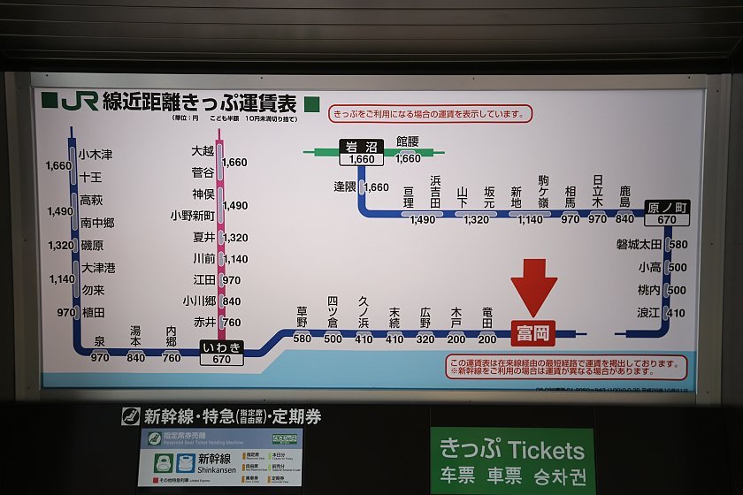
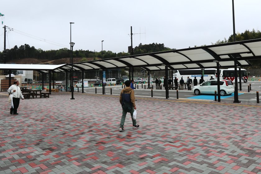
We started our journey in the south and first stopped in Tomioka Town in Fukushima Prefecture. Tomioka's town center was part of the no-entry zone around the Fukushima Daiichi nuclear plant until the evacuation order was lifted in spring 2017. Since our last visit a year ago, the train station and school have reopened, but most former residents have yet to return.
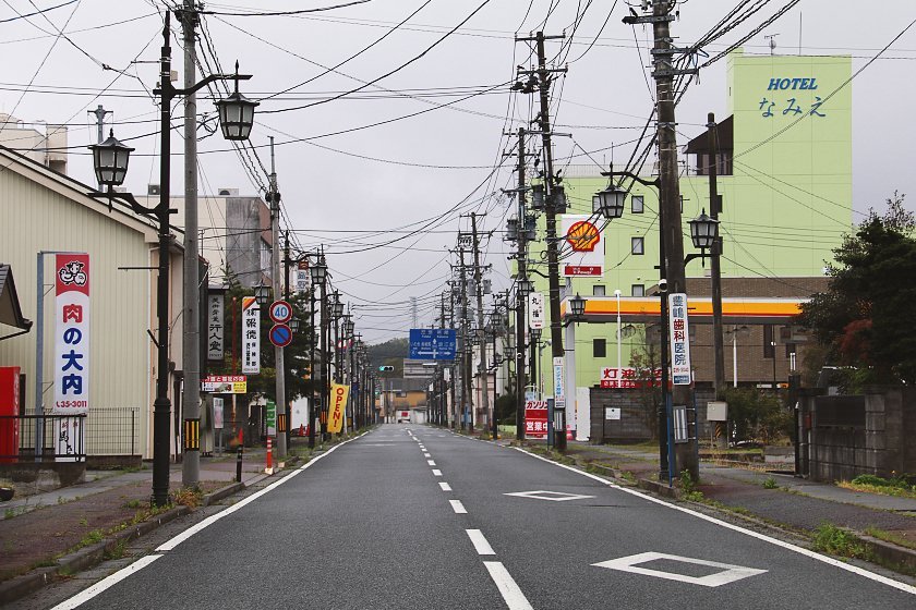
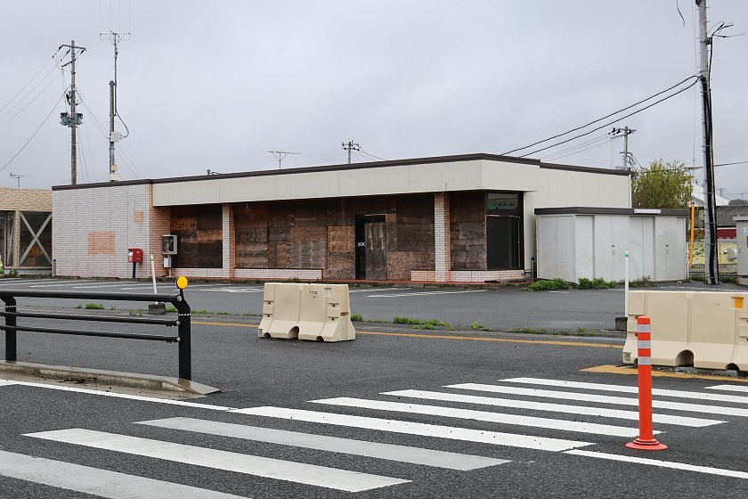
We then proceeded north, driving along National Route No. 6 through the no-entry zone, until we reached Namie Town on the other side. Namie's town center, too, was inside the no-entry zone until spring 2017. Today, it still felt deserted as only a small percentage of residents have returned so far and only a fraction of former local shops and businesses have reopened.
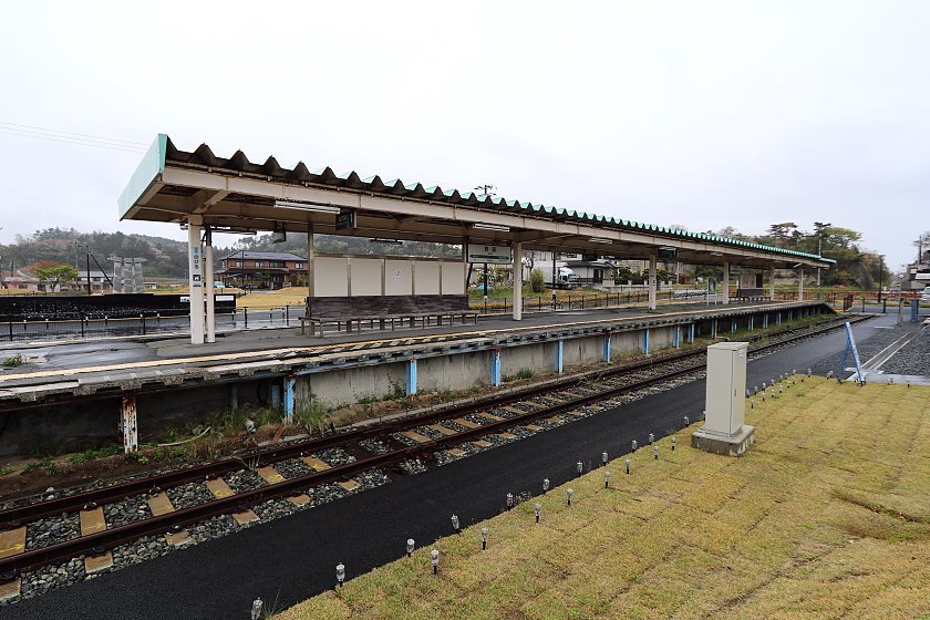
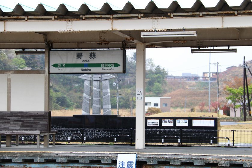
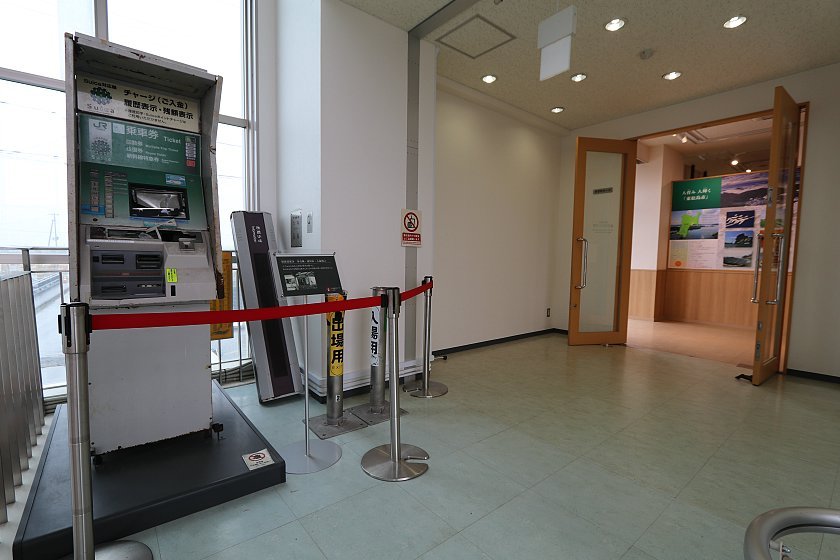
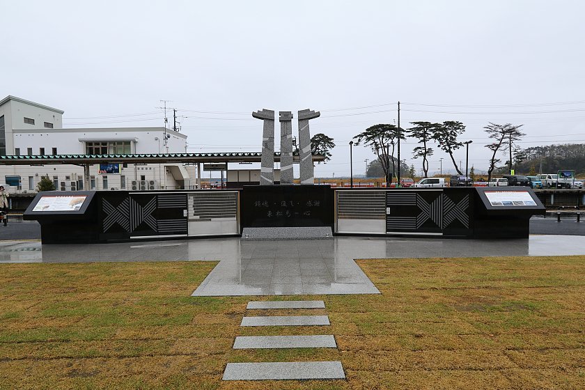
Our next stop was the former Nobiru Station west of Matsushima in Miyagi Prefecture. The station was hit by the tsunami, and the train line - the JR Senseki Line - has since been relocated further inland, but the former station building and platform have been preserved. A small memorial museum was recently opened on the second floor of the building, while a convenience store and tourist information desk are found on the first floor. Next to the station, a small memorial park was built to commemorate the many victims in the area.
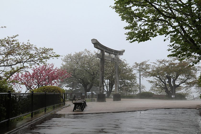
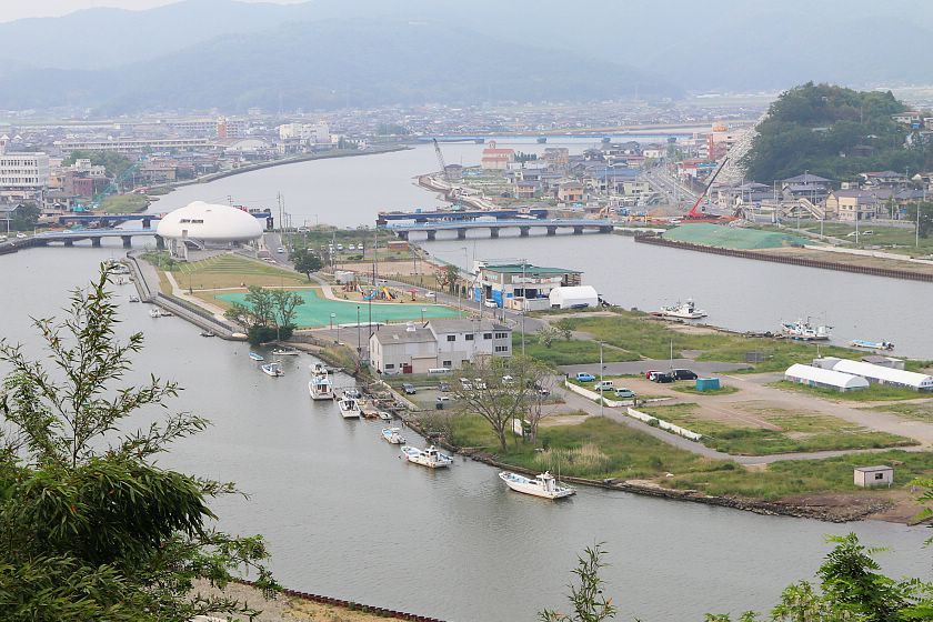
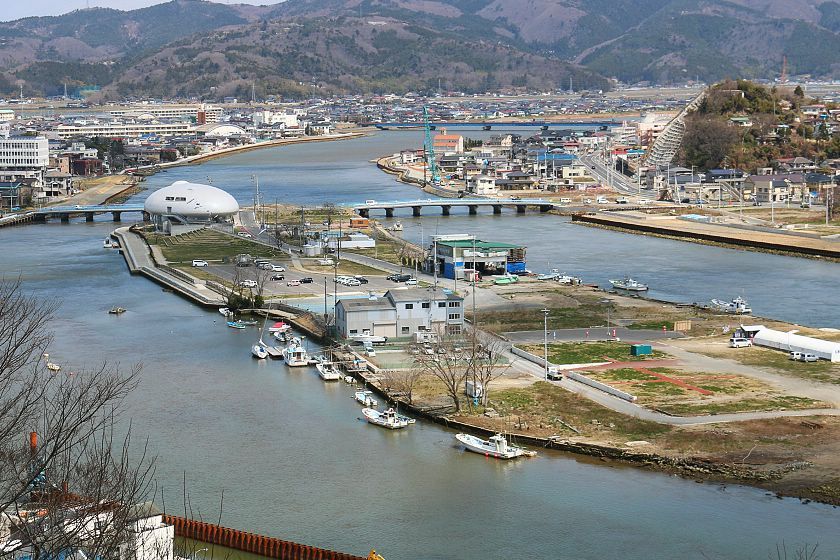
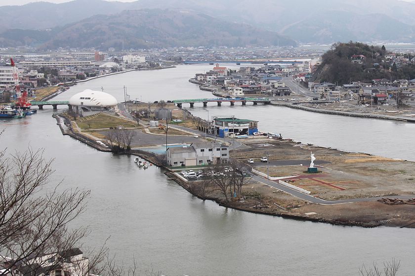
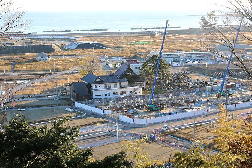
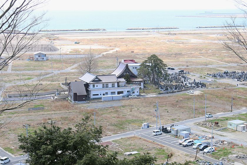
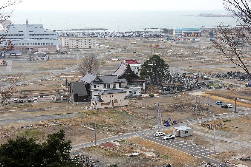
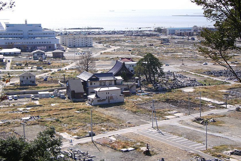
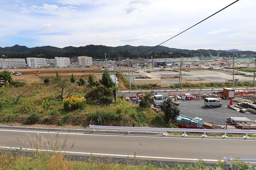
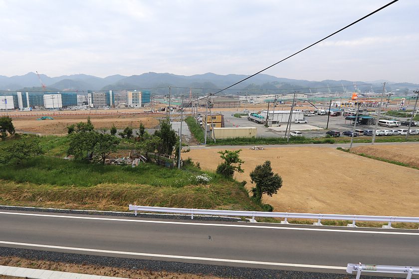
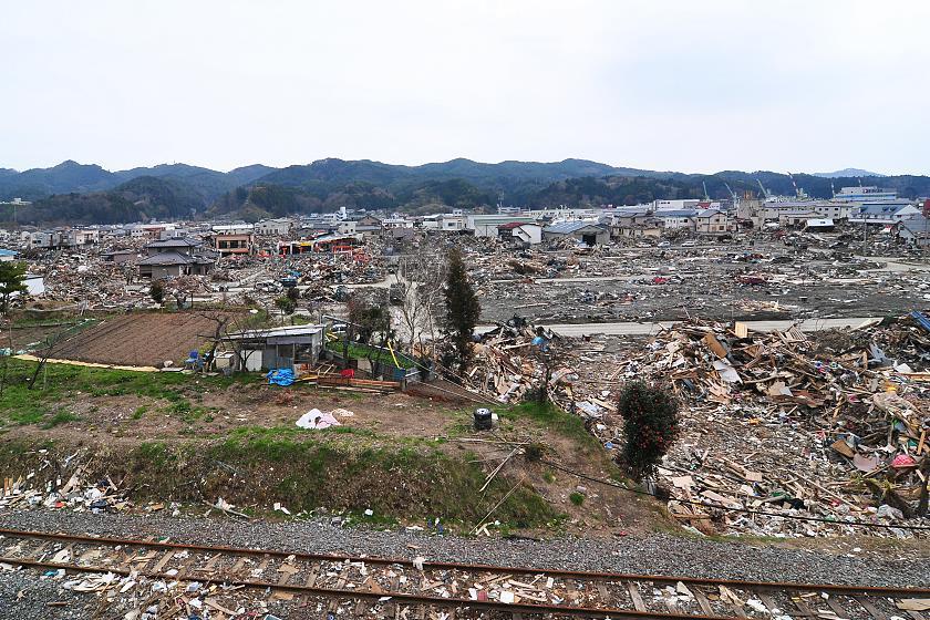
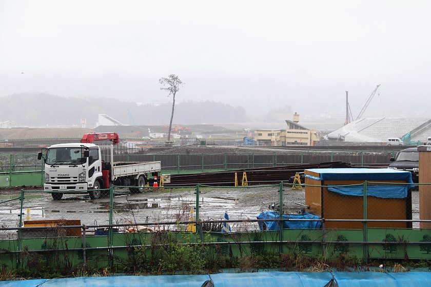
In Ishinomaki we visited Hiyoriyama Park where we encountered rainy weather for the first time in 14 visits. Several residential apartment buildings have risen in the coastal district below the hilltop park.
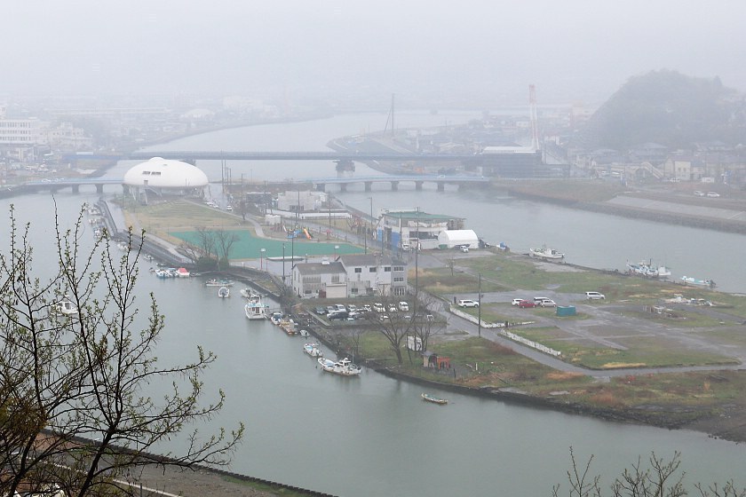
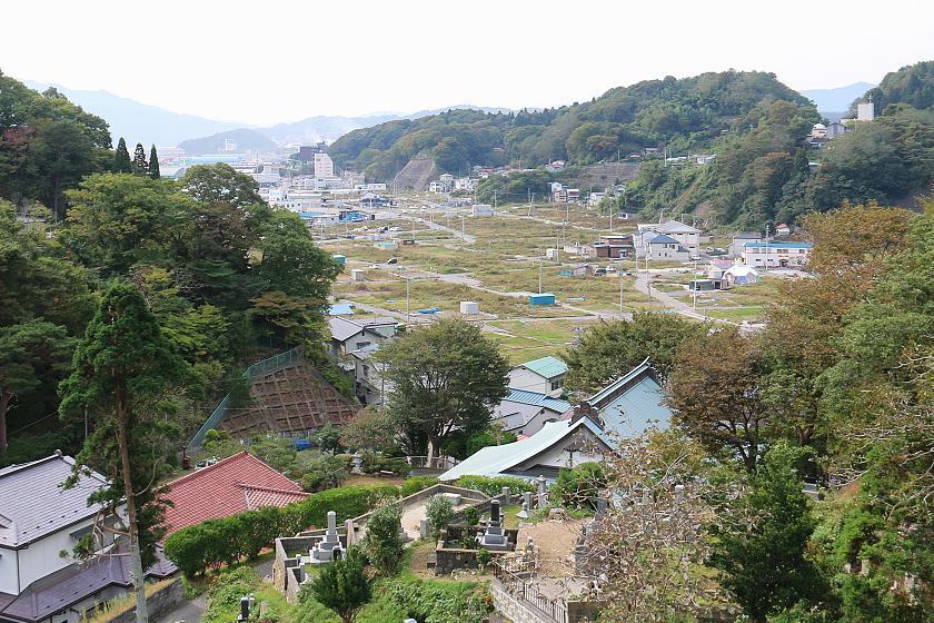
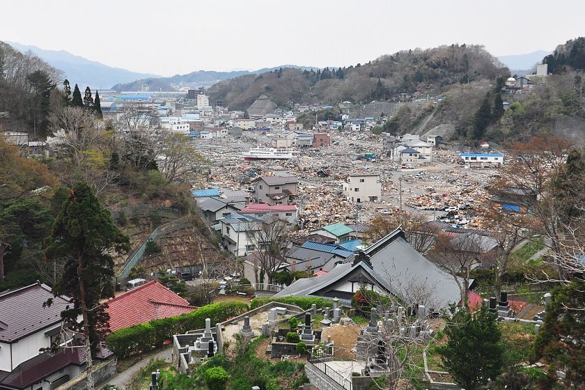
Compare: Apr 2018 - Apr 2017 - May 2016 - Apr 2014 - Apr 2012 - Apr 2011


Compare: Apr 2018 - Apr 2017 - May 2016 - Nov 2015 - Apr 2014 - Apr 2012 - Oct 2011 - Apr 2011
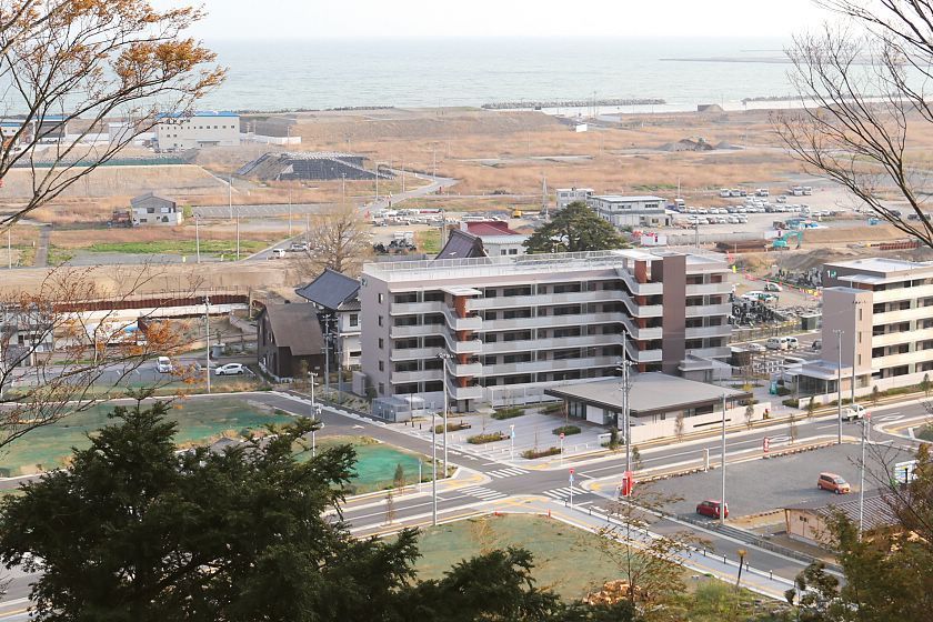
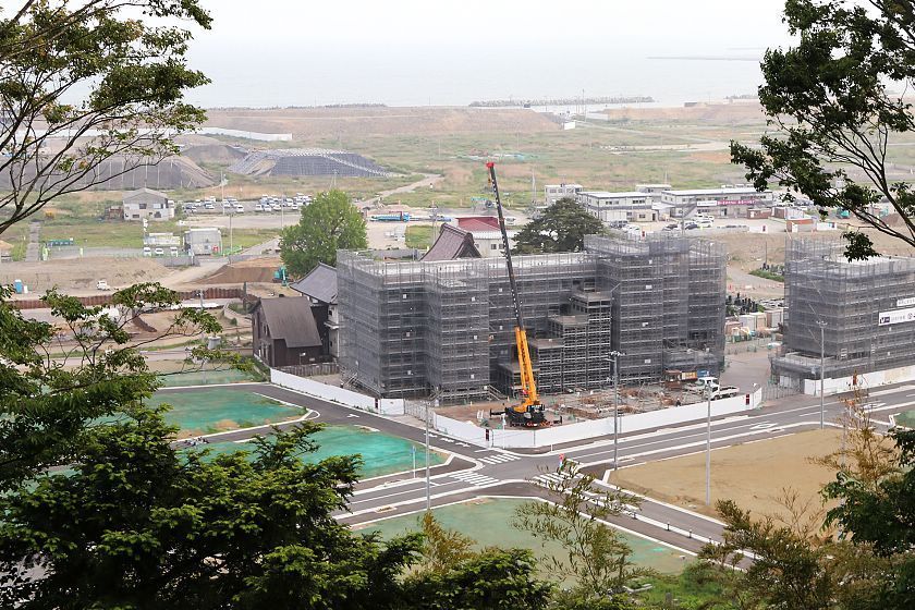
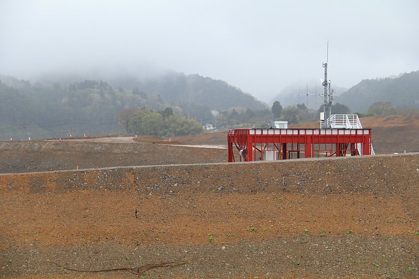
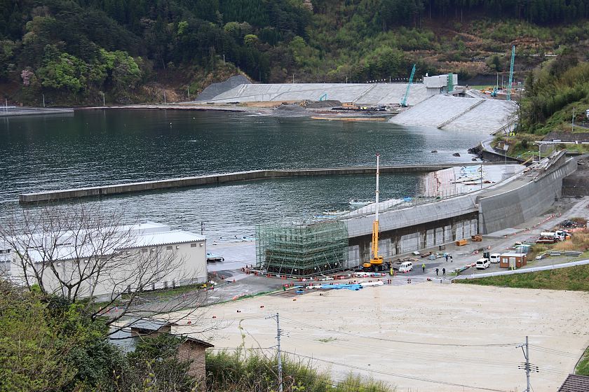
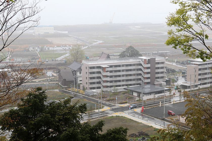
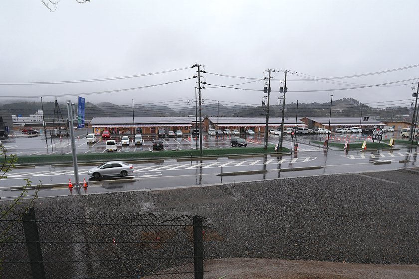
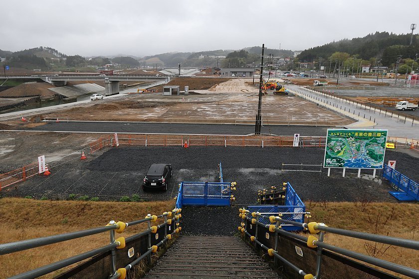
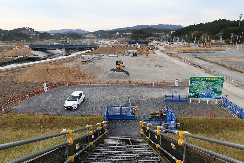
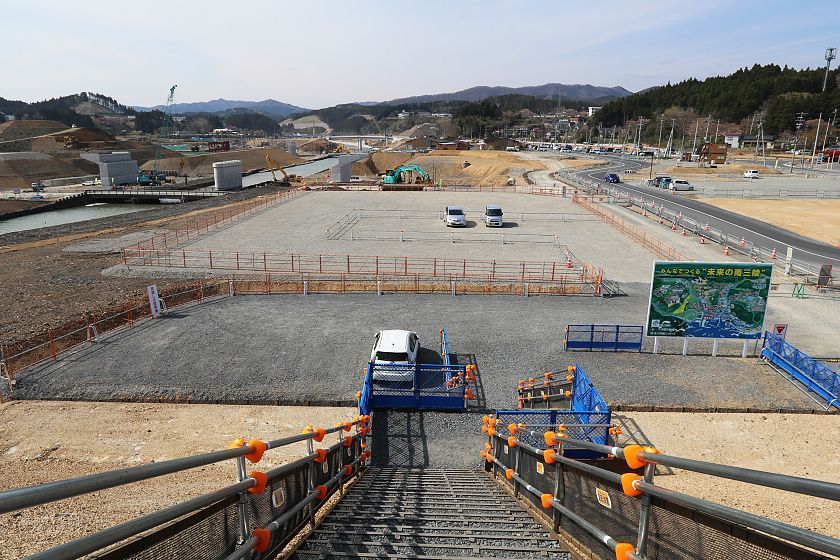
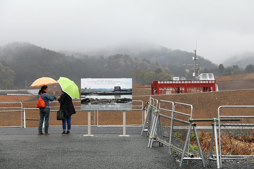
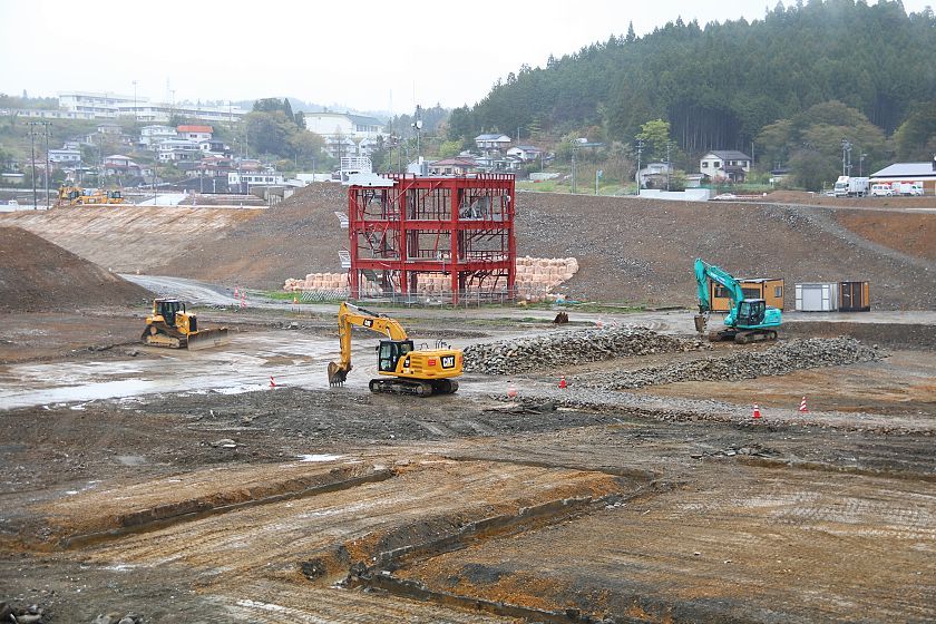
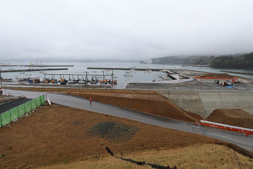
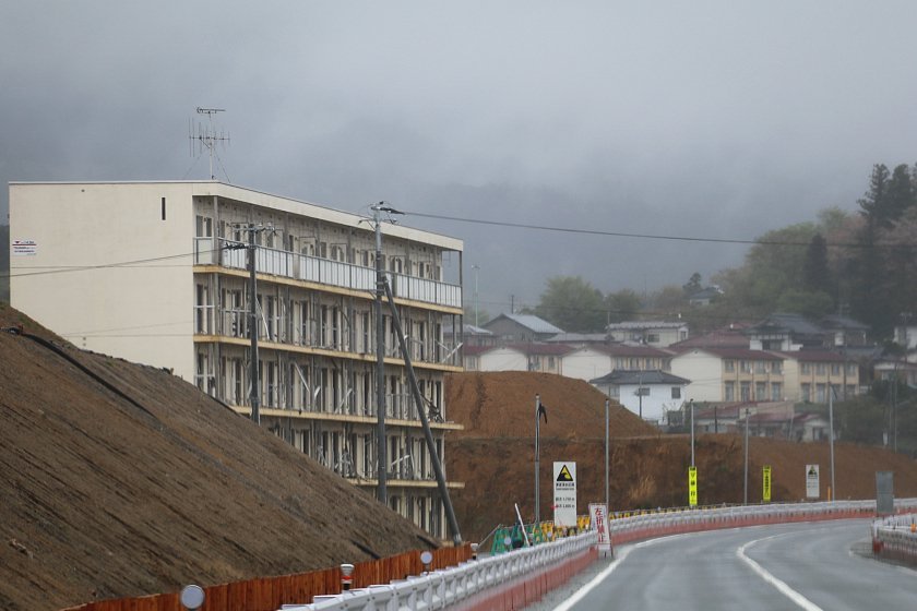
We spent the first night of our trip in Minamisanriku where a new bridge was recently opened in the town center, improving the flow of traffic through the town. The new road also allows for views onto the former Crisis Management Center which has been difficult to view in recent years. The ruined center had gradually disappeared among the tall mountains of soil that have elevated the former town center by over ten meters for better protection from future tsunami. Around the center, a memorial park is scheduled to open around autumn 2020.
Compare: Apr 2018 - Apr 2011

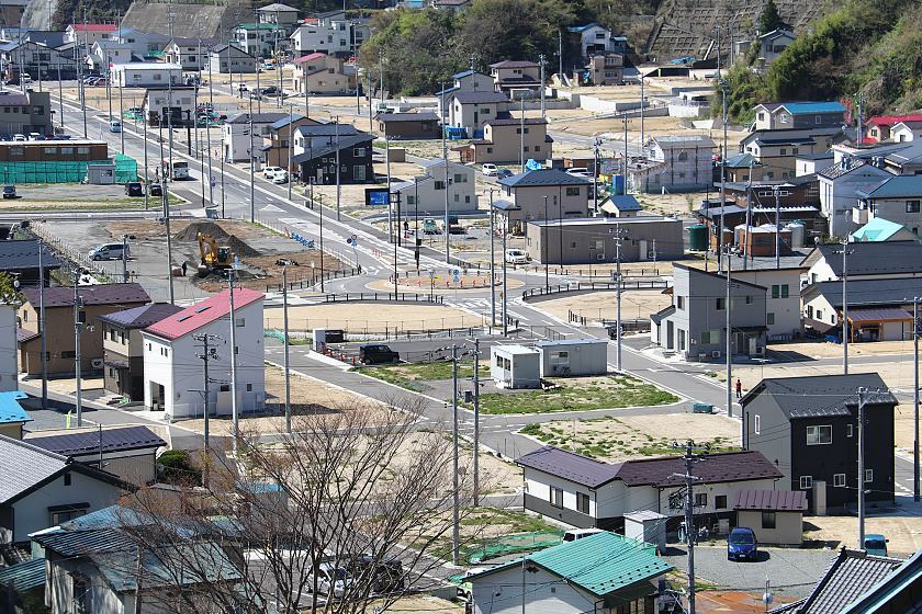
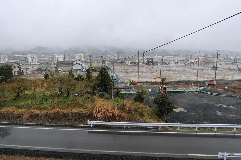
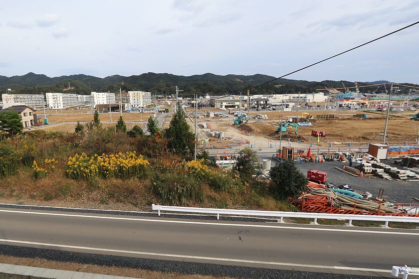
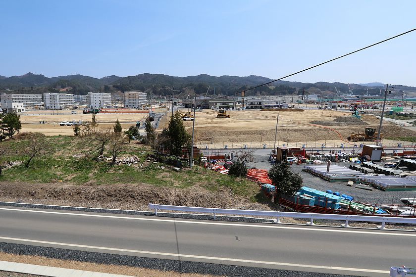
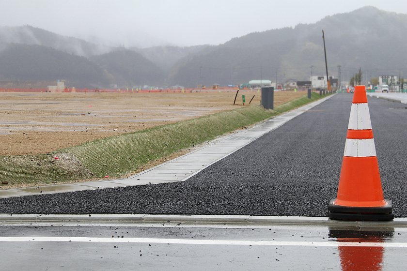
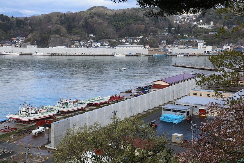
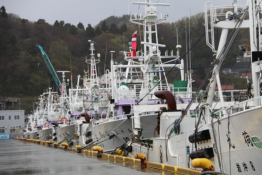
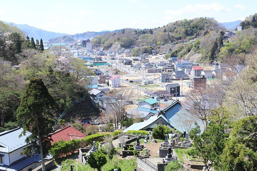
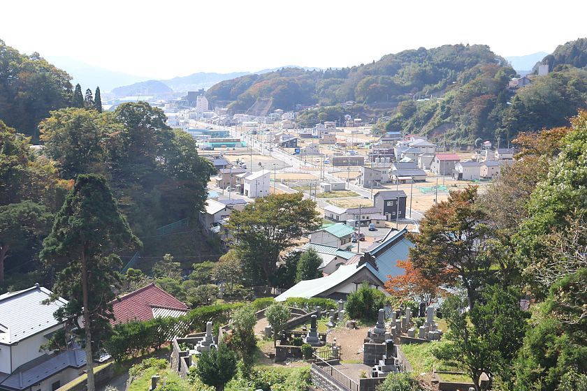
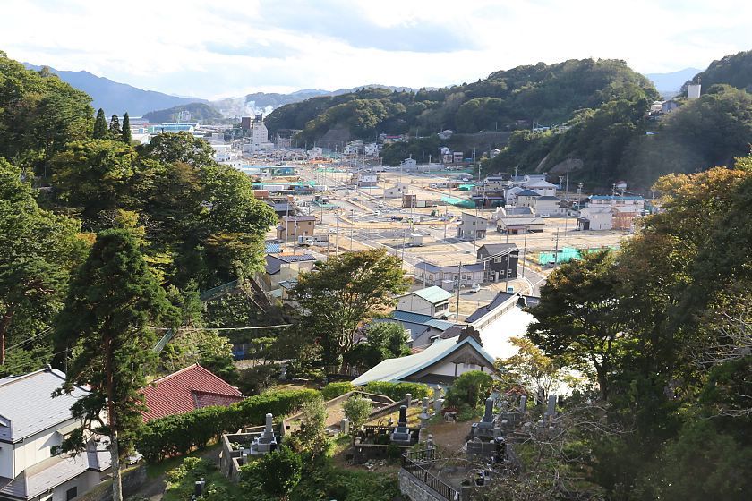
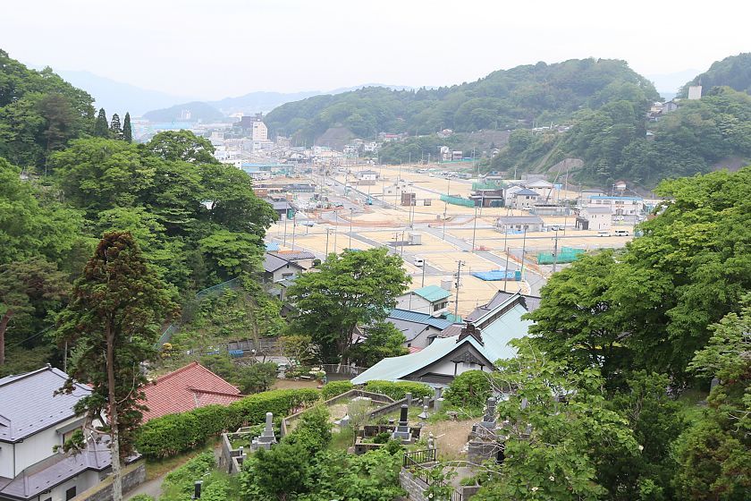
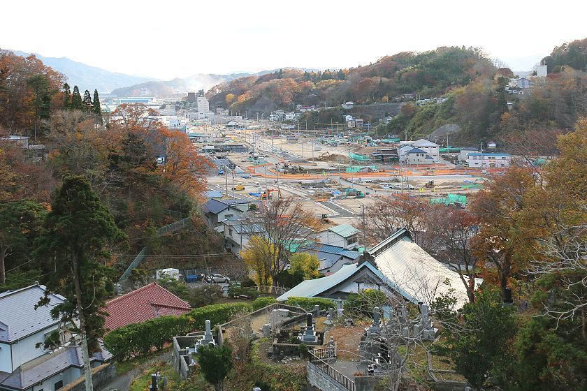
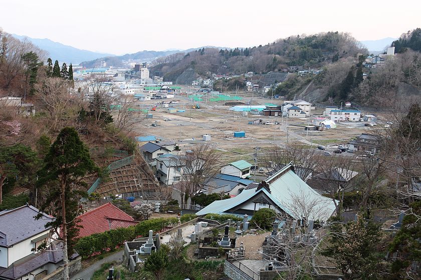
In Kesennuma, the heavily damaged Shishiori district is gradually turning busy again, while wide areas of elevated land are getting ready for redevelopment in Rikuzentakata's former city center.
Compare: Apr 2018 - Oct 2017 - Apr 2017 - Oct 2016 - May 2016 - Apr 2011
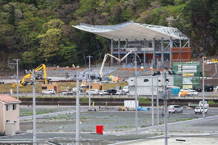
Kamaishi's Unojuku district is getting ready to serve as a venue for the upcoming Rugby World Cup 2019. The new rugby stadium, the Kamaishi Recovery Memorial Stadium, is taking shape, and railway service is scheduled to return to the district next spring.
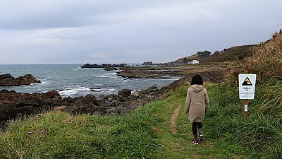
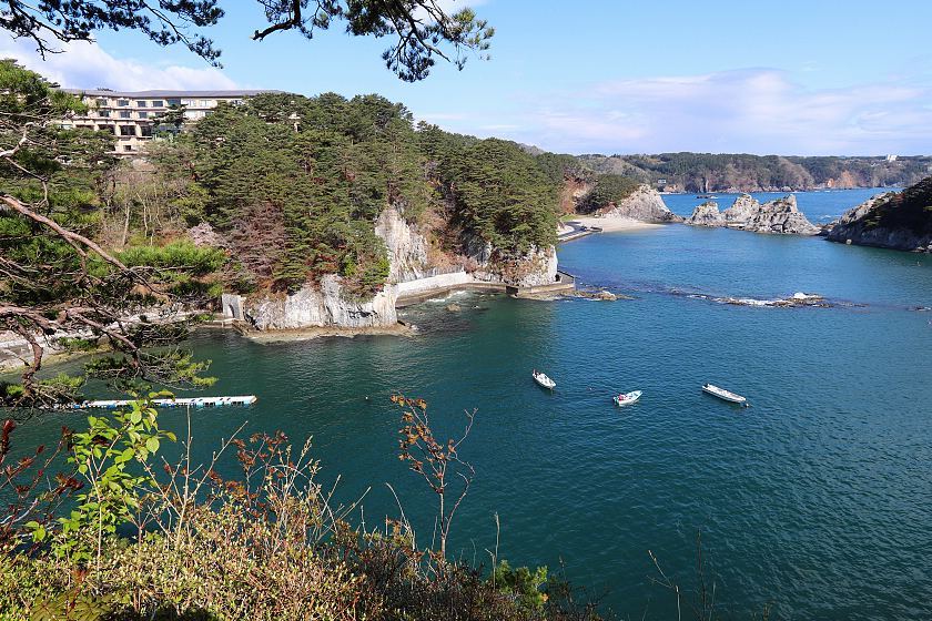
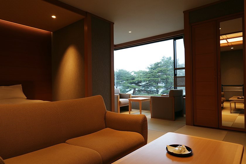
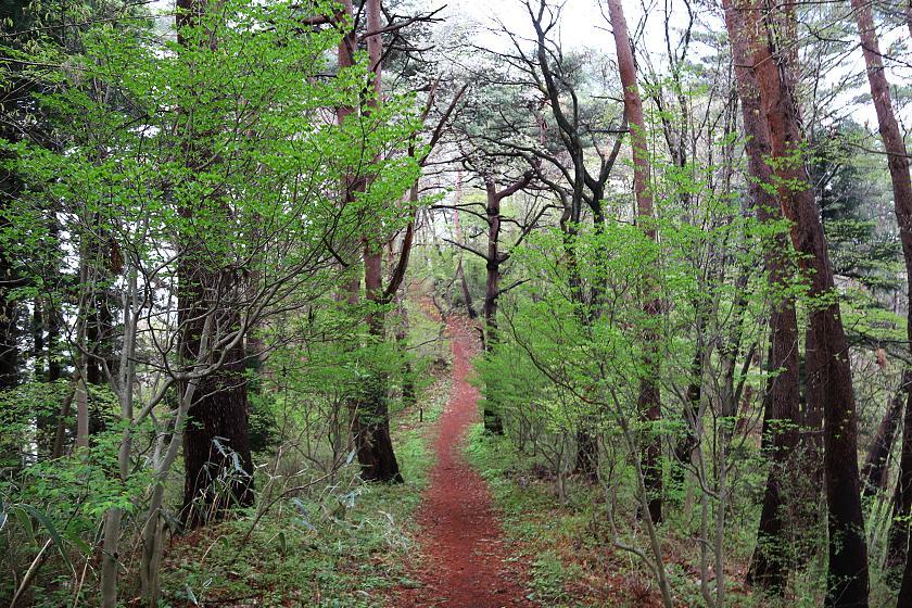
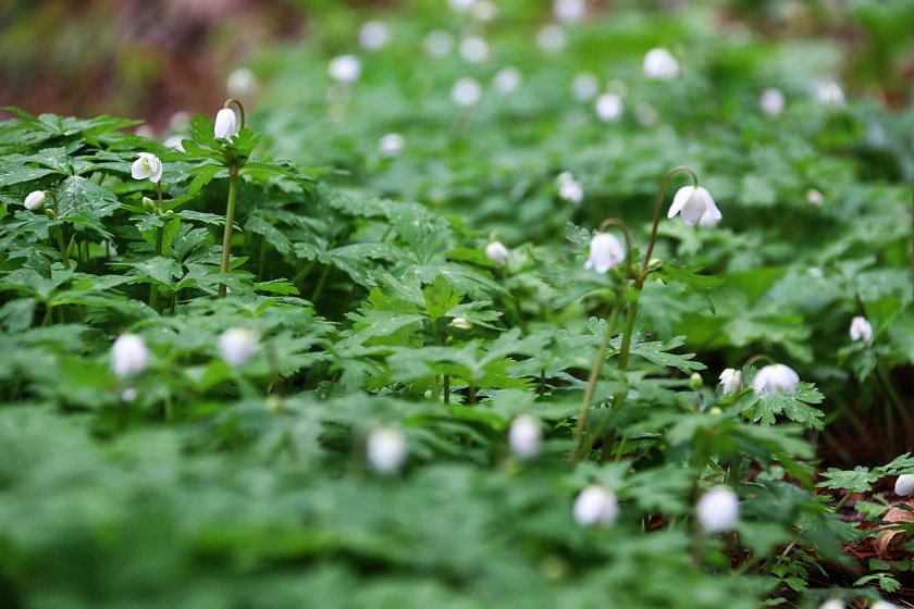
We spent the second night of our trip at Jodogahama in Miyako City where we stayed again at one of my favorite hotels, the pine-tree-surrounded Park Hotel Jodogahama. On the morning of the third day, we enjoyed a pleasant walk through the area's coastal forests.
Compare: Apr 2018 - Oct 2017 - Oct 2016 - May 2016 - Nov 2015 - Apr 2014 - Oct 2013 - Apr 2011
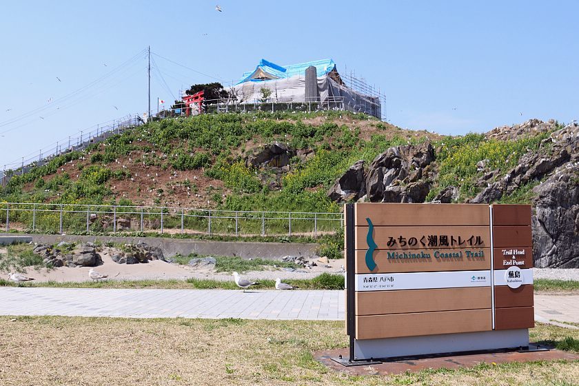
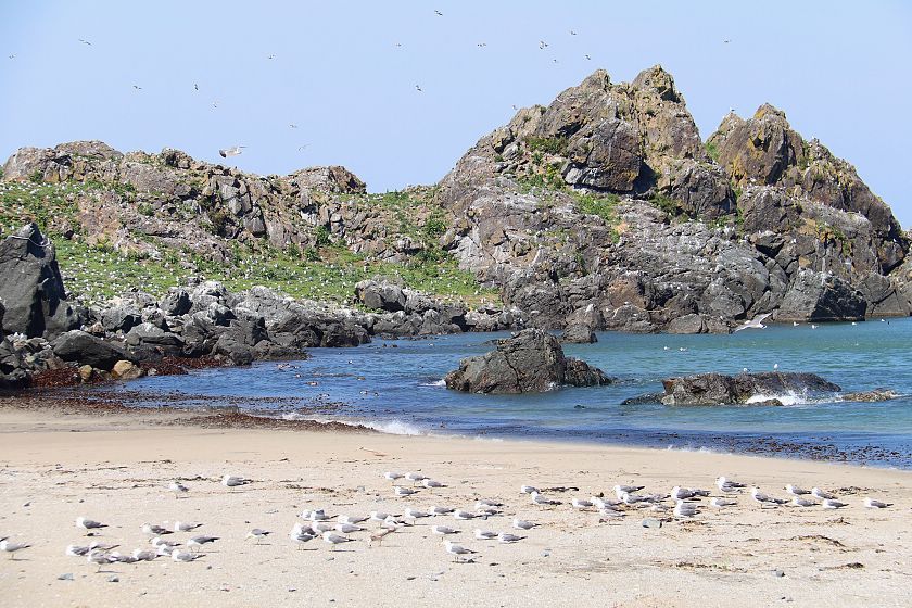
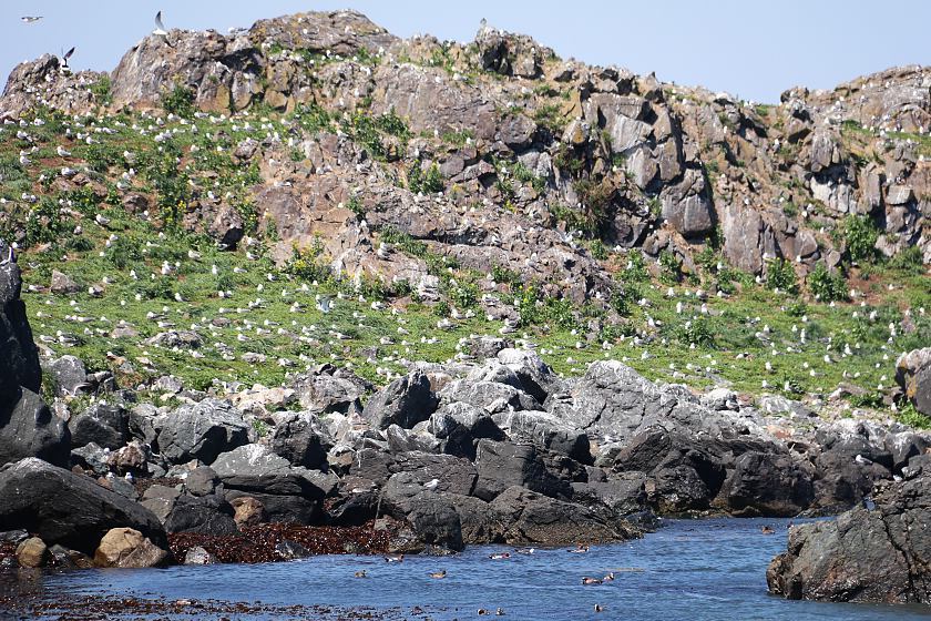
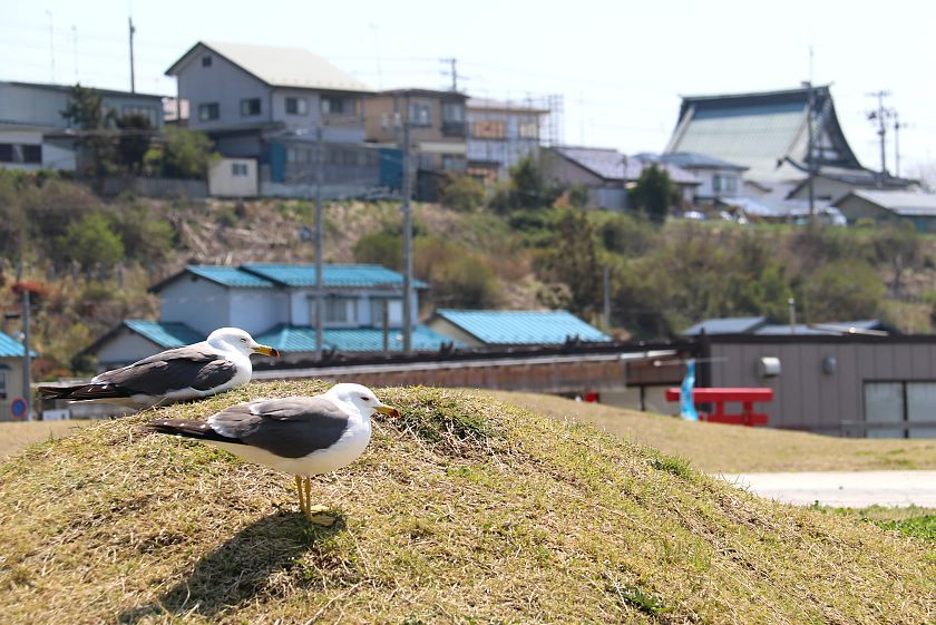
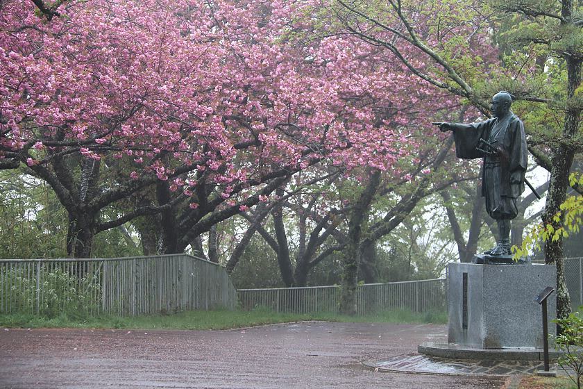
Our journey along the Sanriku Coast ended in Hachinohe, Aomori Prefecture, where we stopped by the Kabushima Shrine. During this time of the year, the peninsula around the shrine is visited by thousands of seagulls that nest here. It is also the starting point of the Michinoku Coastal Trail, a walking trail that follows northeastern Japan's Pacific Coast for over 700 kilometers.