A six-day trip south of Mount Fuji (Part 2)

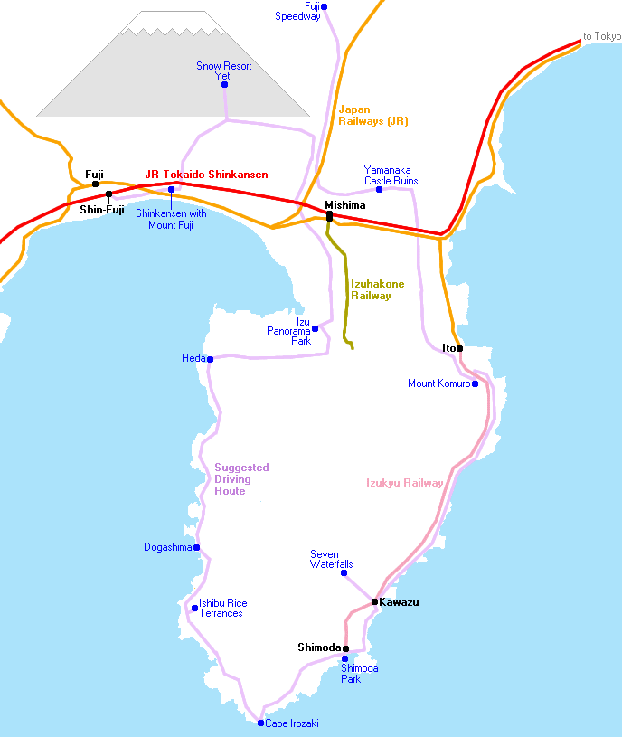
Having made my way from the base of Mount Fuji to the small fishing town of Heda, the second leg of my journey would bring me further along Izu's west coast to its tip, then a little way along the east coast to the historic port town of Shimoda before turning back towards the base of the peninsula.
As with my previous piece - all of the destinations covered here can be reached by public transport, but I would be traveling by rental car - this made for much shorter travel times and punctuated my journey with a series of breathtaking and sometimes quite unexpected views.
Day 3
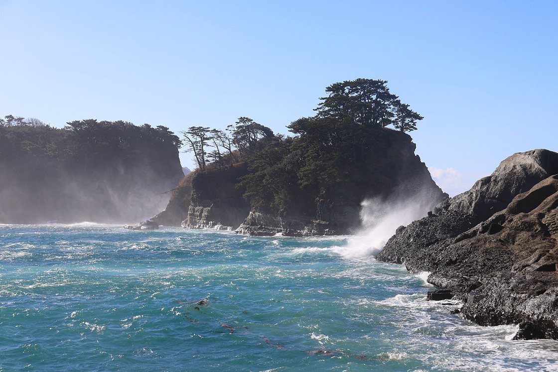
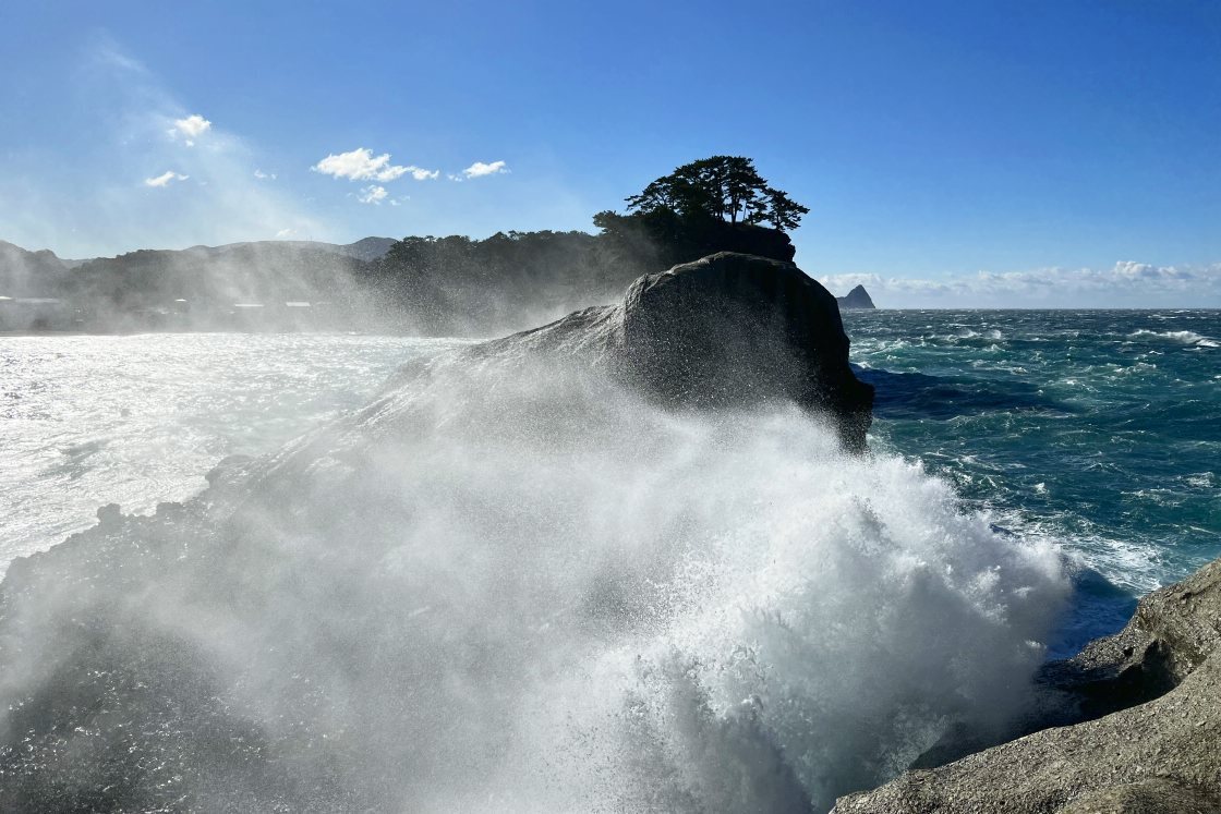
It was another bright, blustery day as I set off on the morning of day three - continuing south along the west coast of the Izu Peninsula to my first stop at Dogashima - a stretch of shore famous for its dramatic rock formations, cliffs and caves, formed by the twin effects of volcanic lava flows and erosion by the sea.
With the regular sightseeing boat canceled due to the powerful winds, I took a stroll around nearby Dogashima Park - a pleasant wooded spot and the perfect vantage point to take in the surrounding rock features. The wind made for some dramatic scenery, with waves driving into the craggy shore, sending plumes of spray high into the air.
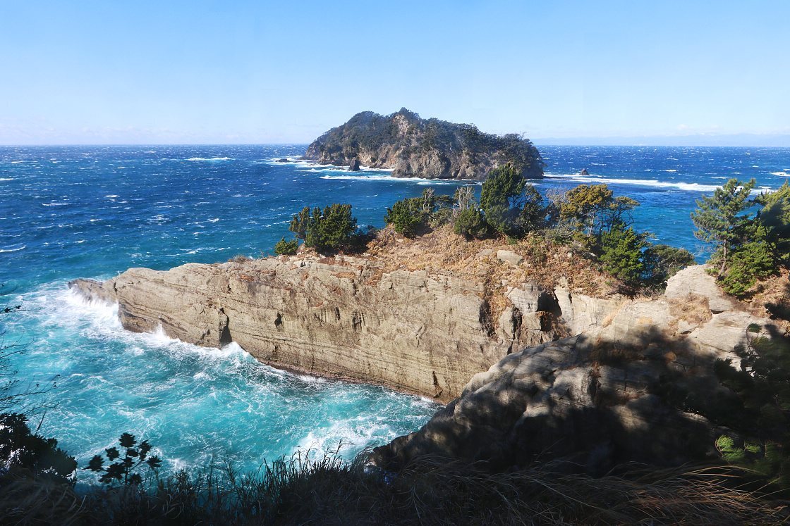
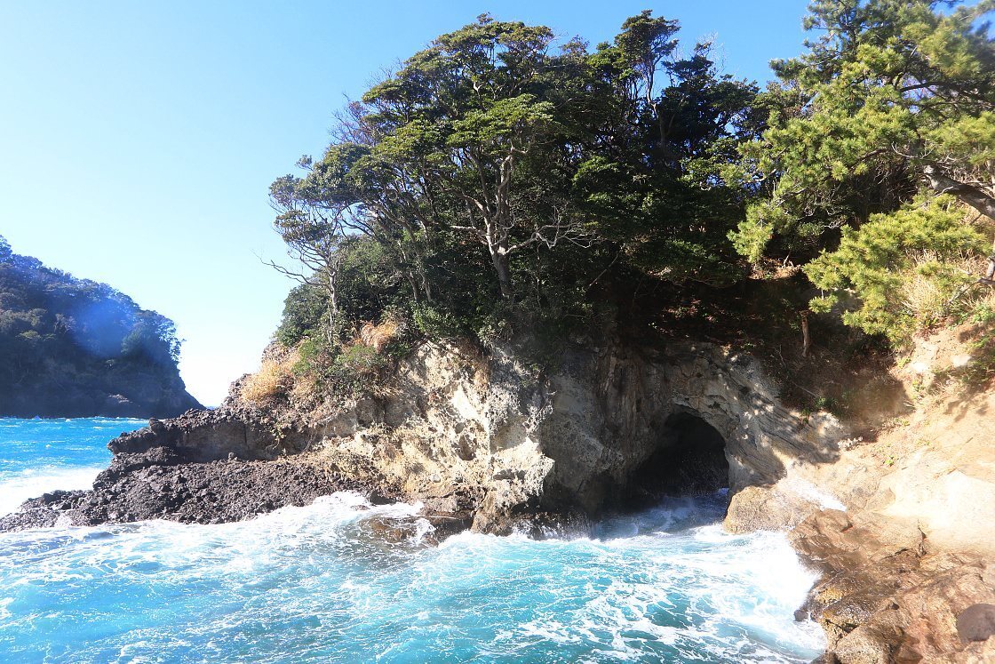
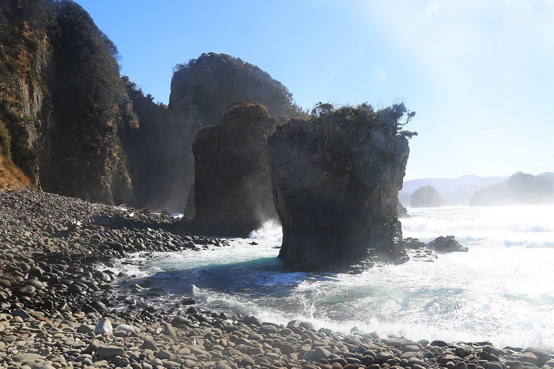
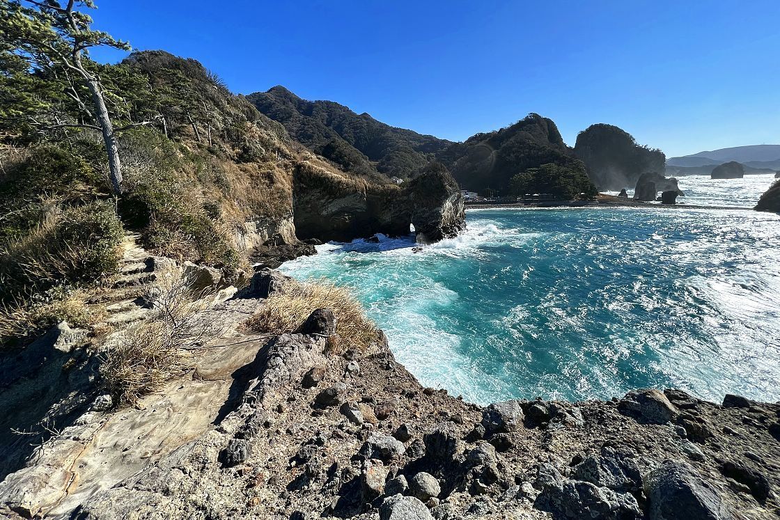
Still with time to spare, I took a quick five-minute drive north to the Futo Coast, a small sheltered bay known for a series of volcanic formations. Making my way along the beach, I followed a short hiking trail past an impressive rock arch and onto a short promontory offering some impressive views of the coast to either side.
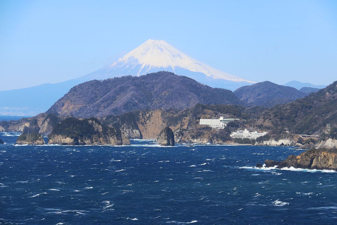
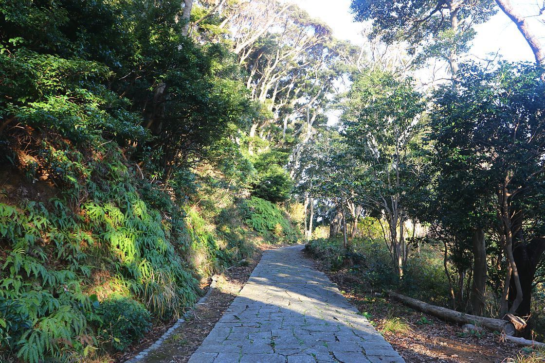
After taking a few minutes to enjoy my surroundings and the bracing sea breeze, it was time to jump back in the car and continue to make my way south on the Fujimi Sculpture Line - a highly scenic stretch of coastal road lined with a series of statues in playful poses. The following 30-minute drive turned out to be something of a highlight, with the landscape to my right periodically dropping away to reveal another craggy shoreline or expanse of ocean.
When Mount Fuji suddenly rose into view, I couldn't resist taking an impromptu pause at a roadside lookout point for a better look and a picture.
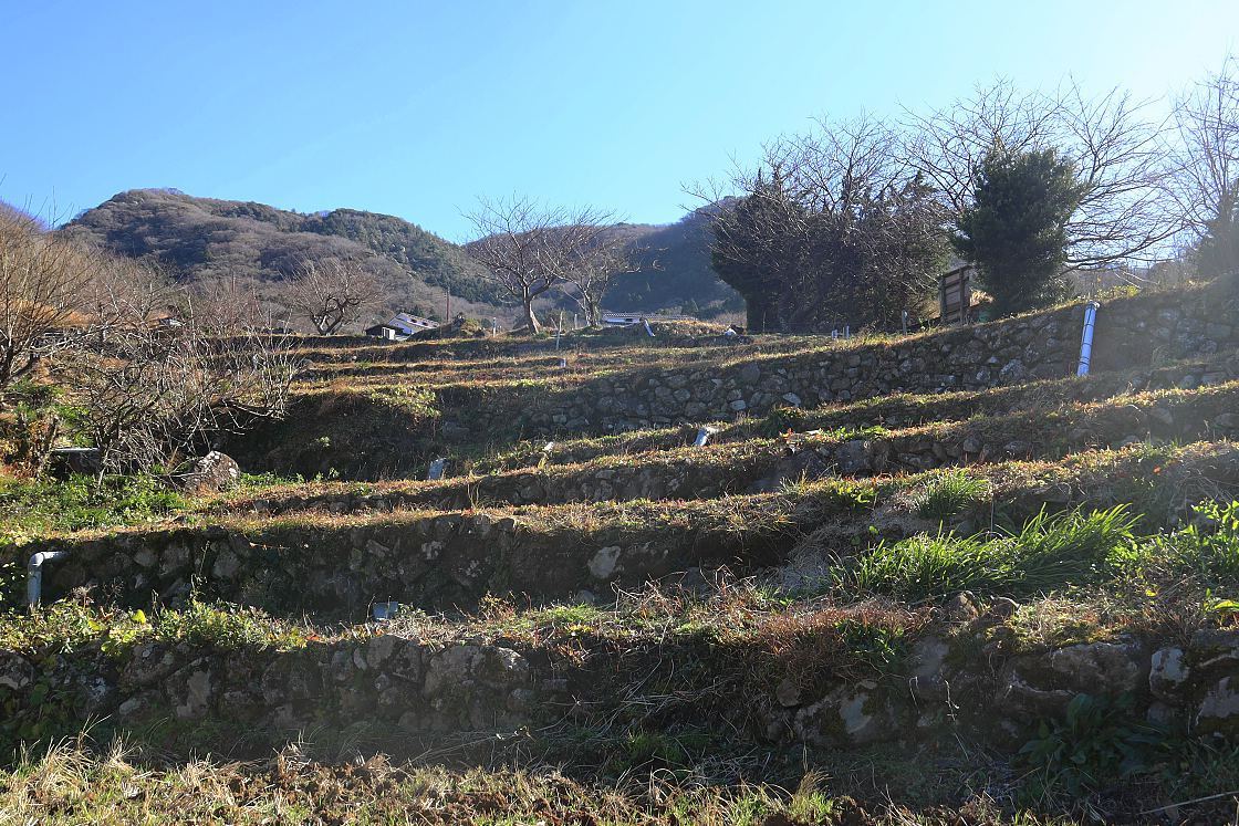
Turning away from the coast for a final uphill push along an increasingly narrow country road, I arrived at my second stop - the Ishibu Rice Terraces. Covering an area a little over four square kilometers, the site is made up of 370 individual rice fields cut into a series of steps in the hillside, arranged into a loose pattern like the loops and whorls of a fingerprint.
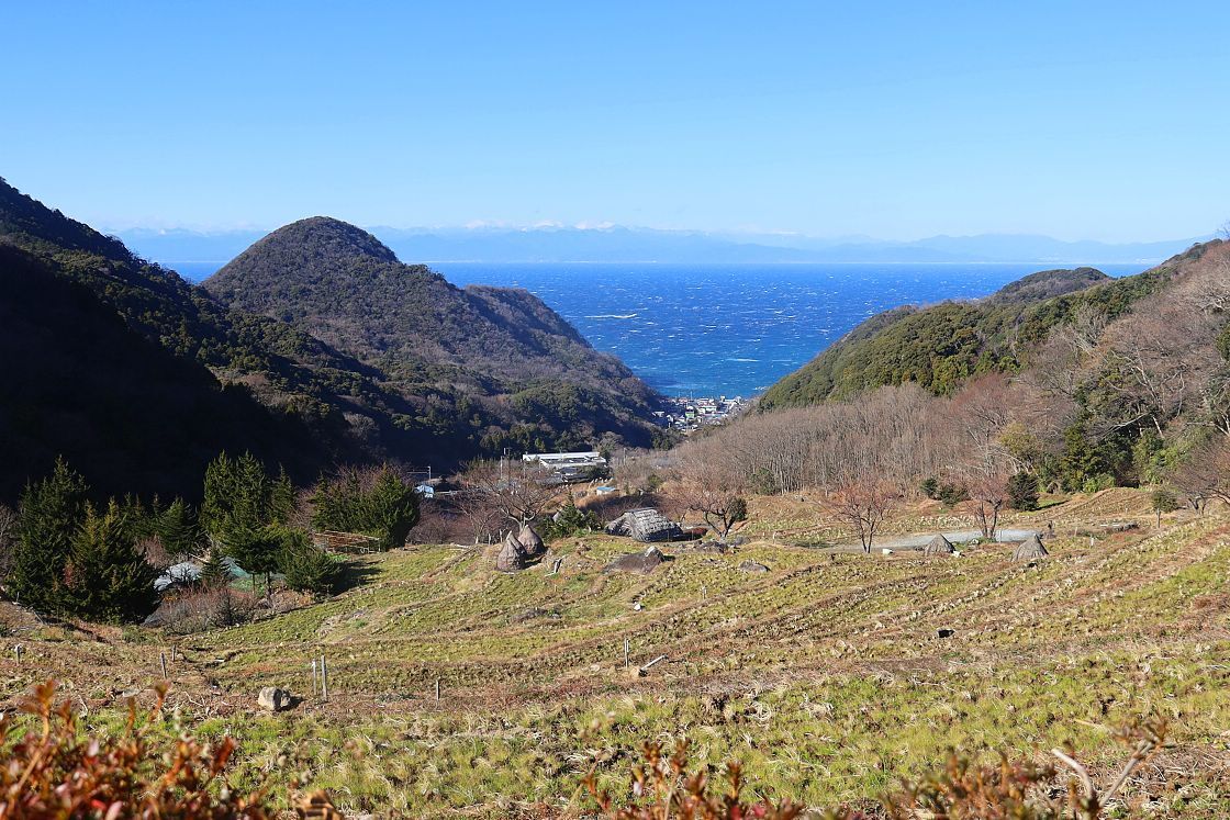
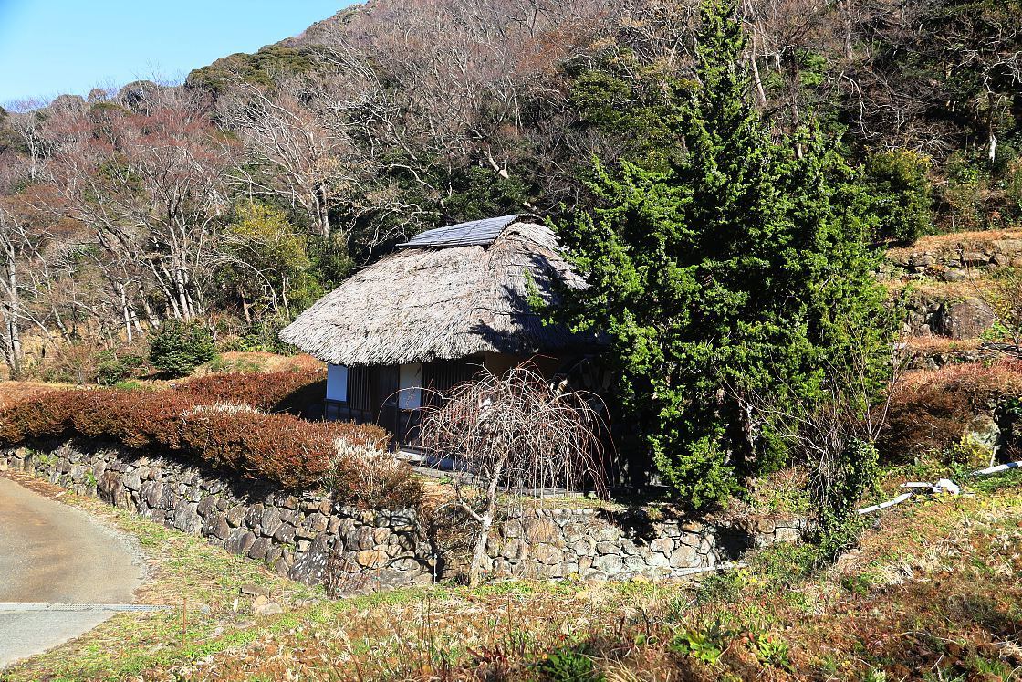
Flanked by rounded hilltops and flowing down towards Ishibu Beach, the terraces are a peaceful and attractive spot, with the atmosphere further enhanced by a handful of traditional thatched buildings. The paddies themselves, restored from long abandonment as part of a village revitalization project in 2000, are each supported by walls of masonry in a style rarely seen in eastern Japan.
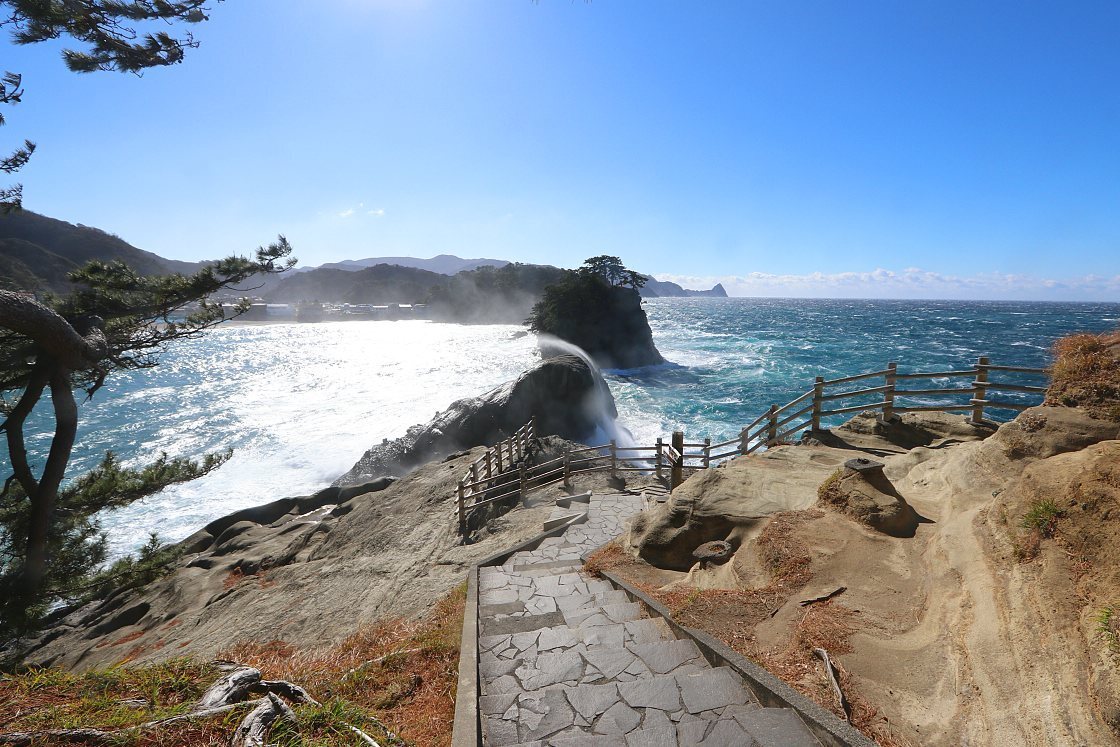
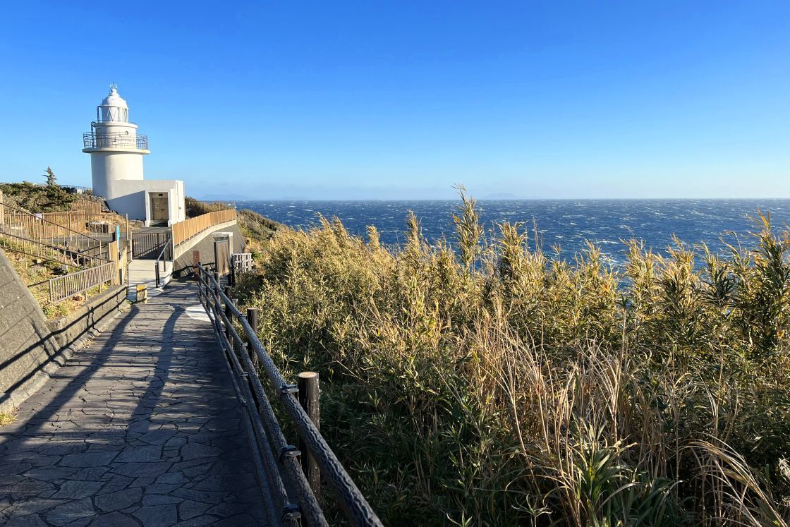
Back on the road, another 40-minute drive brought me to Cape Irozaki at the southernmost tip of the Peninsula. From the visitor center, a short wooded trail leads past the Irozaki Lighthouse, an 11-meter structure first built in 1871, reconstructed in 1933 and still in use today.
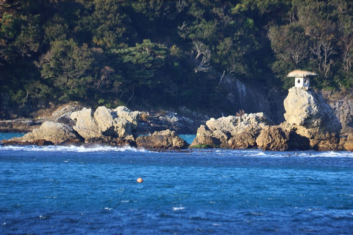
Tucked into a hollow in the cliff face just a few steps from the cape itself is the Iro Shrine, dedicated to the patron deity of sailors. Said to have been founded in 710, the current structure dates to 1901 and was built in part with timber reclaimed from an Edo Period ship.
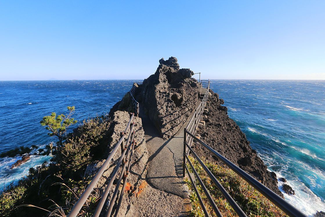
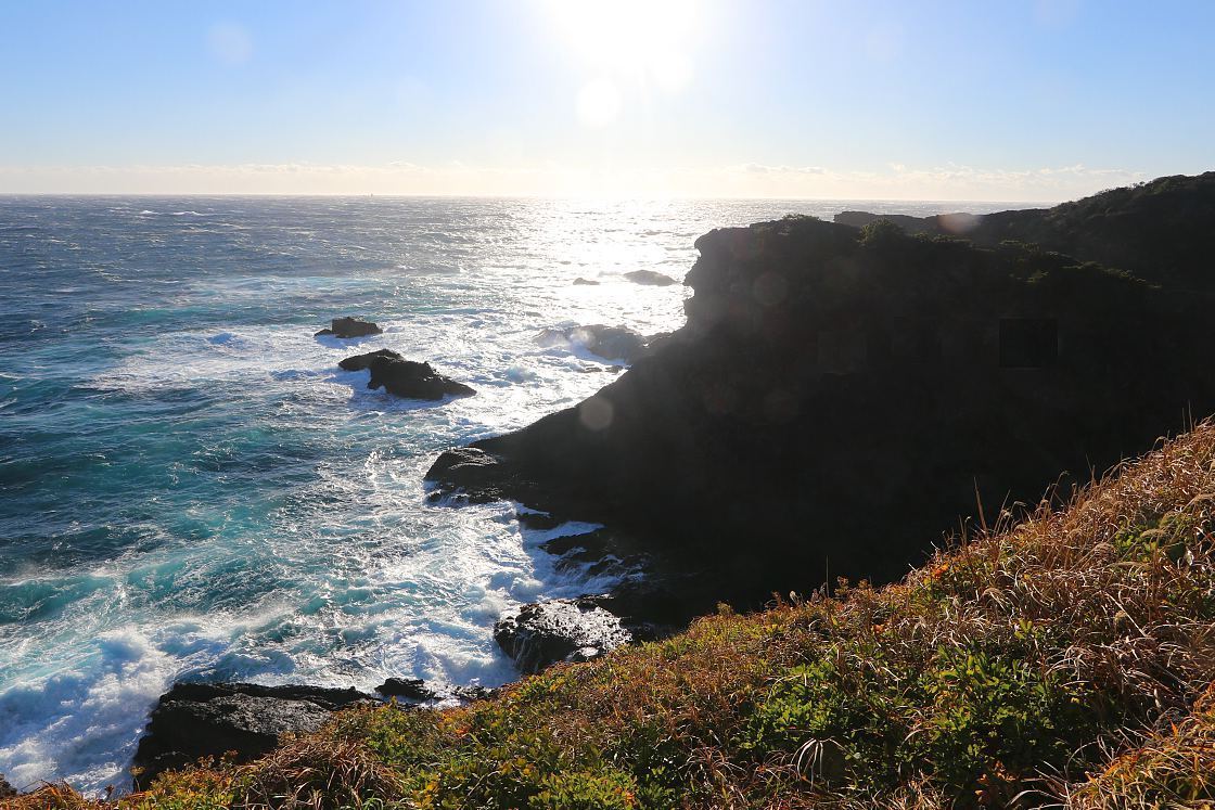
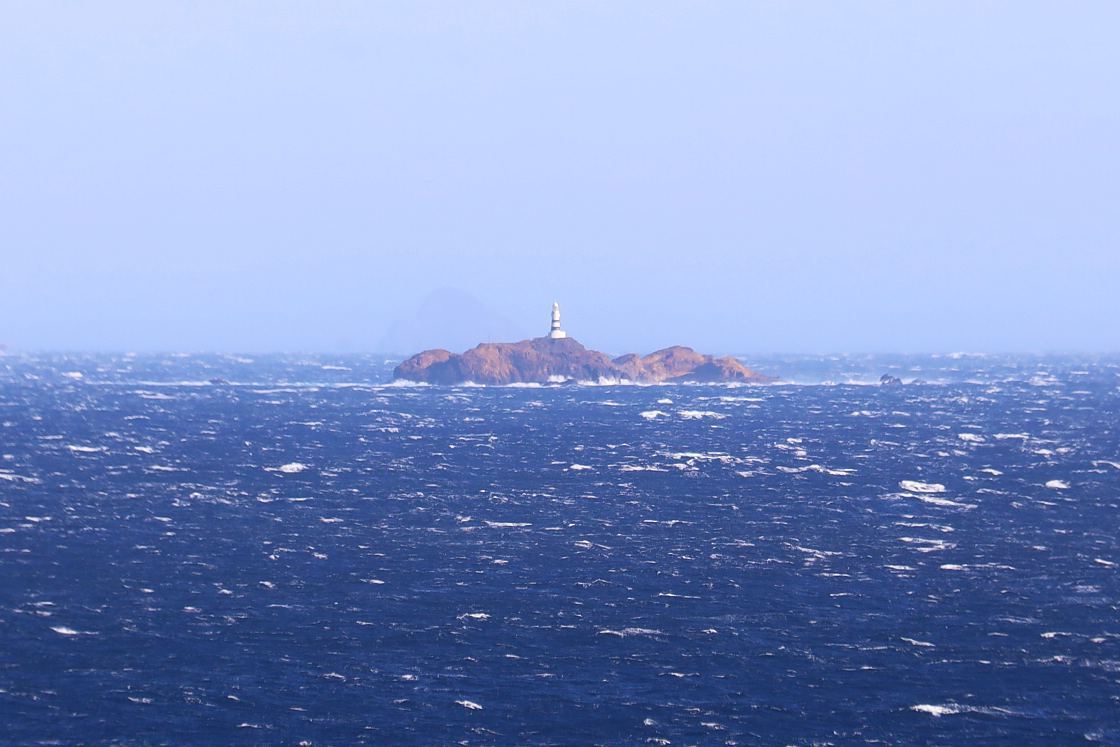
Standing at the very tip of the cape, I took in the dramatic shoreline to either side as powerful waves continued to roll in. One last and especially atmospheric detail was the Mikomotoshima Lighthouse - the oldest lighthouse in all of Japan, perched on a rocky islet 11 kilometers out to sea.
Day 4
I began the next day 18 kilometers around the cape with a morning stroll around Shimoda Park, an attractive wooded area overlooking Shimoda's city center and harbor. In front of the park stands a monument commemorating the landing of Commodore Perry's black ships here in 1854, forcibly opening Japan's borders and ushering in a new era in the nation's history.
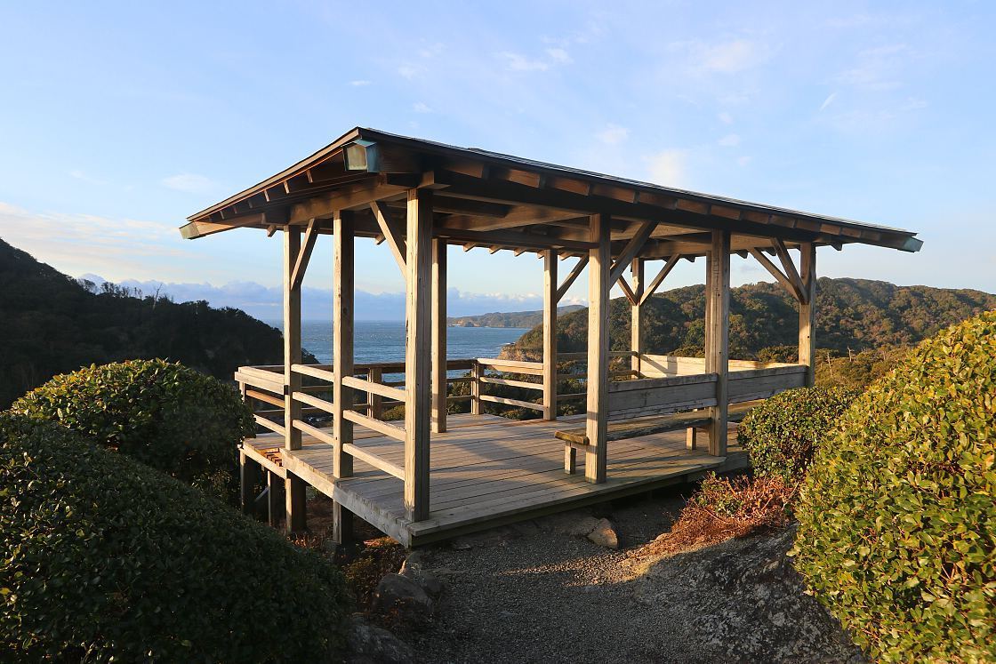
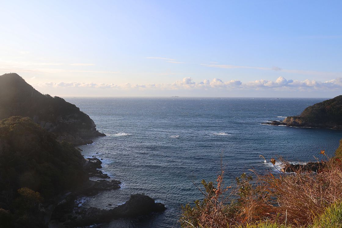
At the park's southern end, I found a pleasant observation deck with sweeping views across the Wakanoura Bay and further out to the southern tip of the peninsula. Finding a set of steps down to the rocky shoreline, I strolled for a while along the water's edge before doubling back onto the main path.
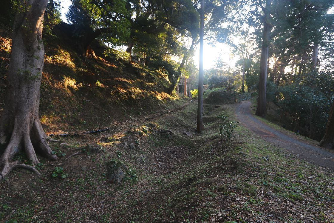
Towards the middle of the park, the base of an earthen defensive wall and the shallow imprint of a moat are all that remains of Shimoda Castle, once an important stronghold of the powerful local Hojo clan. Built in an innovative E
shaped formation and on a scale unmatched in the region, the castle would stand for just two years before falling to the Toyotomi in 1590 after a heroic 50-day resistance.
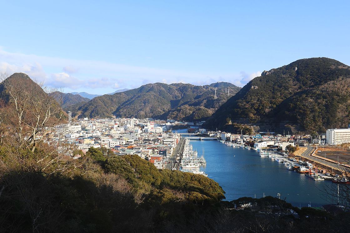
Leaving the ruins behind, I made my way east along the main path, lined with old pines and hydrangea plants that bloom spectacularly in early summer. Climbing above the treeline to the park's highest point, I was rewarded with a commanding view of the harbor, the surrounding city center and round, wooded hills arcing gracefully into the distance.
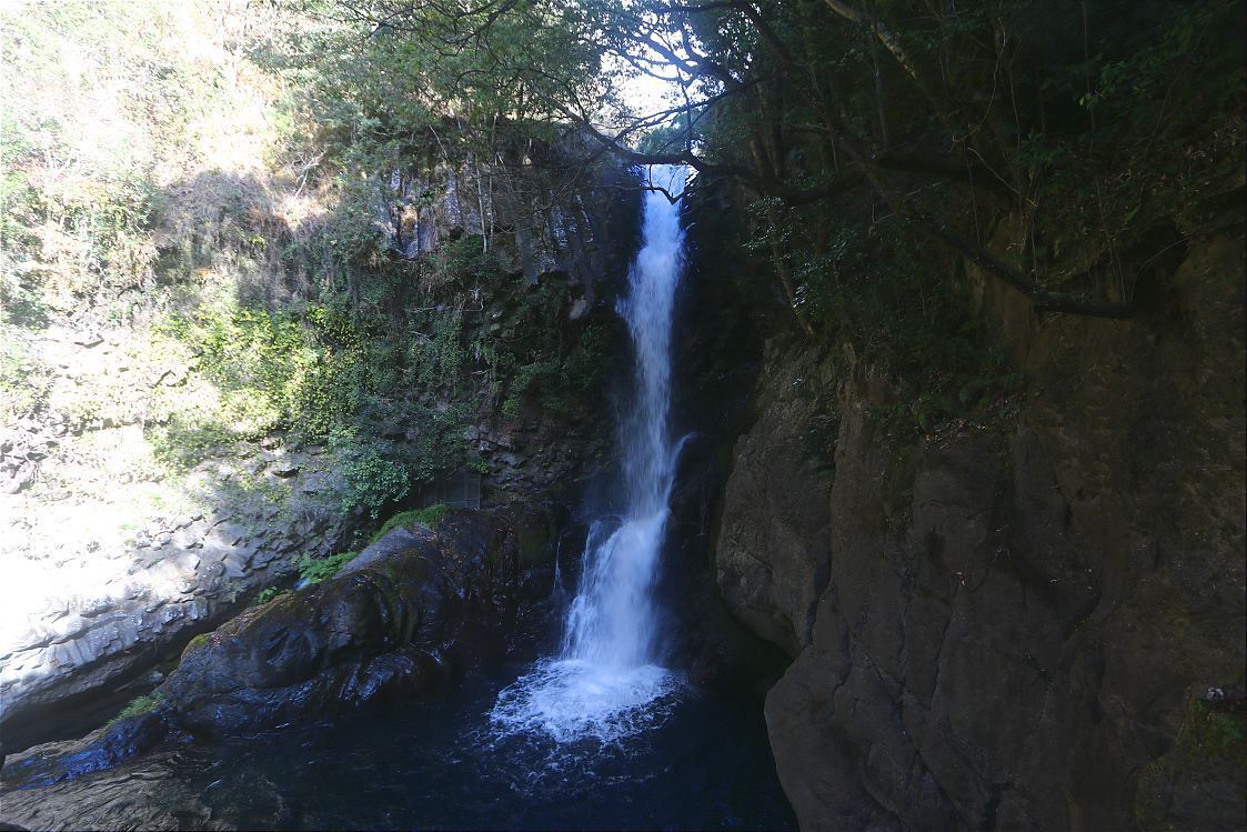
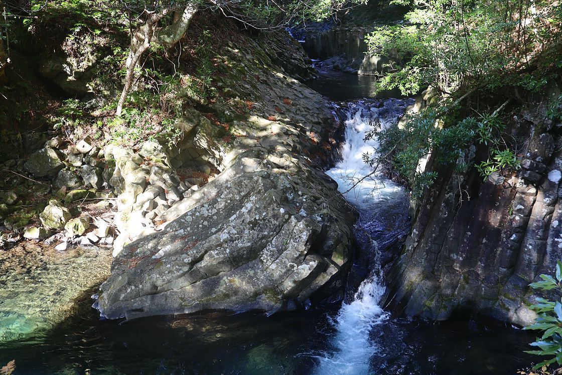
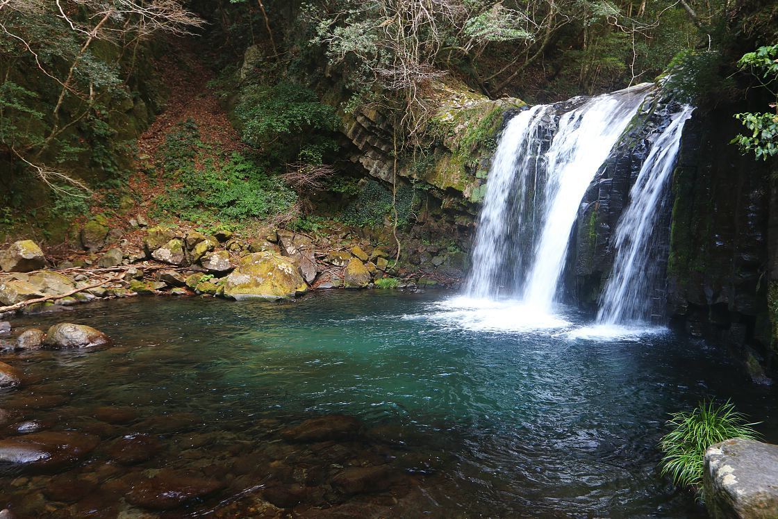
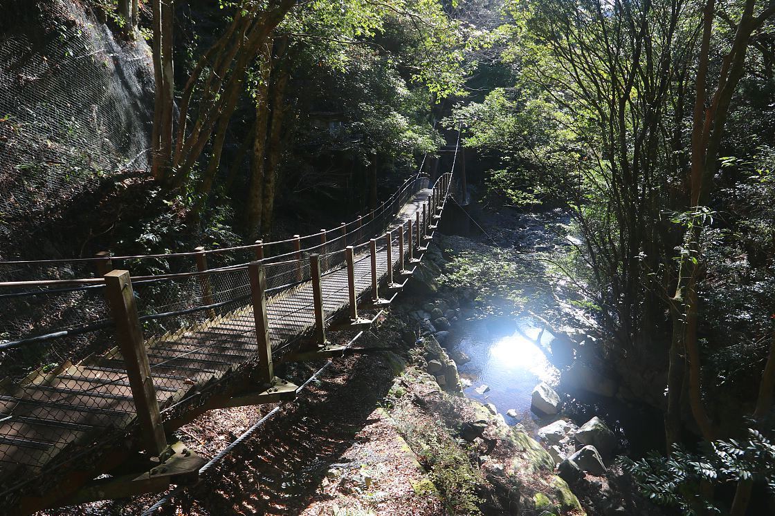
Back in the car, I followed the coast north before turning inland for the final stop of this leg of my journey - the Nanadaru or Seven Waterfalls of Kawazu. Formed by volcanic lava flow some 25,000 years ago, the waterfalls are located along the Kawazu River and can be easily reached by a walking trail leading from Nanadaru Onsen, the tiny hot spring resort at the base of the falls.
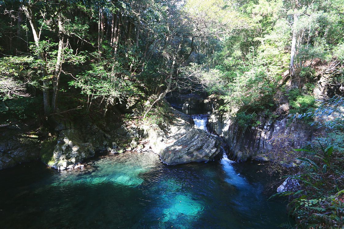
The waterfalls themselves vary quite considerably in height, with the largest found close to the start of the trail (note that in order to get a good view of this one, visitors must pay to enter the public baths of the Amagiso Ryokan).
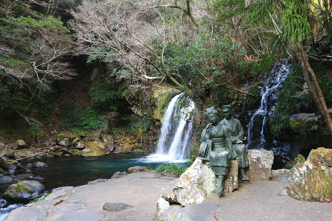
The Dancer of Izu
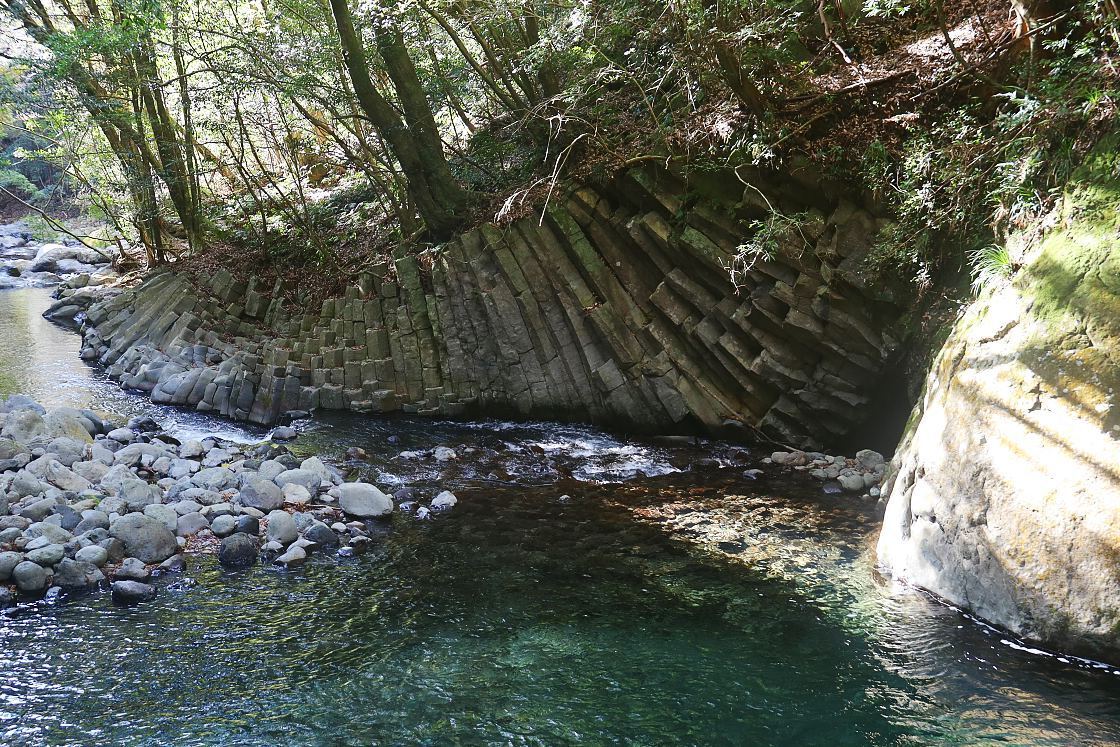
The trail is also known for a series of curiously segmented rock formations known as columnar joints, created by lava contracting as it cools. Said to resemble natural forms - here the rounded surface of a crab's shell, there the scaly body of a snake coiling around the river bed - the structures seem to grow in size, culminating in a vast, striated wall overlooking the kama (teapot) falls.
With the light through the treetops beginning to fade, it was time for me to begin picking my way back along the trail to my waiting rental car. In the third and final part of my Izu adventure, I'll continue back up the peninsula towards Mount Fuji, with stops for peaceful coastal views, another fascinating castle ruin, and a visit to one of Japan's best known motorsport venues.