In the footsteps of the Shogun
| Travel Reports by Chashitsu | view profile of Chashitsu |
| previous post |
| next post |
| Note: The opinions and views expressed in this user report are those of the individual author and do not necessarily reflect the opinions and views of japan-guide.com. |
October 30, 2014 - In the footsteps of the Shogun
After centuries of feudal wars, Japan was united following the battle of Sekigahara in 1600 under the Tokugawa shogunate. The centre of political power moved to a new capital Edo (modern day Tokyo) on the swampy plains of the Kanto although the Emperor and court remained in Kyoto. As with all military regimes there was a need to secure good lines of communication and supply between Kyoto and Edo in particular. With this in mind five main highways were constructed along Chinese lines modelled on those originally instituted by Ghengis Khan. These military roads were constructed in the early days of the Tokugawa shogunate and served as communications routes. The Nakasendo being the central mountain route for the summer and the Tokaido road being the eastern seaboard route largely avoiding the mountains. Both were about 500 km in length and connected Edo with Kyoto. Post towns were situated every few kilometers to provide accommodation, sustenance and fresh horses, they also provided a means of policing the movement of goods and personnel. A few sections of these roads are preserved as hiking trails and some of the old post towns conserved in their Edo period form. This report is a result of travelling along a small sector of both the Nakasendo and Tokaido roads.
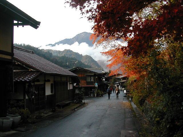
The highways were carefully laid out with predetermined widths and villages at convenient intervals (every 8 km or so), designated as post towns to provide accommodation and provisions. Local villages were co-opted to supply additional labour, horses, food and utensils at peak times. Whilst early use of the highways was for the transmission of messages, conveying diplomatic missions, spies and important goods and materials, they were soon to be used for unofficial travel. In later years they were used for pilgrimage and commerce with the development of a richer merchant class. Artists were commissioned to commemorate the highways in wood block prints. Hiroshige completed the series of works called the üg69 stations of the Nakasendoüh. The Nakasendo travels from the Sanjo bridge in Kyoto, follows the eastern shore of lake Biwa, through Hikone, striking eastwards over the mountains at Sekigahara, across the Gifu plains, skirting the southern Japanese Alps into the Kiso valley. The road travels up the valley, crosses the plain between Matsumoto and Karuisawa before dropping down to the Kanto plain, linking up with the Arakawa river valley and on to the Nihon bridge in Edo. The section passing through the Kiso valley included eleven post towns, collectively known as Kiso-ji and renowned for it's spectacular scenery. The Magome to Tsumago section has been restored as a hiking trail and the towns have been preserved as they were two hundred years ago.
We travelled from Kyoto by train to Nakatsugawa via Nagoya and onward by local bus to Magome to experience travelling the Nakasendo. The old town of Magome is a ribbon development around the Nakasendo road which travels up a steep hill with all signs of modern traffic and street furniture banned. The road is lined by period inns, restaurants and shops selling local products. A stream runs alongside the road and many of the buildings have overshot water wheels to provide energy.
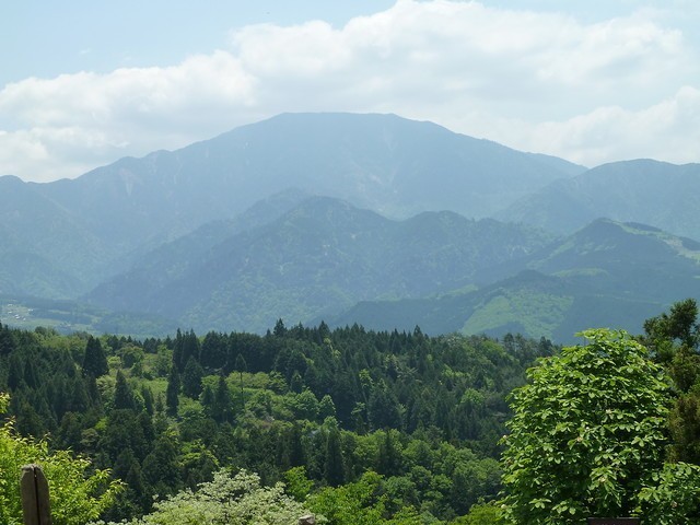
As you emerge from the town there are wonderful views of Mount Ena (over 2100 m). The road steadily rises through the small hamlet of Magome-toge to the reach the pass at 850 m, where there is a monument and a small tea house providing basic refreshments. The monument contains the following verse ügThese white clouds evoke memories of my long walk under fresh green leavesüh
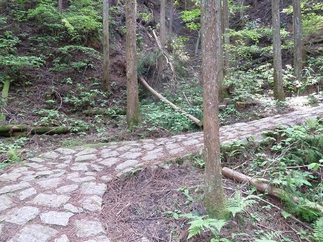
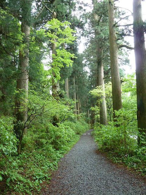
The descent down to the Kiso valley itself is through ancient woodland with gushing streams. The remains of a former barrier station is to be found, established to ensure that valuable timber was not smuggled out of the valley illegally. As a result the Kiso valley is today a lush forest of cypresses, cedars, zelkovas and broad leaf trees. A small abandoned tea house is to be found by a weeping cherry adds to the charm.
Further down the valley a small diversion takes you to the Odaki & Medaki waterfalls and on to the hamlet of Otsumago (Upper Tsumago) leaving the dense woodland behind.
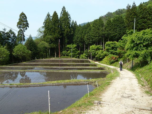
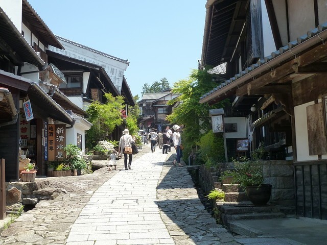
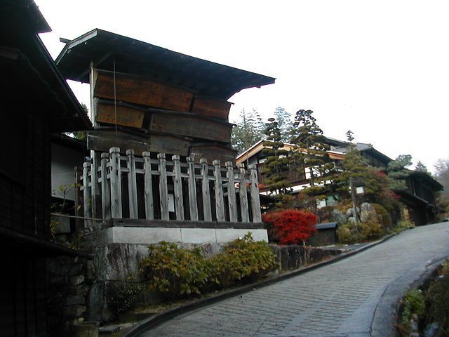
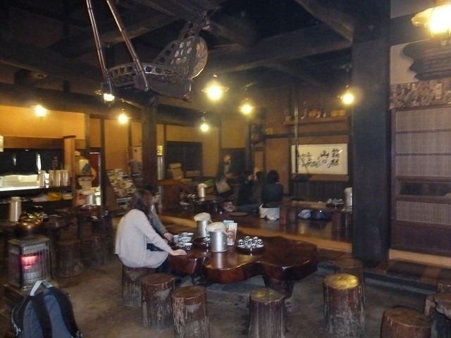
The path now joins a small road with small traditional farms scattered both sides of the valley and finally descends into Tsumago itself. By this time the rain had cleared with the cloud lingering amongst the mountain tops. Tsumago consist of some sixty period houses, mainly commercial premises of shops, restaurants, inns and two museums. At one end of the town is an original noticeboard used by the Bakufu government to announce new laws and prohibitions and a nearby inn with a lovely garden.
Each of the post towns were required to accommodate local government offices, the Honjin lodging house for the daimyo, senior samurai and court nobles, the Waki-honjin was for lower class samurai and officials and other accommodations providing food and rest. The chaya provided areas for rest and refreshments for the general traveller.
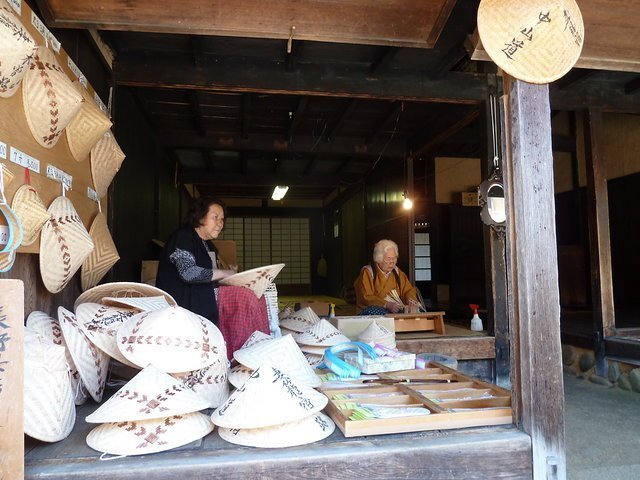
Today the shops of Tsumago cater for the tourists more than those travelling the Nakasendo and have a few craft outlets such as the hat makers and paper makers.
Sometime later while based in Kamakura we travelled to Hakone-Moto a small town and transport hub for the Hakone district, which includes Mount Fuji and took the bus to Hata-juku a station on the old Tokaido road (one not preserved). The Tokaido road had fewer stations, 53 in all, as the conditions were somewhat easier going than via the Nakasendo. Hata-juku was situated between Odawara (10th) and Hakone (11th) station and acted as a resting place before ascending the Hakone pass. We set off in lowering clouds and light rain to discover that the path was somewhat tougher going than the Nakasendo, until we reached the Amazake Chaya tea house at the pass, some drenching hour or more later. There was a small museum adjacent with a few pictures illustrating the journey of times past but the warmth of the tea house beckoned ? a stove was burning and this was the end of May but welcome indeed. We dried out and sampled the local amazake brew (made from malted rice) before descending into Moto-Hakone on the shore of Lake Ashi.
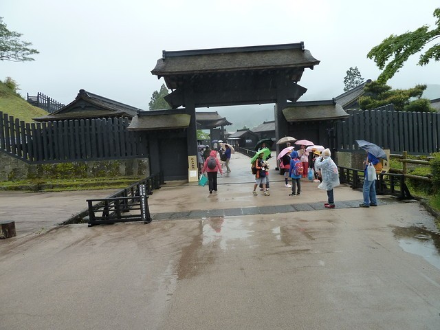
From here we took the trail through the Edo period cedars to Hakone-Machi and the Sekisho checkpoint. The checkpoint was a barrier station established to control arms entering Edo and women escaping to the provinces. The facilities include large enclosed waiting areas each side of the checkpoint where travellers waited clearance, quarters and facilities for the foot soldiers and the officers (20-30 in number). A lookout kept watch over Lake Ashi from a tower within the confines. The facilities included a shooting range and special guest room designed to intimidate travellers ? the use of torture is not mentioned of course although ügarresting implementsüh are!
| previous post |
| next post |
|
List of Posts:
2017/07/25 - Japan's tectonic landscape reflected in the gardens 2017/07/15 - Flora of Japan 2016/04/27 - Time in Asakusa 2016/04/25 - Kakunodate 2016/04/23 - A Thousand Cranes 2016/04/22 - Castle in the Clouds 2016/04/21 - The beauty of Koraku-en 2016/04/20 - Far from the Madding Kyoto Crowds - Part 1 2016/04/20 - Far from the Madding Kyoto Crowds - Part 2 2016/04/18 - A Day in the Mountains 2016/04/17 - Delights of Hikone 2016/04/16 - Nara Revisited 2015/01/03 - Kamakura temples and gardens 2015/01/01 - Takayama Temple Trail 2014/12/29 - Kurama - Kibune hiking trail 2014/11/10 - A visit to Himeji 2014/11/05 - Shigemori Mirei - The Rebel in the Garden 2014/11/04 - Arashiyama and nearby sights 2014/11/03 - The less visited sites of Nara 2014/11/03 - The gems of Matsue 2014/10/31 - Agon-shu Monastery 2014/10/30 - In the footsteps of the Shogun 2014/10/30 - Tale of the Genji |