Japan’s ultimate Alps hike: The Kamikochi-Yari-Hotaka Circuit

Home to roughly half of Japan's summits over 3000 meters tall, the Northern Japanese Alps are a collage of deep valleys, soaring peaks and craggy ridges that shape some of Japan's most dramatic alpine landscapes.
While there are countless fantastic trails that explore every corner of the range, there is one venerated trek many aficionados consider "the one" every hiker's bucket list must include: the Kamikochi-Yari-Hotaka Circuit.
This 3-day hike is an up-close-and-personal introduction to two of Japan's most well-known peaks: Mt. Yarigatake (æäā¢Ŗx) and Mt. Okuhotaka-dake (ē£ĢõŹéŖx), the fifth and third tallest mountains in the country, respectively. Starting in the tranquil Kamikochi (ÅŃŹéÆn) valley, the route climbs 1675 meters to the spear-like peak of Yarigatake, then traverses the ridgeline connecting it to Okuhotaka-dake via the notorious Daikiretto (æÕāLāīābāg)—arguably the most exhilarating stretch of non-technical hiking in all Japan—before descending back to Kamikochi.
Day 1: Kamikochi to Mt. Yarigatake Summit
Like so many Northern Alps hikes, mine began at the Kamikochi Bus Terminal. Surrounded by throngs of visitors enjoying the mountain scenery, I first registered my itinerary with the mountain rescue authority and filled my water bottle before setting off.
Within an hour, after passing the Myojinkan lodge, the day-trip tourist crowds had disappeared, the drizzling rain had stopped, and the long hike really began.
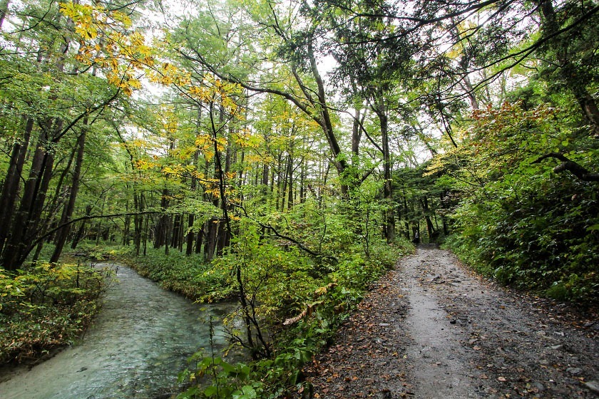
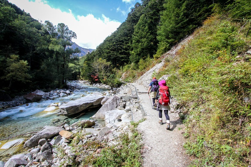
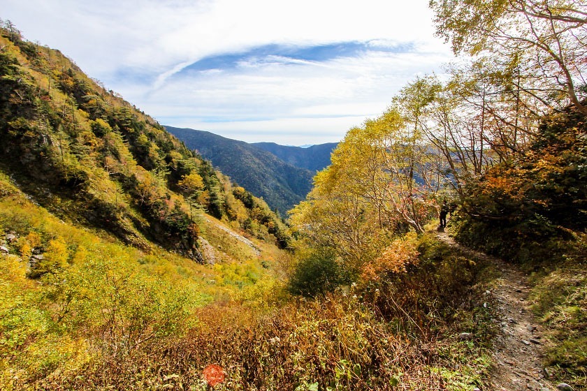
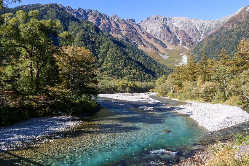
The first 2-3 hours of the hike are relatively flat and forested with the trail paralleling the Azusagawa River as it winds along the valley floor.
Soon, though, after passing the Tokusawa and Yokoo lodges, the trail gets steeper and steeper as it starts climbing up into the Yarisawa Valley, the source of the Azusagawa.
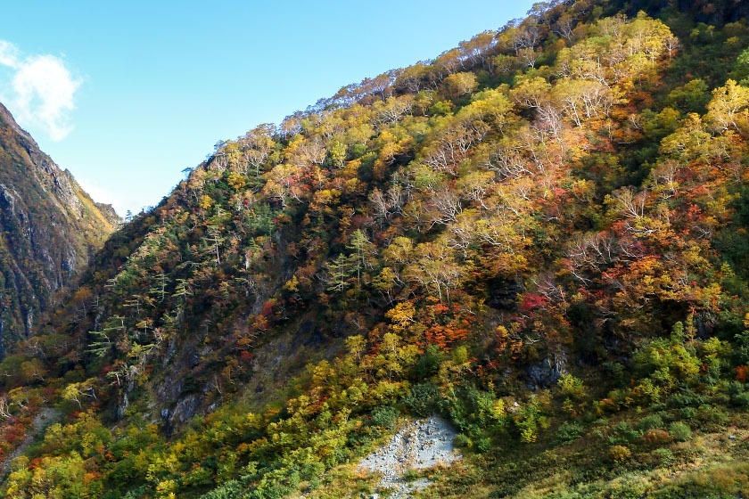
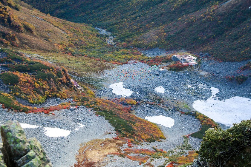
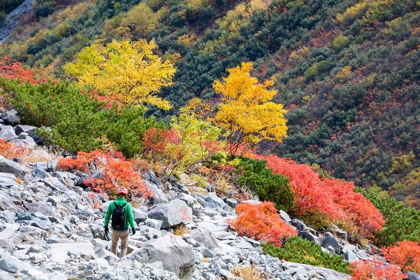
After reaching the Yarisawa Lodge, I found myself out of the forest and into increasingly rocky terrain. As I climbed higher, the trees and high alpine bushes covering the valley walls were more and more colorful with autumn colors at their peak timing, making for some pretty gorgeous views.
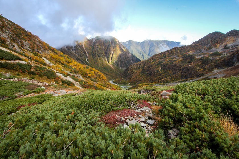
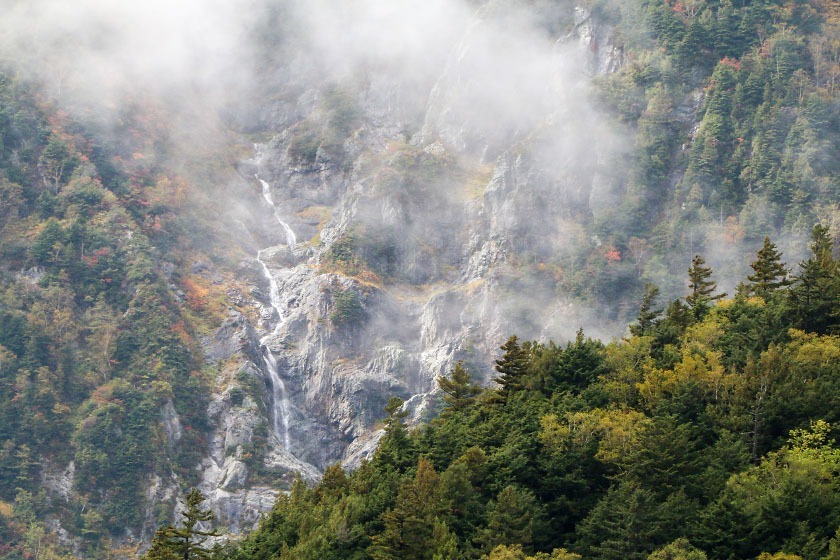
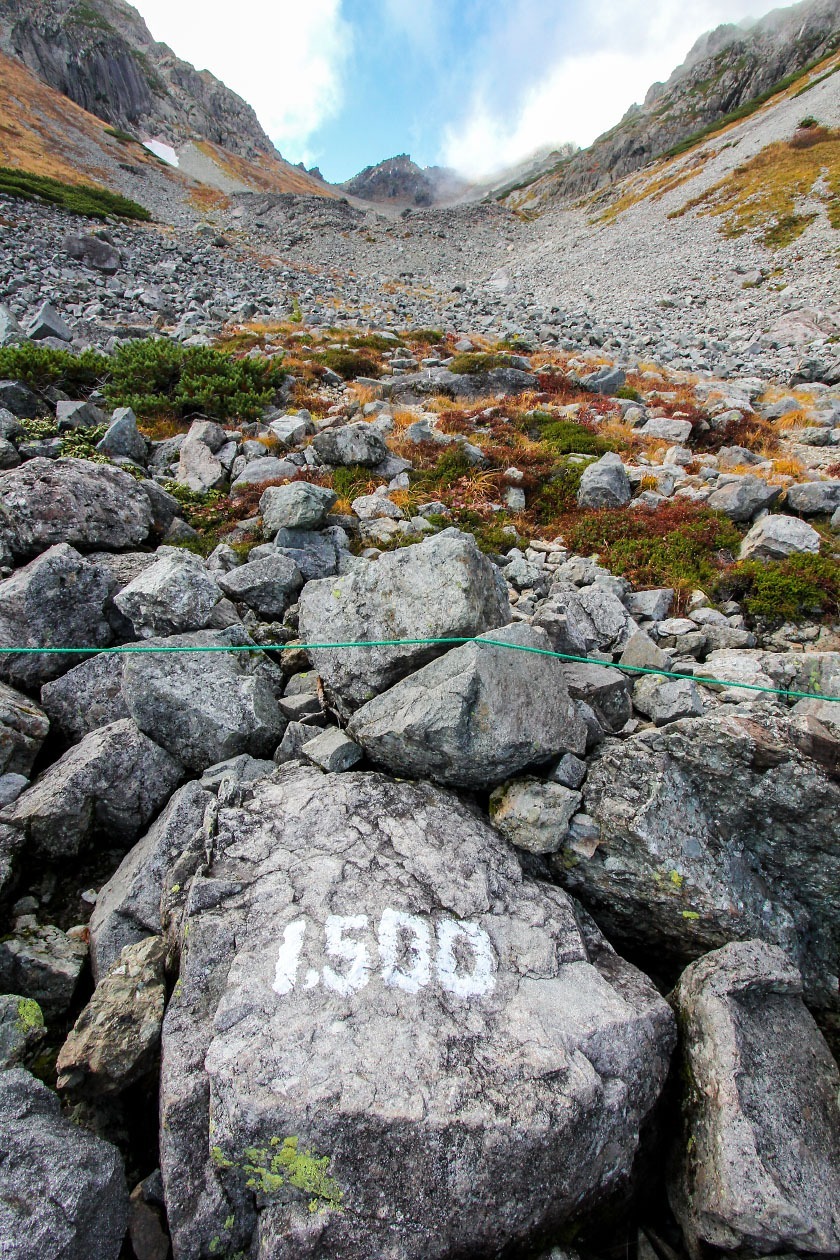
5-6 hours in, the final push up the Yarisawa becomes an exhausting, steep, rocky slog as the plant life becomes sparser and the terrain takes on an otherworldly appearance. But, with a lucky break in the clouds, the jagged peak of Yarigatake showed itself at the very top of the valley, beckoning me on.
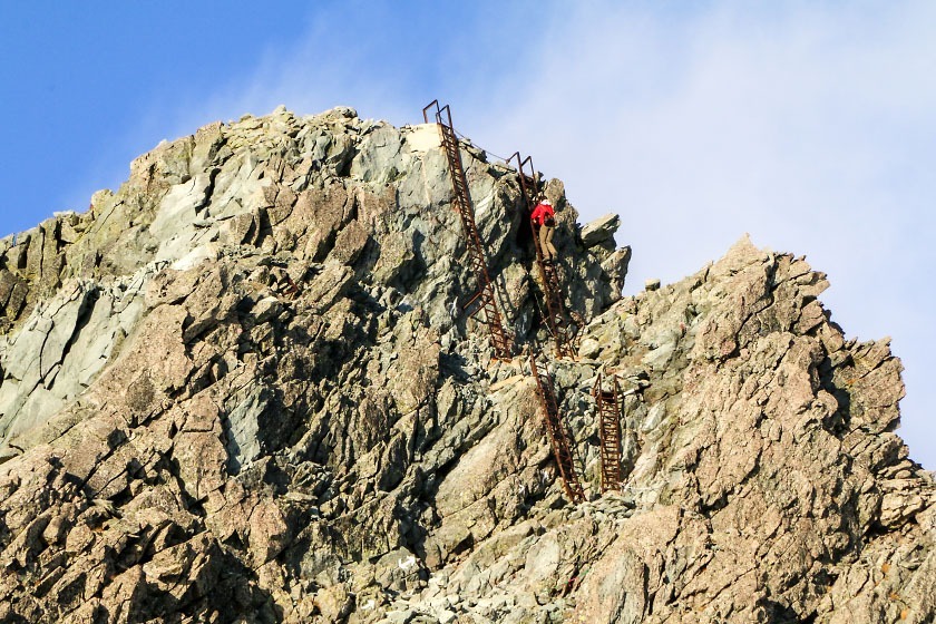
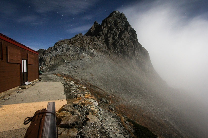
And finally I'd made it to the ridge (at 3000 meters above sea level), standing just a few steps from the enormous pyramid that forms the summit of Yarigatake. I took a moment to celebrate (and catch my breath) as I watched high up on the summit as some hikers climbed up the precarious steel ladders and chains leading to the top.
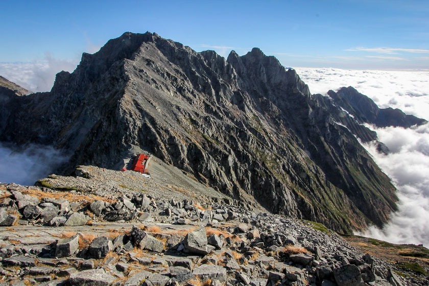
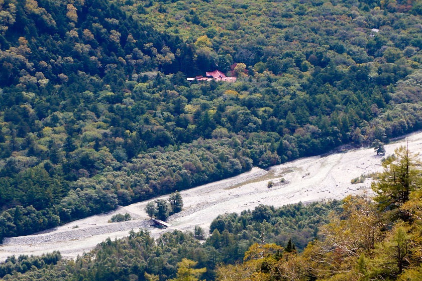
Unfortunately, it was getting a bit late when I arrived, so I decided to hold off on the summit myself and check in at the Yarigatake Sanso mountain lodge, where I was staying the night.
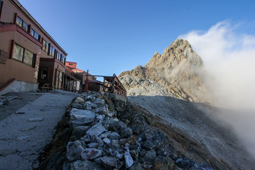
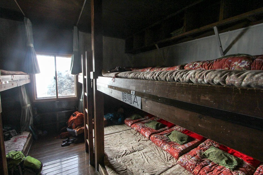
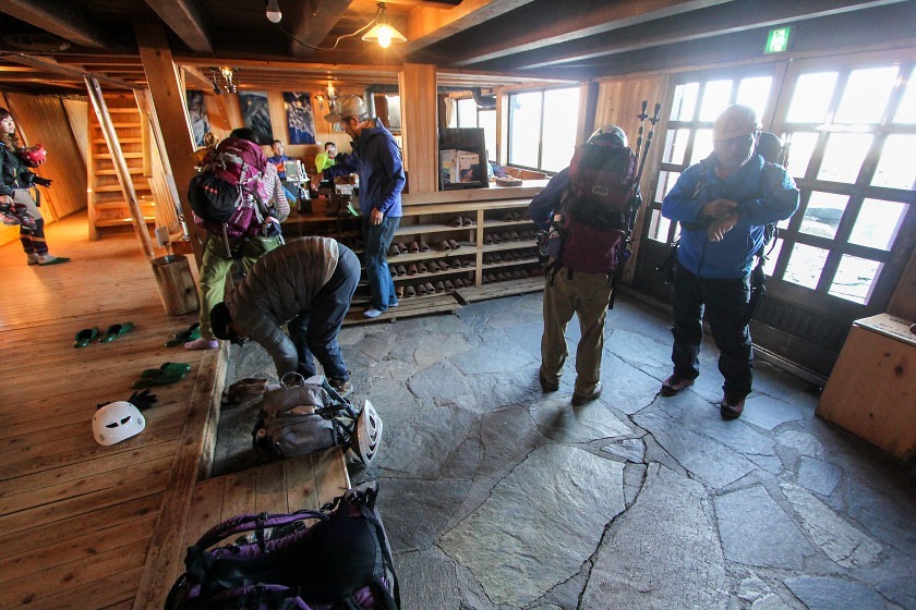
Yarigatake Sanso is a part of a network of strategically-located mountain lodges offering accommodation that make it possible to tackle high peaks like Yari in manageable sections on multi-day hikes, and are a unique experience in themselves.
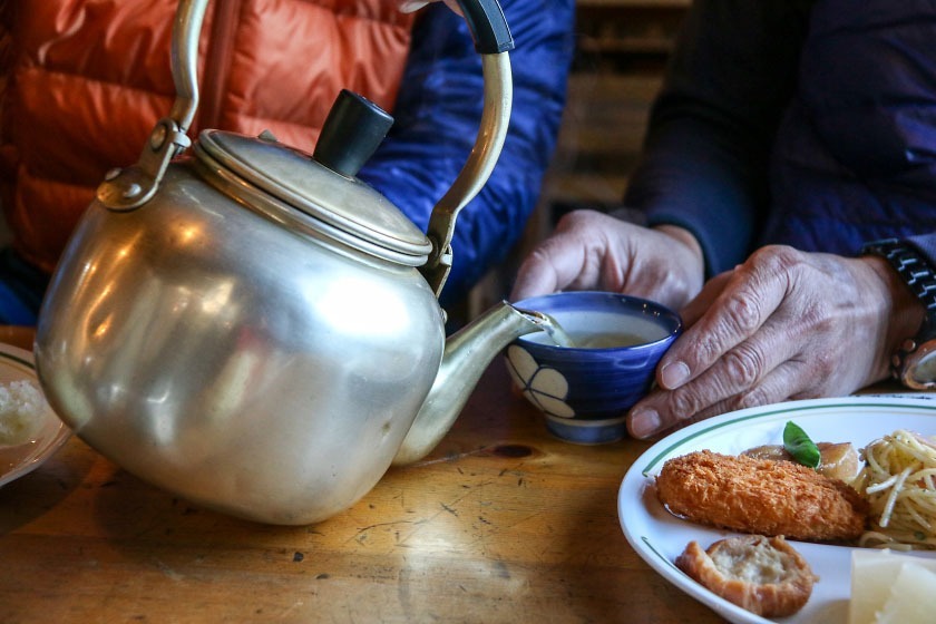
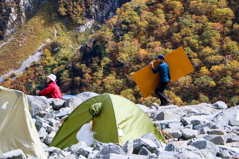
Guests can request a hot meal (dinner, breakfast, or both) and are provided with a futon and warm blankets, drinking water, toilets, and other provisions. A night with two meals at Yarigatake Sanso is 9800 yen (6800 without). Tent pitching sites are also available for 1000 yen/person/night.
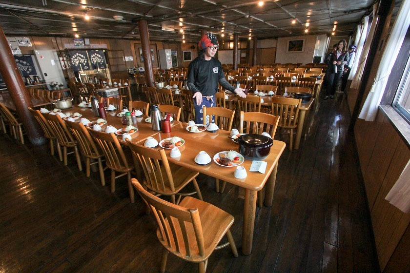
After checking in and enjoying a nice hot dinner, I spent a leisurely evening chatting with other hikers from around the world and got myself to bed as early as possible to rest up for the big day ahead: tackling the Hotaka ridgeline...and the Daikiretto.
Day 2: Yarigatake to Okuhotaka-dake via the Daikiretto
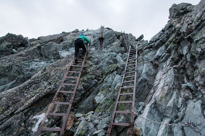
The next morning, I left the mountain hut at 4:00am equipped with a helmet and headlamp to take care of some unfinished business.
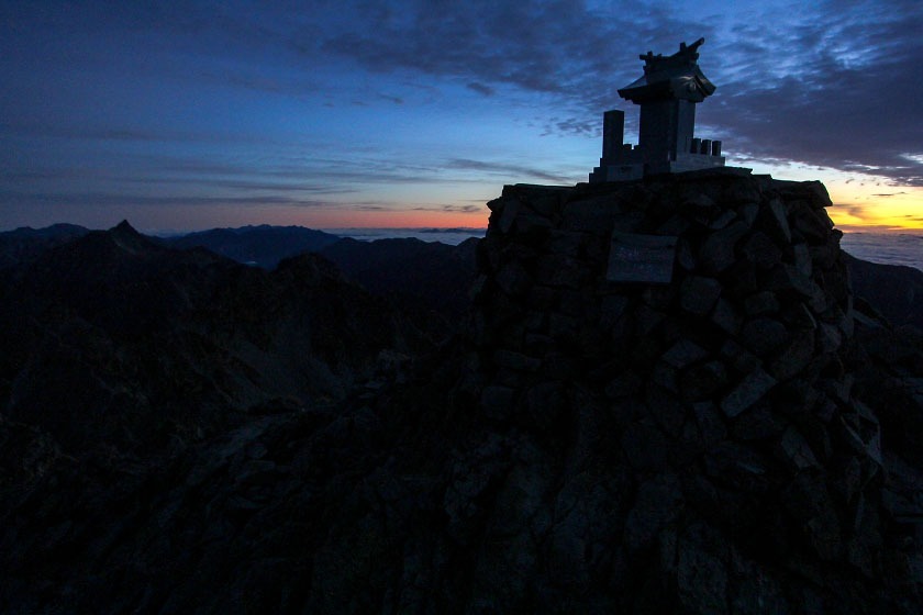
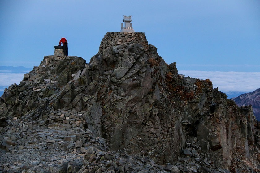
Climbing the final 200 meters to the summit of Yarigatake (3180 meters) only takes 20-30 minutes, but as you pull yourself up rocks and chains and ladders on near-vertical rock walls, those minutes can feel pretty long. But after a relatively quick ascent, I was standing on top of the tiny, pointy perch that is the peak of Yari, looking out over the entirety of the Northern Alps.
After relishing the views, I descended back down to the hut to get some breakfast and return my rental helmet (meant for protection from loose rocks knocked down from hikers above you while ascending) before hitting the trail.
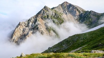
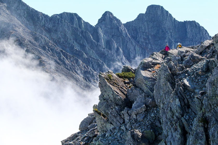
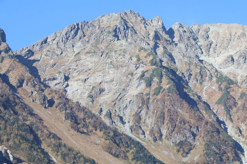
My course for today was the ridgeline itself. The trail leads from Yarigatake Sanso over three other 3000-plus-meter peaks (Obamidake, Nakadake, and Minamidake), showcasing jaw-dropping scenery all the while, before hitting an abrupt stop: a place where the ridge suddenly drops away known as the Daikiretto.
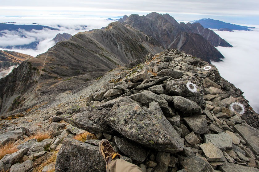
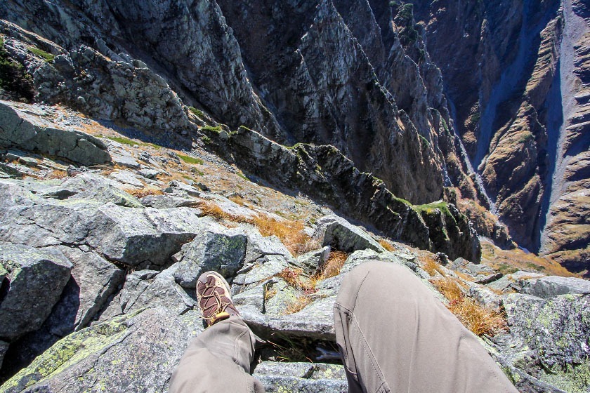
After about two hours of hiking from Yari, I was finally standing face-to-face with a legend. The Daikiretto is a large gap in the Hotaka ridgeline where the ridge drops about 300 meters on either side of two bookending peaks, Minamidake and Kitahotaka-dake. In several spots, the ridge shrinks to a width best measured in centimeters, and extremely steep, exposed ascents and descents with chains (or just scrambling up rock) liberally pepper the stretch.
Just mentioning the Daikiretto to seasoned Japanese hikers is enough to elicit concerned faces and an air of reverant awe.
And so with a deep breath, I took the plunge down the side of Minamidake and continued my journey.
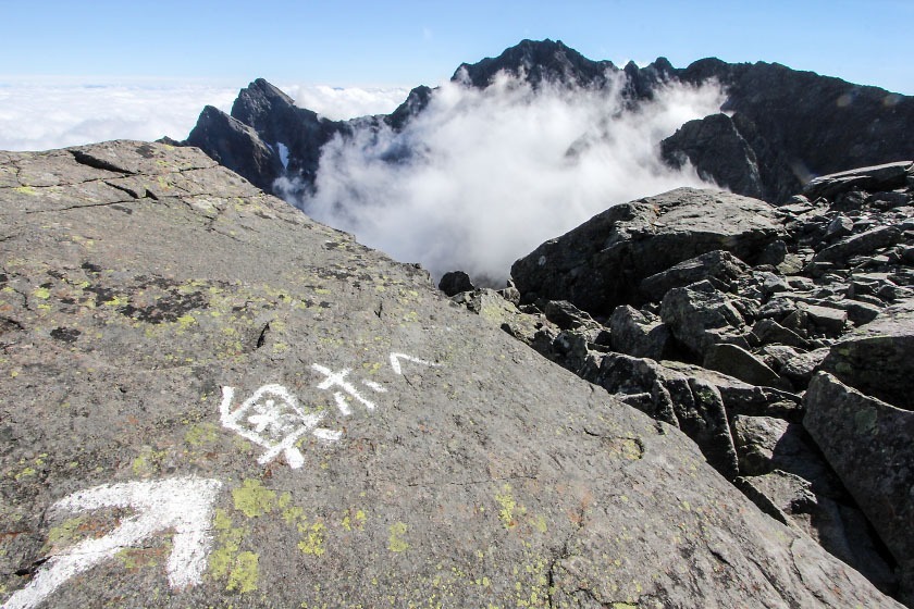
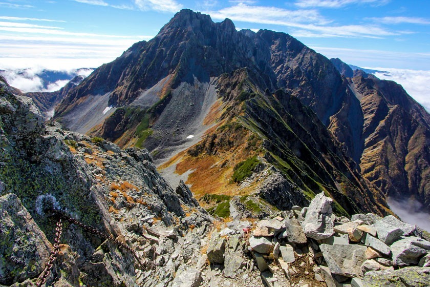
After a couple of the most hair-raising hours of my life, I turned around on top of Kitahotaka-dake (3106m) and looked back at where I came from. Clouds were silently rolling over the ridge below, but I could see as far back as the now-distant spear of Yarigatake. It felt good to earn this unforgettable view.
But I wasn't quite done today. I enjoyed a hot plate of spaghetti on the veranda of the Kitahotaka Goya hut for some extra energy, and I continued my hike south on the ridgeline towards my ultimate prize: Mt. Okuhotaka-dake.
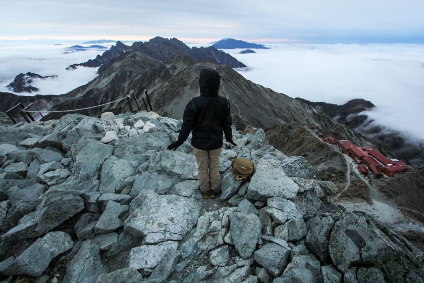
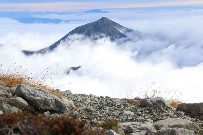
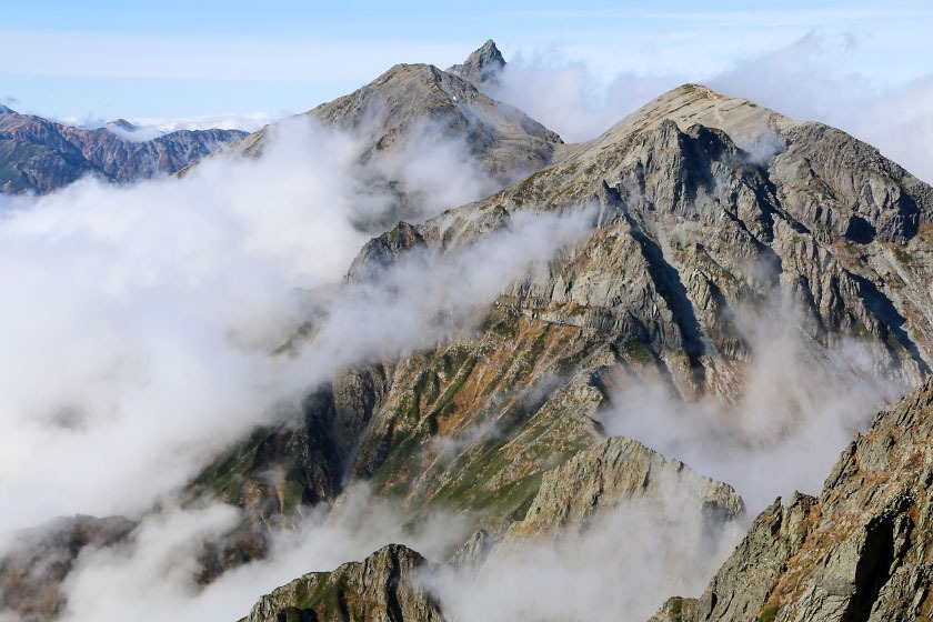
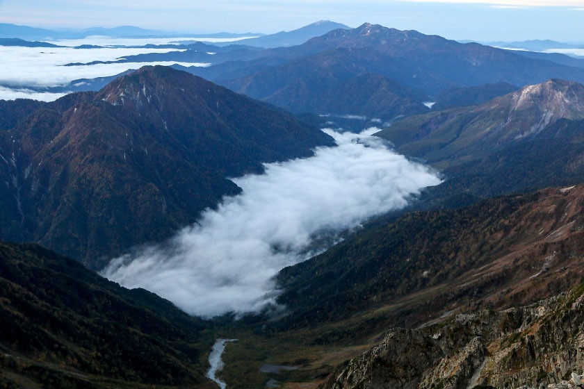
While the Daikiretto often steals the spotlight, the stretch between Kitahotaka and Mt. Karasawa-dake (the ridge's next peak) is no cakewalk. After another 2 hours of knife-edge ridgeline and steep climbing, I finally stood on the peak of Karasawa-dake, where I finally got my first good look at Okuhotaka-dake itself, now surrounded by a sea of clouds.
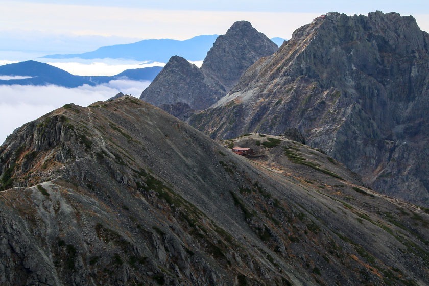
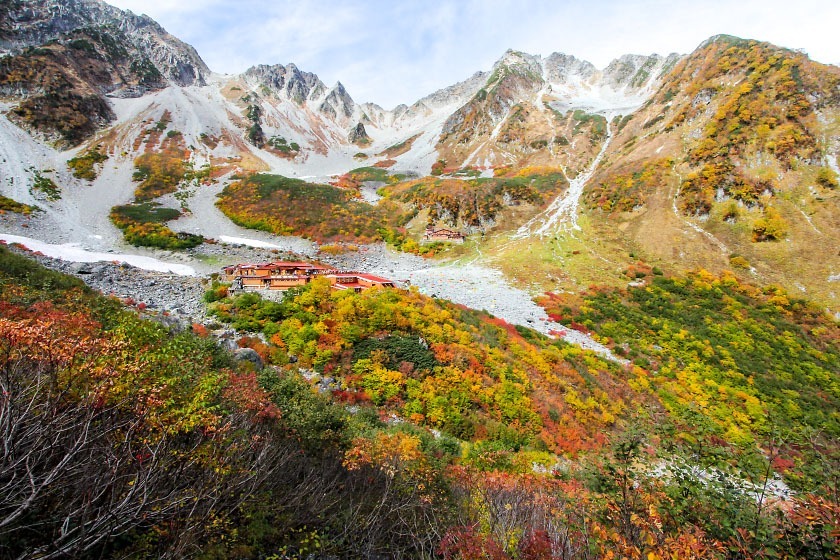
Tired from a long, exciting day, I checked myself in at Hotakadake Sanso and took a seat in one of the comfy chairs around the wood-burning stove in the lounge. This lodge has room for 300 guests and charges 9800 yen with 2 meals (6600 without), or 1000 yen/person for a campsite.
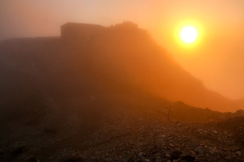
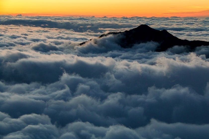
I decided after dinner to scurry back up to the top of Mt. Karasawa-dake (a 15-minute climb) to catch a beautiful sunset over the clouds, and then relaxed with other hikers that evening back in the lodge; a lovely way to end a rewarding day.
Day 3: Mt. Okuhotaka-dake back to Kamikochi via the Karasawa Valley
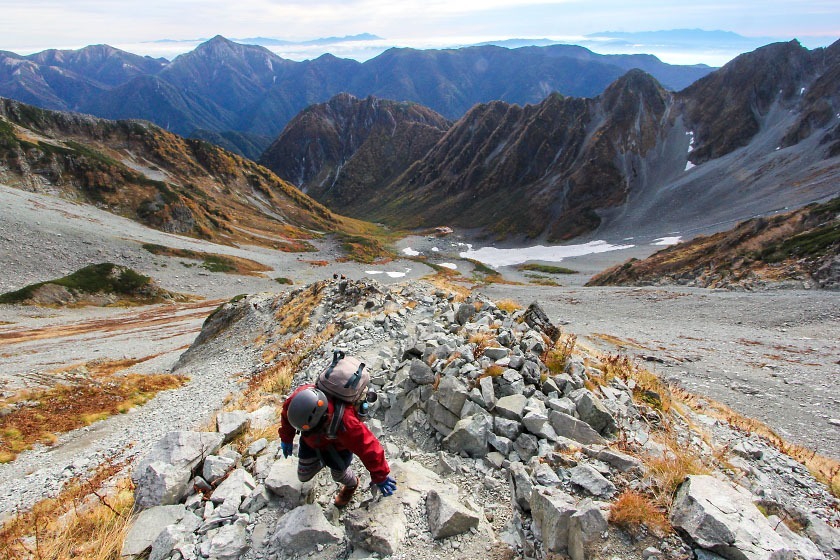
The next morning, I rose again before the sun, donned my headlamp, and started climbing up the side of the massive Mt. Okuhotaka-dake (3190m). In a little under an hour, I was at the summit, just in time to see the sun's light slowly illuminating Japan's third tallest peak.
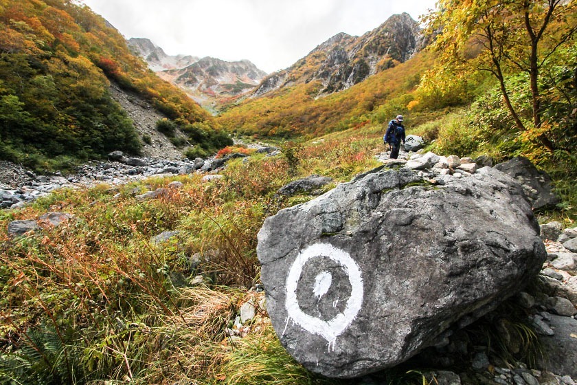
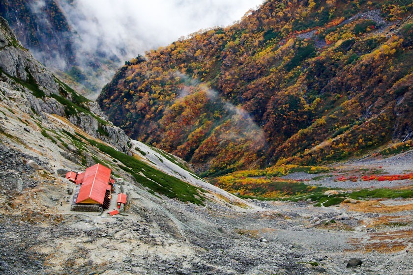
From the summit, I then descended back down to the hut, grabbed my pack, and headed down into the Karasawa Valley directly below the hut. While many people choose to finish their descents from Okuhotaka via the more direct (and extremely steep) Dakesawa Valley that leads directly into Kamikochi, I instead chose the Karasawa for one reason: timing.
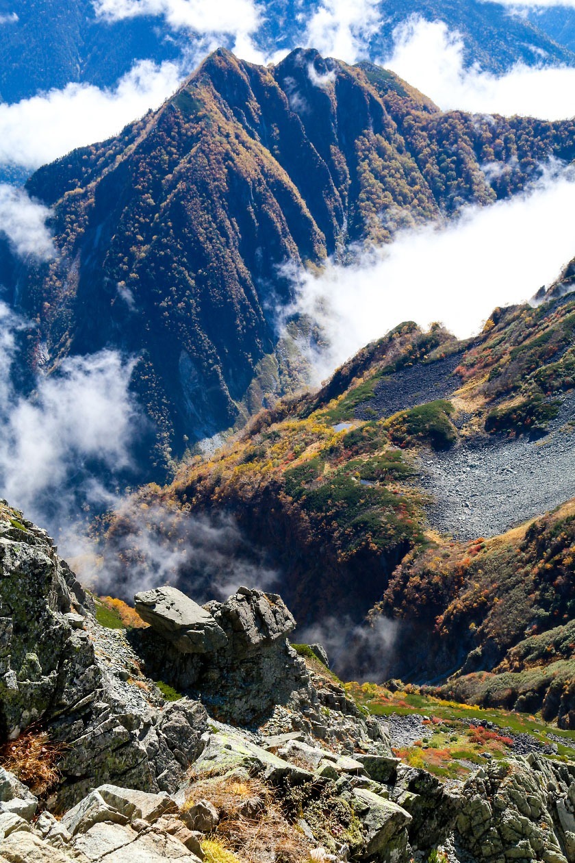
If you have the good fortune to be on this hike around early October, the Karasawa is famous for its brilliant display of autumn colors that cover much of the valley at their peak. Happily, my timing happened to be pretty good: the colors in the valley were lovelier and lovelier as I descended.
See my 2017 autumn color report from the Karasawa for more info on catching the colors here (as well as an alternate, more direct approach to the valley).

After reaching the Karasawa Hyutte, I finally started on my way back to Kamikochi. From the Karasawa, you can choose between two routes: continue on a gradual descent of the valley itself, or, as I chose, an alternate route known as the Panorama Course. The latter takes a higher trail that affords some lovely views of the Karasawa and Kamikochi valleys before dropping elevation relatively rapidly and meeting up with the main trail just beside the Tokusawa Lodge.
Back at the Tokusawa Lodge, I treated myself to a delicious post-descent soft serve ice cream cone with a talented climber/photographer I met on the trail and then made the last hour-long saunter back to Kamikochi.
Standing in front of the famous Kappabashi Bridge where I began two days earlier, I looked back up at the Hotaka massif, remembering that just that morning I was standing on top of those peaks. I'd seen this classic view from the Kappabashi many times before on other visits to Kamikochi. But this afternoon, it was like seeing it again for the first time.
This hike can be done safely during the main hiking season between mid-July and mid-October while there is no snow and all the mountain huts mentioned here are all open. Some huts (including the Yarigatake Sanso) open as early as late April, but expect large amounts of snow through early June, and bring crampons and appropriate snow-trekking gear. All huts (as well as Kamikochi itself) close by mid-November for the winter.
In bad weather, the Hotaka ridgeline can be extremely dangerous: a handful of people lose their lives from falls in this area every year. Use caution and good judgement in inclement weather here or simply postpone or avoid traversing exposed areas in bad conditions.