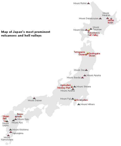
Most of Japan's mountains are of volcanic origin. While volcanoes cause major destruction and inconvenience during their eruptions, many of them are also tourist attractions for their scenic landscapes, hiking trails and relaxing hot springs. Also related to volcanoes are the so called hell valleys (jigokudani), fields of volcanic activity that attract tourists with spectacular steam vents, hot streams and the smell of sulfur in the air.
Most of Japan's volcanoes are found in Hokkaido, the Tohoku, Kanto and Chubu regions, and on Kyushu, while comparatively fewer are found in the Kansai, Shikoku and Chugoku regions. Mount Fuji is the tallest and most famous volcano in Japan. Several prominent volcanoes around the country are nicknamed after Mount Fuji, e.g. Rishiri-Fuji or Aizu-Fuji, because of their similar shape and local fame.
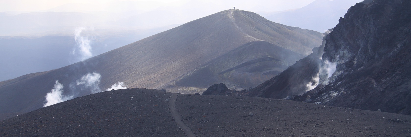
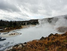
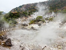
The hell valley at Noboribetsu Onsen
Warning levels
The Japan Meteorological Agency maintains a 5-level warning system for volcanic activity. The scale begins at level one, which indicates a normal state, although visitors should still be aware that they approach a potentially active volcano. Level two indicates a no-entry zone around the crater, while level three prohibits hiking up the mountain. At level four, nearby residents should prepare to evacuate, and level five calls for immediate evacuation due to an imminent eruption threatening residential areas.
See our Disaster Update page for a list of prominent volcanoes that are currently closed.
Last eruption: 2000-8000 years ago Height: 1721 meters
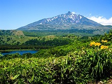
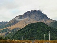
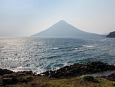
Mount Rishiri, also referred to as Rishiri-Fuji, is a volcano on Rishiri Island about 20 kilometers off the northern tip of Hokkaido. Over 1700 meters tall, it rises impressively out of the sea. Visitors can drive about halfway up the mountain before continuing the rest of the way to the peak on foot. The hike takes a full day and is quite challenging.
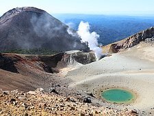
Mount Meakan is an active volcano in Akan Mashu National Park in eastern Hokkaido, offering some of the best volcanic landscape in all of Japan. It has erupted multiple times in recent decades.
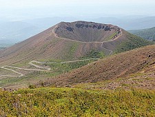
Located in Shikotsu-Toya National Park beside Lake Shikotsuko, Mount Tarumae is one of Japan's most active volcanoes. It most recently erupted in 1981. Hikers can reach the summit in under an hour from a parking lot at the 8th Station and are rewarded with impressive views of the desolate landscape as well as Lake Shikotsuko below. It is possible to circle the crater in about two hours, but visitors are not allowed to enter the interior of the crater due to poisonous gases.
Mount Usu last erupted in the year 2000, causing damage to the onsen town below it. Today, visitors can explore the ruined landscape via walking trails around the new west craters. On the east side of the mountain, the Usuzan Ropeway brings visitors close to the volcano's summit and older crater and offers views over Lake Toya and Showa Shinzan, a young mountain which was created by an eruption in 1944. Showa Shinzan is still actively venting sulfurous fumes today.
On the border between Yamagata and Miyagi prefectures, Mount Zao is known for its spectacular Okama Crater which can be reached in a short walk from a parking lot. In the winter, Mount Zao is a popular site to see snow monsters (frozen trees), but access to the crater is not easily possible.
The Azuma Mountains are a volcanic mountain range along the border of Fukushima and Yamagata Prefectures. The star attraction is Azuma-Kofuji, a miniature version of Mount Fuji that is beautifully symmetrical and can be climbed and circled in about one hour.
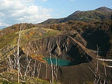
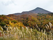
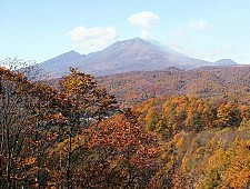
Overlooking Aizu-Wakamatsu in western Fukushima Prefecture, Mount Bandai is nicknamed Aizu-Fuji due to the mountain's former conical profile that resembled Mount Fuji. However, the mountain drastically changed shape during its last eruption in 1888, which also formed the Urabandai area. There are several hiking trails to the summit and around the base of the mountain.
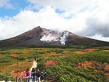
Mount Asama in Nagano and Gunma prefectures is one of the most active volcanoes on Japan's main island of Honshu. There are a number of hiking trails around Mount Asama, however, as of 1972, the crater at the summit is off limits due to volcanic activity. Mount Asama is popularly visited in combination with Karuizawa, a resort town at the base of the mountain.
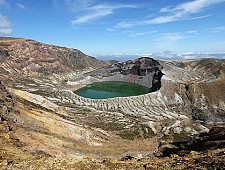
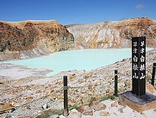
Mount Shirane is a series of volcanic peaks above the town of Kusatsu Onsen in Gunma Prefecture, known for its easily reached, picturesque crater lake. Mount Shirane provides the high quality, sulfuric hot spring waters to the onsen towns of Kusatsu and Manza.
Located on the island of Izu Oshima, the largest of the Izu Islands, Mount Mihara is an active volcano that has seen explosive eruptions. It is possible to hike up to the summit of Mount Mihara and walk around its crater relatively easily.
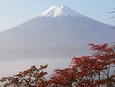
Mount Fuji, the highest mountain in the country, is a beautifully symmetrical volcano and the symbol of Japan. Climbing Mount Fuji is popular during summer with people ascending via four different trails. The Fuji Five Lakes (Fujigoko) region north of Mount Fuji is a popular resort destination with views of the mountain.
Last eruption: 10,000-50,000 years ago Height: 1729 meters
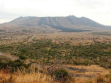
Mount Daisen is the tallest volcano in the Chugoku Region. It is covered by a network of hiking trails of varying difficulty levels. The mountain exhibits beautiful autumn colors from late October to early November, and offers some of western Japan's best skiing in winter.
Mount Unzen is located at the center of the Shimabara Peninsula in Nagasaki Prefecture. A well-done disaster museum at its eastern base commemorates the mountain's most recent eruptions that caused damage and deaths in the 1990s. Heisei Shinzan, now the mountain's tallest peak, was formed in the recent eruptions.
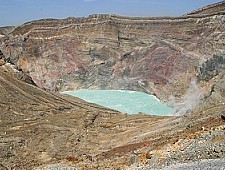
Mount Aso lies in the center of Kyushu and is part of the Aso-Kuju National Park. Its caldera is one of the largest in the world with a diameter of about 25 kilometers and a circumference of over 100 kilometers. Nakadake Crater at the center of the active caldera is easily visited by car or ropeway, but note that it is not always accessible due to volcanic gases or activity.
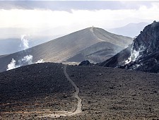
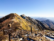
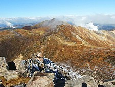
The Kuju Mountains are a range of volcanic peaks in the Aso-Kuju National Park in central Kyushu. They include the Nakadake peak (1791 meters), the highest point on the island. The mountain range is covered by a network of hiking trails that offer spectacular views of the volcanic terrain.
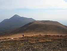
Mount Kirishima is an active volcanic range on the border between Miyazaki and Kagoshima prefectures. Its a popular hiking destination with its many peaks and fascinating volcanic landscape. However, some of the trails remain closed due to the 2011 eruption of Shinmoedake. The onsen town at the base of the mountain offers quality hot spring waters.
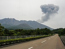
Located in Kagoshima, Sakurajima is one of Japan's most active volcanoes and the symbol of the city. Despite experiencing multiple small eruptions daily, the peninsula is inhabited and visitors can also stay on Sakurajima; however falling ash is often an inconvenience to those living in the area. There are also a few observation points from where the eruptions can be seen from a distance.
Mount Kaimondake, also known as Satsuma-Fuji, is a conical shaped mountain on the Satsuma Peninsula. It is possible to hike up the mountain in about two to three hours and take in the breathtaking views of the surrounding area. In addition to hiking, there are also hot springs and the famous sand baths in nearby Ibusuki.
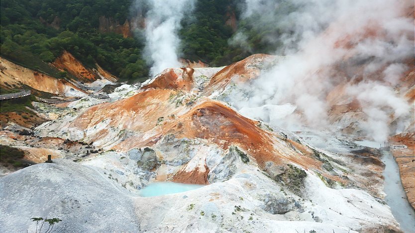
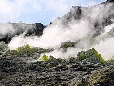
Hell valleys (jigokudani)
Hell valleys are barren, volcanically active grounds with a rocky terrain, hot steam vents, sulfurous streams, bubbling springs and mud pools. Hell valleys earn their name by their desolate landscape, the smell of sulfur in the air and occasional deaths of small animals who fell victim to the heavy, poisonous gases that are emitted by some of the vents and settle just above the ground. Local authorities will close off sections of hell valleys that pose a health risk to visiting tourists.
Mount Iozan lies in the vicinity of Kawayu Onsen in Akan National Park
and was the site of a sulfur mining operation during the Meiji Period (1868-1912). Visitors can walk around the smoking yellow sulfurous vents and eat eggs cooked in heat of the mountain.
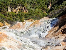
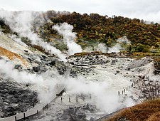
Arguably Japan's most handsome hell valley, the Noboribetsu Jigokudani lies just above the town of Noboribetsu Onsen. It is home to hot steam vents, sulfurous streams and other volcanic activity and serves as the source of Noboribetsu's hot spring waters. Walking trails through the wooded hills lead to additional areas of volcanic activity, including a footbath along a naturally warm river.
Goshogake Onsen is a hot spring in the Hachimantai Mountains. One of Japan's best hell valleys, it lies behind the onsen's sole ryokan and features a two kilometer long, scenic walking route that leads to bubbling mud ponds, hissing sulfur vents and hot water streams.
Tamagawa Onsen is a unique hot spring in Towada-Hachimantai National Park. The hell valley above the ryokan features Japan's single most productive source, the country's most acidic waters, hissing sulfurous vents and a slightly radioactive stone that is believed to have a wide range of health effects. As a result, many people spend hours lying on the radioactive rocks in the hell valley.
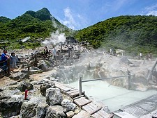
Owakudani is a hell valley in Hakone along the Hakone Ropeway. Visitors can walk along a short trail into the volcanic zone to view the steam vents and bubbling pools. Many people also purchase and eat eggs that were cooked in the naturally hot water. On clear days, good views of Mount Fuji can be enjoyed from Owakudani.
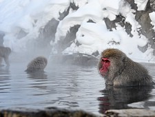
The Jigokudani Monkey Park in Yamanouchi is the main attraction of an otherwise minor hell valley. The park is inhabited by wild monkeys who enjoy bathing in a man-made pool, especially in the winter. While there are not many signs of volcanic activity inside the monkey park, a small sulfuric vent and geyser can be seen along the path to it, and the onsen towns of Shibu and Yudanaka are located nearby.
The Unzen Hells (Unzen Jigoku) are located on the slopes of Mount Unzen. The hells surround the hot spring resort town of Unzen Onsen and provide waters to the ryokan baths around the town. There is a network of walking trails through the hells that allow visitors to see several steam vents, gushing hot springs, mud holes and observation points around the barren, rocky area.
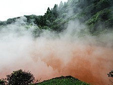
Unlike a typical hell valley, Beppu's hells consist of eight spectacular hot spring pools that are highly developed for tourism. Six of the hells are located in the Kannawa district and two in the Shibaseki district. The eight boiling hot springs range in color from blue to red to white, and offer a variety of tourist attractions within their vicinity.