Land of Volcanoes: Exploring Aso-Kuju National Park

Japan is one of the most volcanically active countries on Planet Earth. Today, over 100 of Japan's volcanoes are considered active, about 50 of which are so active that they are constantly monitored by the government for safety. In many real ways, volcanoes shape the very landscape and identity of Japan.
To truly appreciate this part of Japan's geology, you have to see it for yourself. And few places in Japan display the scale of earth's volcanic power more dramatically than Aso-Kuju National Park.
Located in the middle of Kyushu, Japan's southernmost main island, Aso-Kuju National Park is made up of a collection of volcanic mountains and the unique landscapes surrounding them. From the highly active Mount Aso and its city-sized caldera to the Kuju Mountains, the highest mountains on Kyushu, to the twin-peaked Mount Yufu and the popular hot spring resort town of Yufuin at its foot, the park offers much to explore.
To experience the best of what this place has to offer, I journeyed to Kyushu for a two-day trip, starting in nearby Kumamoto City.
Day 1: Aso
My plan was simple: from Kumamoto City, start by heading straight to Aso, just an hour's drive away, to explore the giant caldera, see its smoking crater as close as possible, and take in the volcanic landscapes. From there, head to the Kuju Mountains to stay the night and do some proper hiking on my second day.
With a lot of ground to cover and just two days to do it in, I decided to get myself a rental car. While it is possible to travel around the park by train and bus, having a car offers a great deal of freedom and time to visit virtually any place you want.
And so I began my drive. Approaching the west entrance of the Aso Caldera, you might be hard pressed to distinguish it from other rural mountain areas in the country. But then, cresting the outer rim, a giant mountain in the middle of a suspiciously shaped valley filled with rice fields and rural towns comes into view. And I started to feel a sense of the scale of this place.
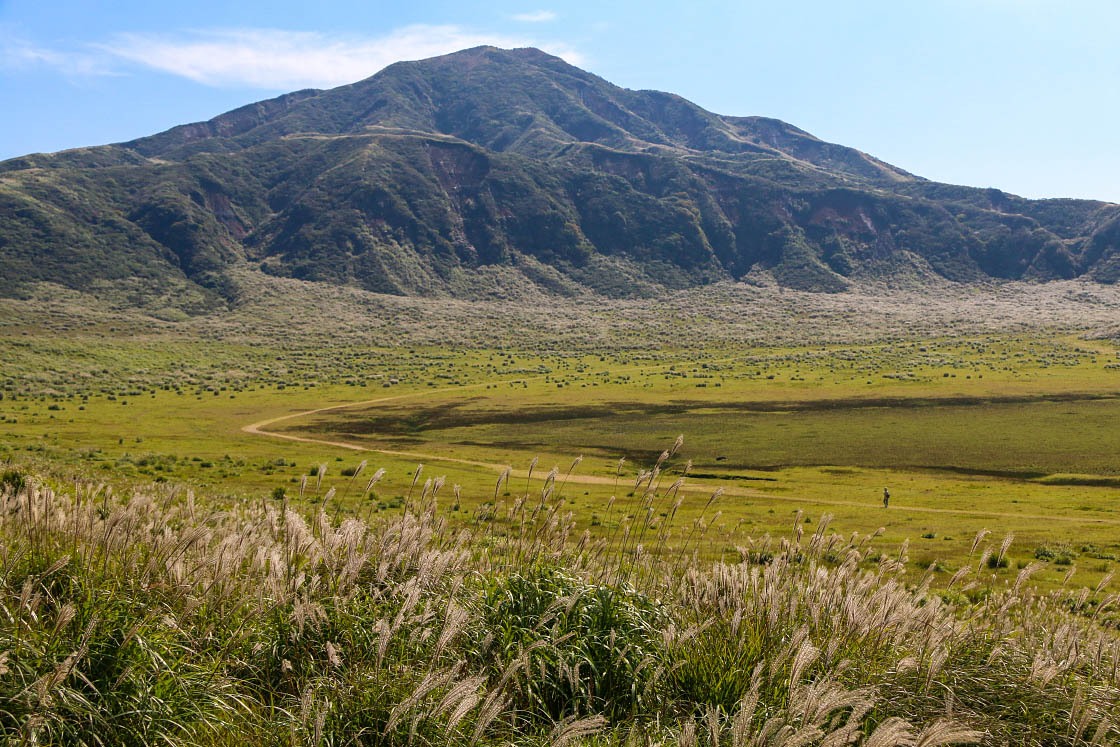
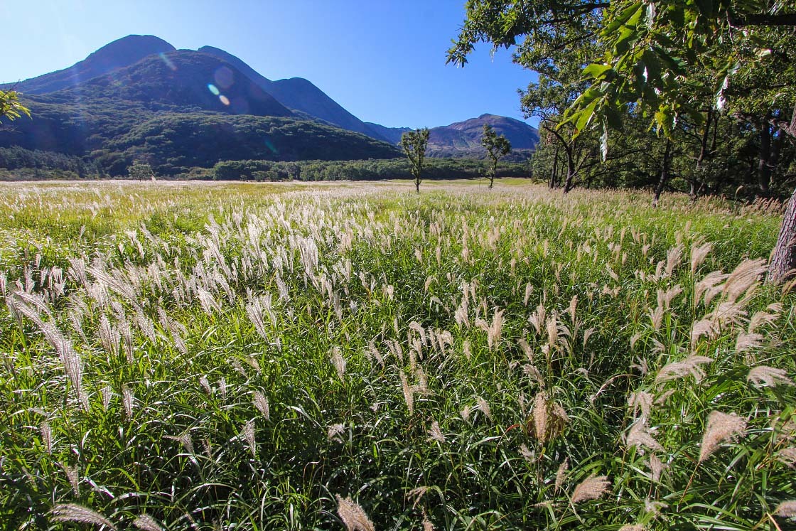
As I made my way deeper into the heart of the bowl-shaped caldera, I found myself driving up the inner mountains at the very center of the caldera. Collectively, these peaks are known simply as Aso-san, or Mount Aso.
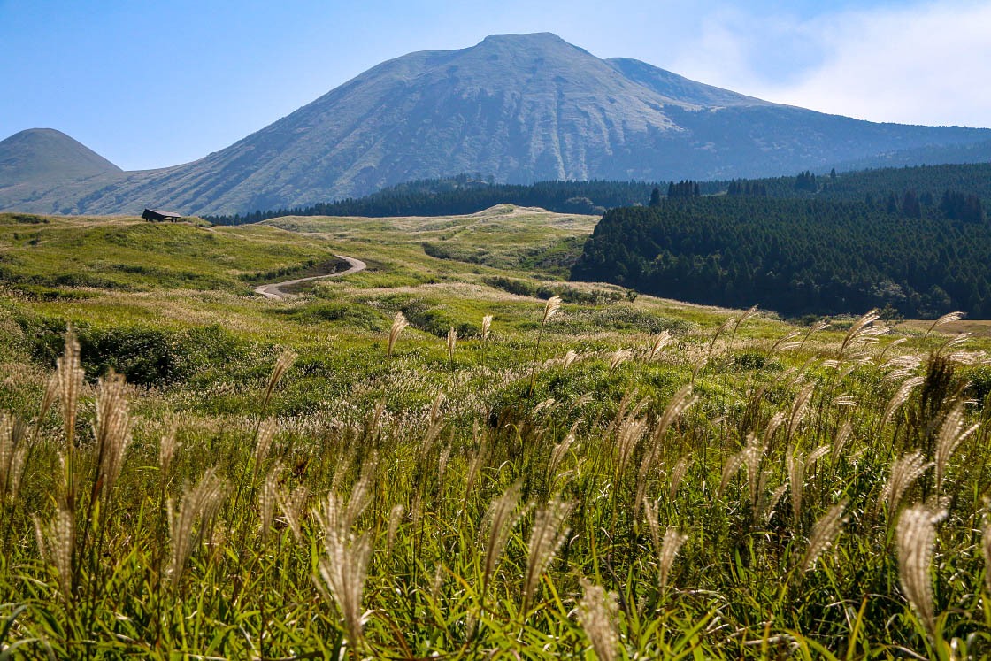
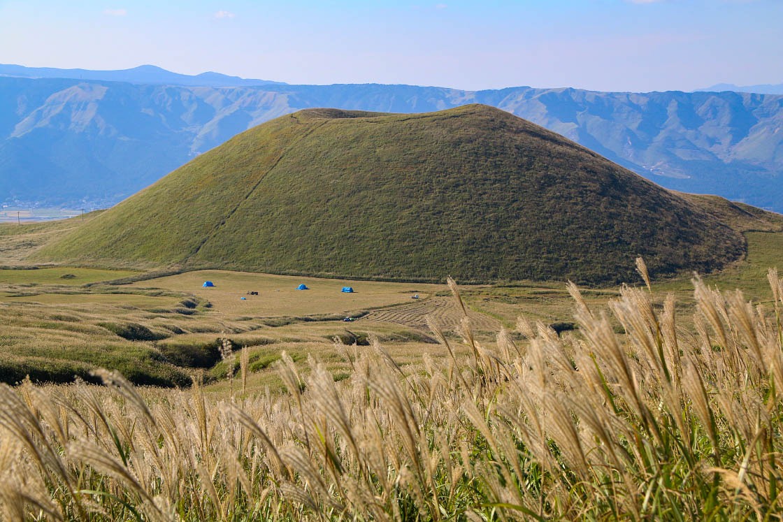
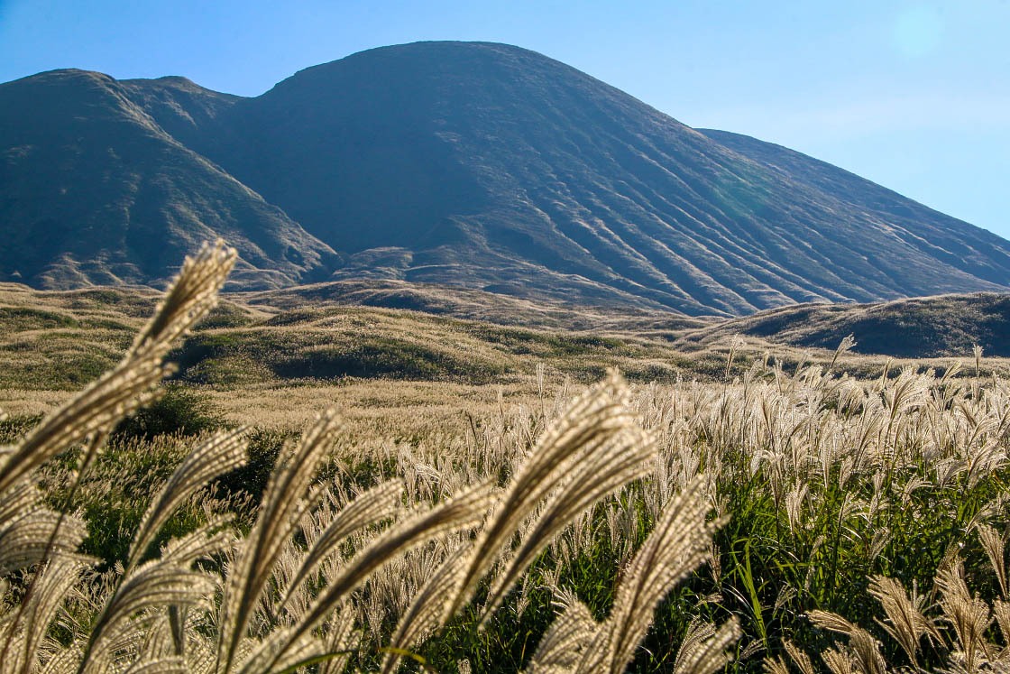
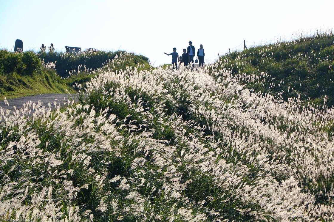
The most striking feature to me as I drove was the distinct lack of trees. Unlike so many other mountains in Japan, the mountainsides here were instead covered almost entirely in grasses, including an abundance of susuki (pampas grass), which on this October day were glowing a whitish gold in the morning light.
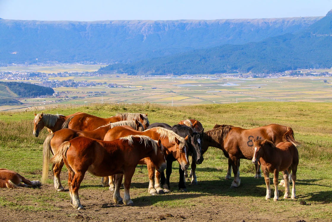
Also dotting the large meadows were horses and cattle, grazing or resting in the grasses.
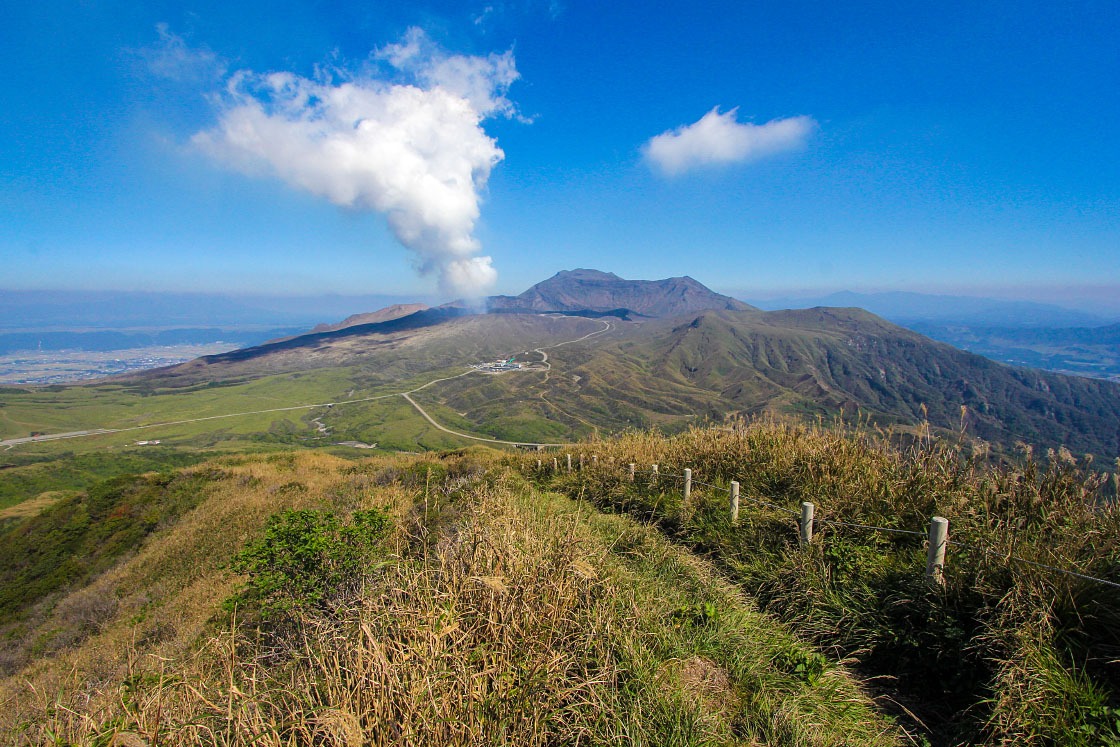
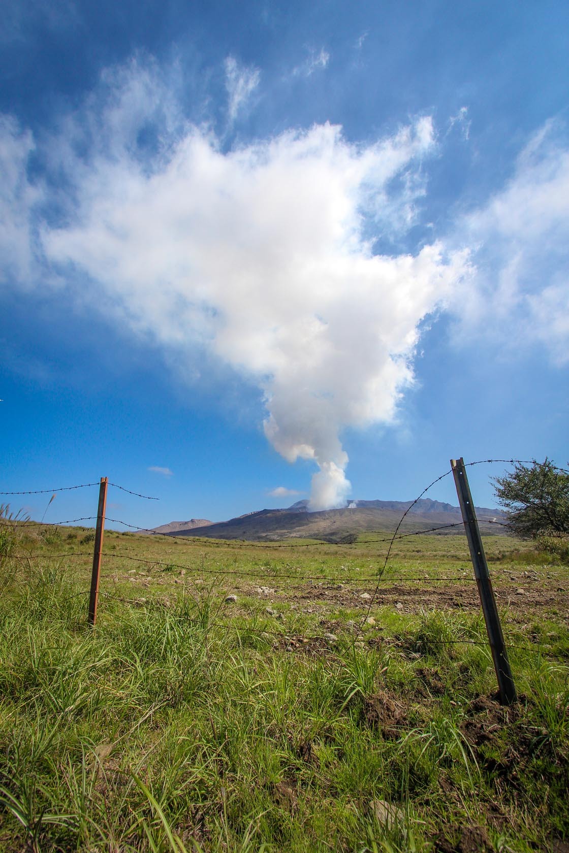
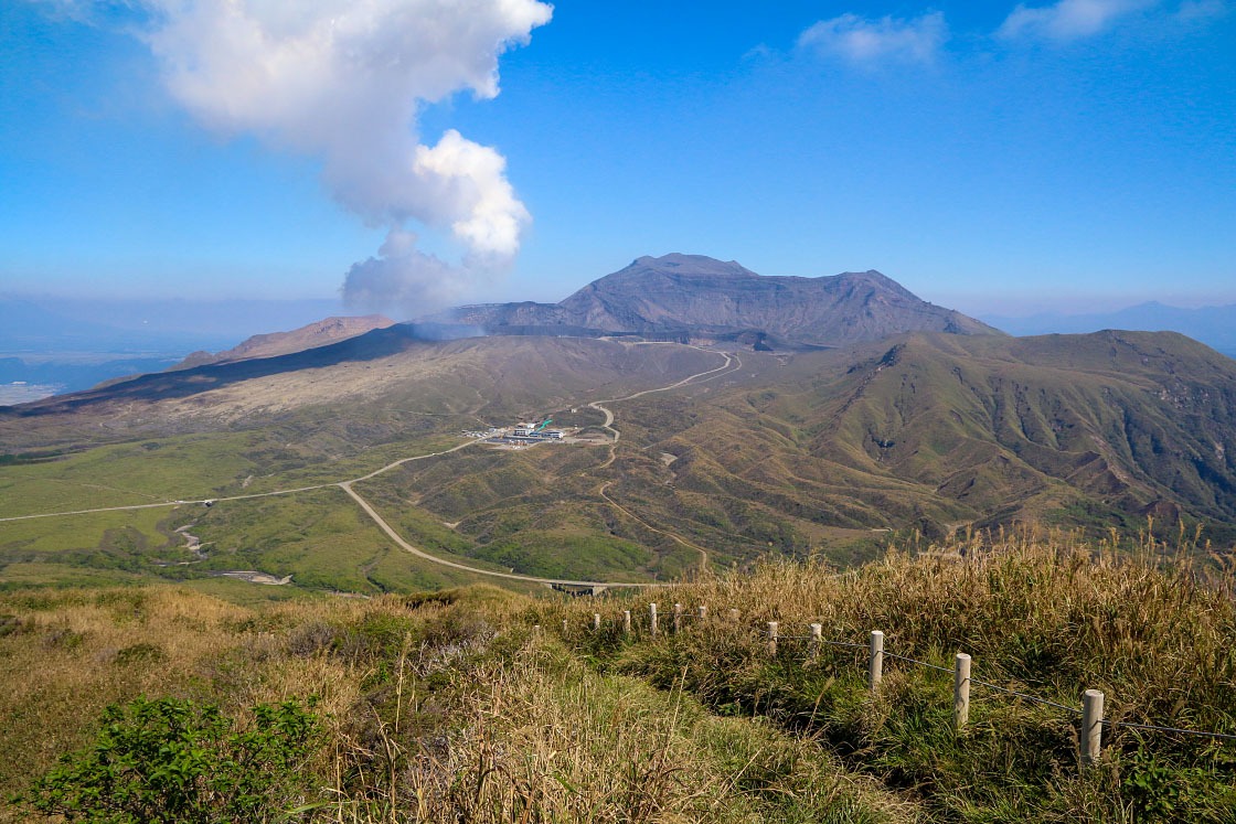
After driving further and further up, I finally turned a corner to see right ahead of me a giant billow of white smoke rising from a dark greyish brown mountain in the distance. I'd reached the upper area of the central cone of Mt. Aso, and was staring at the fumes of a very active volcanic crater of Mt. Naka-dake.
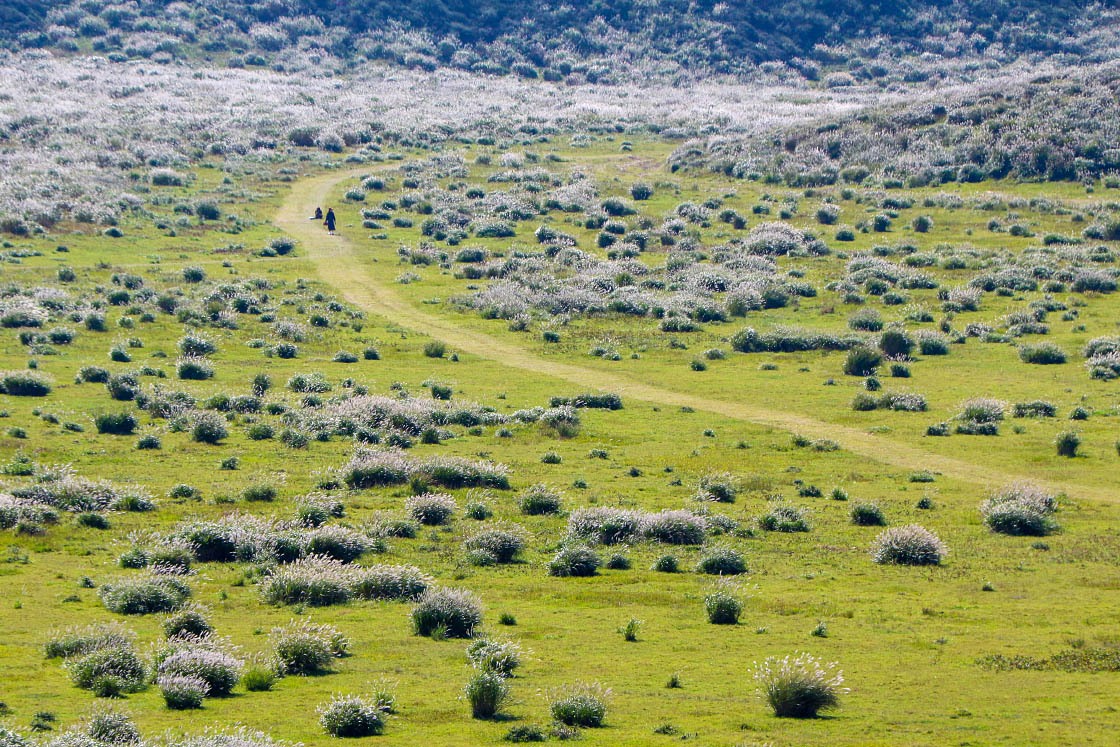
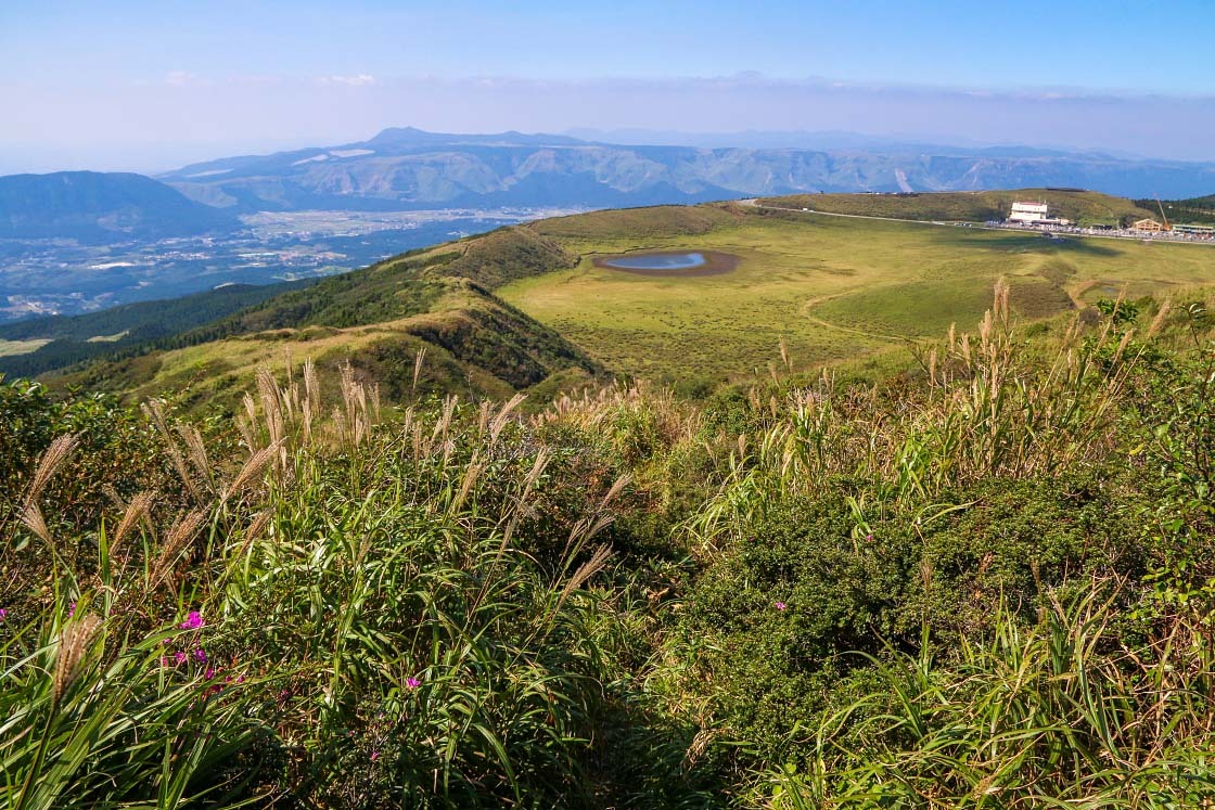
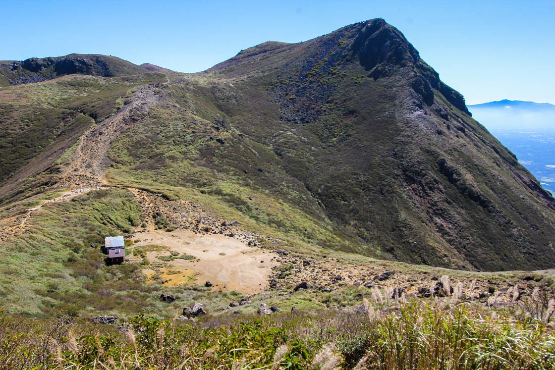
Atop the central cone of Aso is a large open highland. In the center is the smoking Naka-dake crater. But just before it lies a serene, flat, grass-covered field known as the Kusasenri. About 27,000 years ago, a titanic eruption larger than any other among Aso's volcanic cones ripped apart the mountain here to form this now peaceful pasture.
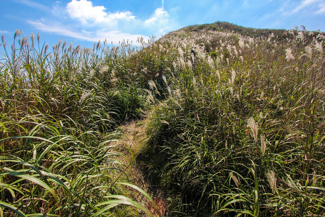
Wanting to take some time to explore this uncannily quiet place, the prominent peak called Mt. Eboshi towering above the field called my name. So I grabbed my hiking shoes and headed across the field toward the mountain.
About 40 minutes later, I found myself looking down over an incredible view of the landscape.
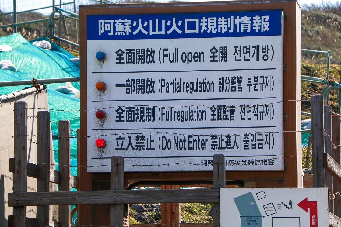
After my short hike, I got back in my car and headed as far inward as I could go: the outer edge of Naka-dake crater. It was here I was reminded just how real this volcano is. Poisonous gas and even the constant threat of eruption is a real danger in the area immediately around this crater. When the threat becomes too high, the entire area is often completely closed off to visitors for safely.
On the day I visited (in October 2019), significant volcanic activity had forced the closure of the area for many months, with a no-entry zone with a 1-kilometer radius extending from the center of Naka-dake.
While the closure is expected to be lifted, even when the area is accessible, gases around the actual crater can be very intense and potentially dangerous and shouldn't be taken lightly. Before visiting, you can check current warning levels and access conditions at the Aso Volcano Disaster Prevention Council website.
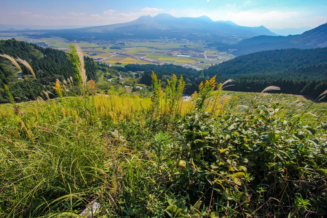
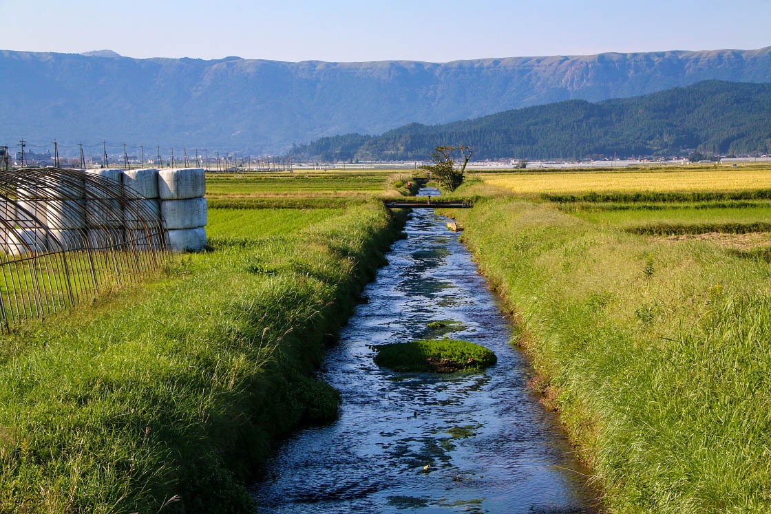
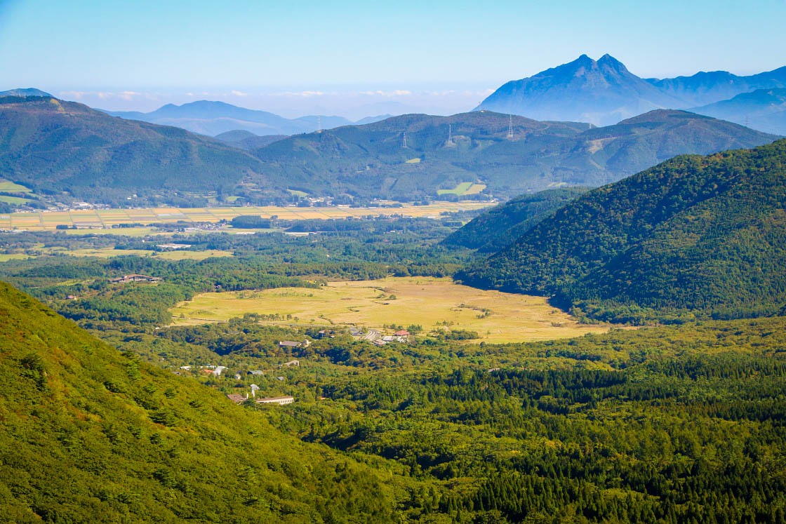
From the Naka-dake crater I decided to go somewhere I could get a sense of just how big the Aso caldera really is. I headed back down the mountain and back across the caldera floor, this time heading to the northern rim, driving through the small town and farm fields of Aso.
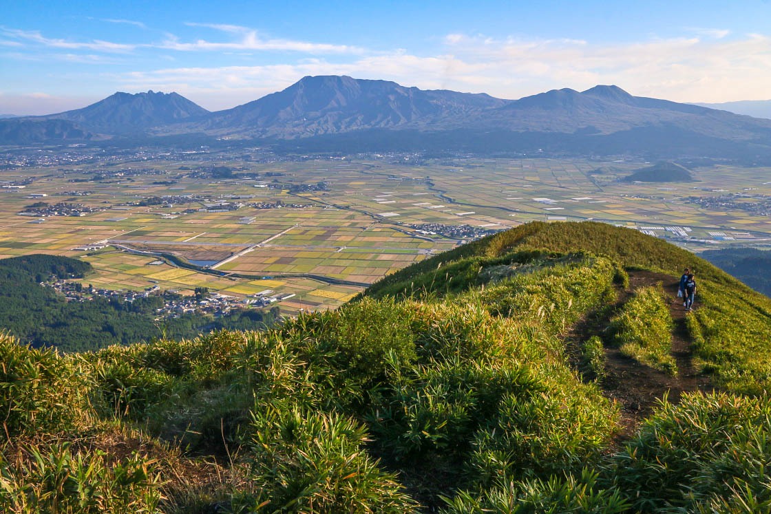
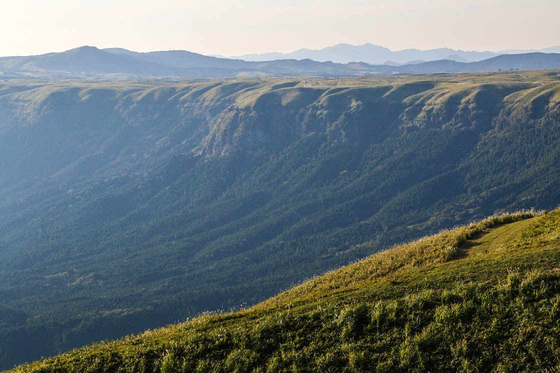
About one hour later, I found myself on top of the outer rim of Aso at an impressive lookout point called Daikanbo.
From here the sense of scale began to sink in. Below me stretched out a patchwork of rice fields and clusters of buildings with the hulking mass of Mt. Aso in the center. And wrapping around the entire city and mountain peaks ahead of me was the wall of rock upon which I was standing.
The entire place seemed punch out of the earth as if by the fist of an inconceivably enormous giant. Though contemplating its true origin--the mass of this entire area sinking into the earth as the vast magma chamber beneath it collapsed in sun-swallowing explosions of fire and smoke--may be even more humbling.
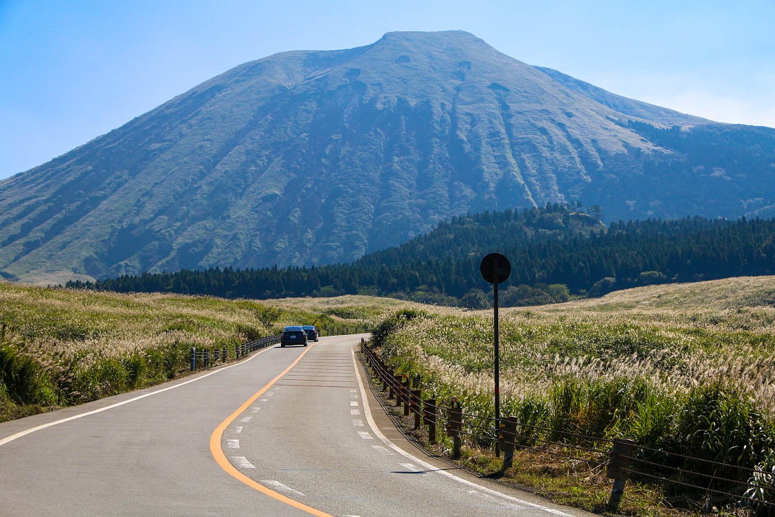
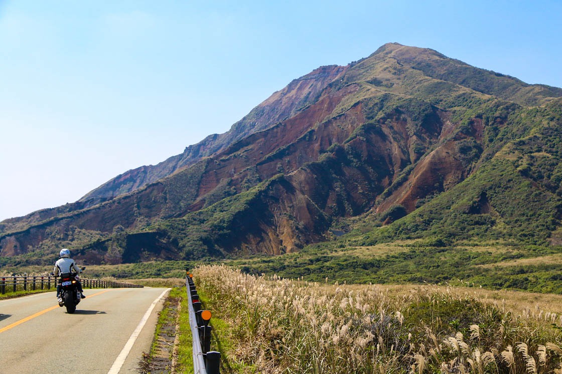
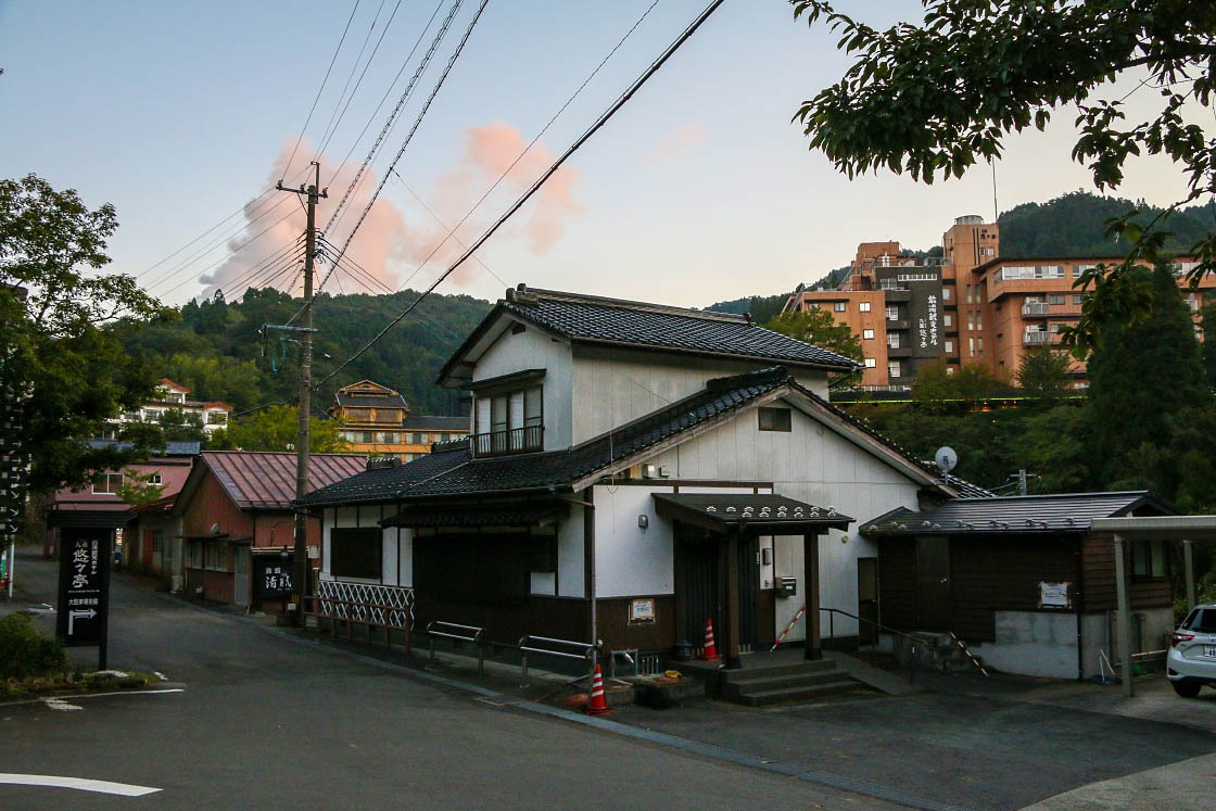
From the rim, it was time to head to my accommodation for the night. A 40-minute drive north along the gorgeously scenic Yamanami Highway, which runs the entire northern two-thirds of the national park, took me up the rolling foothills hills of the Kuju Mountains. Amongst the mountain valleys I found the hot spring resort town of Sujiyu Onsen. Not far away, a billow of geothermal steam towered above the small town, a sign that I was still deep in the interior of this volcano-peppered national park.
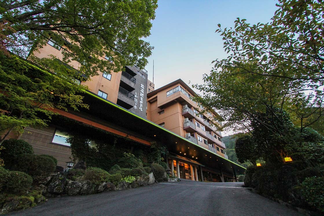
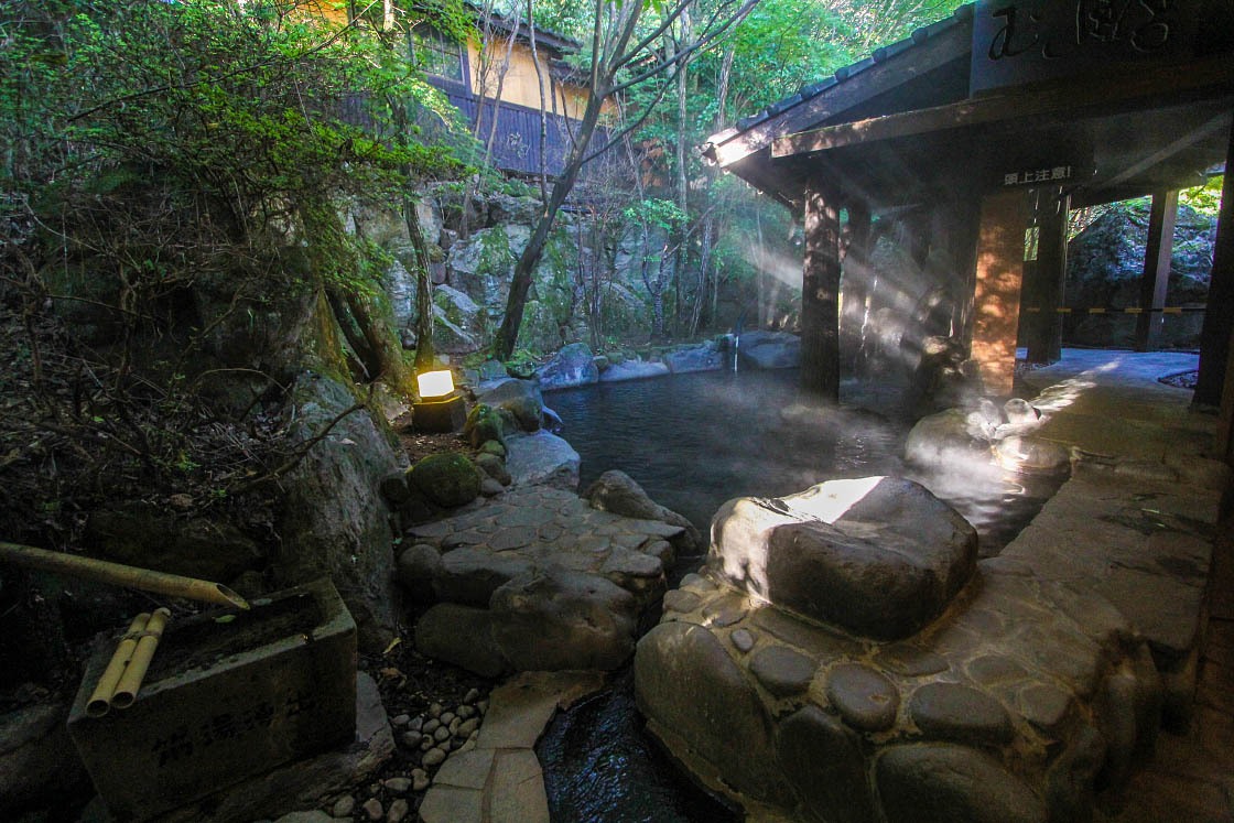
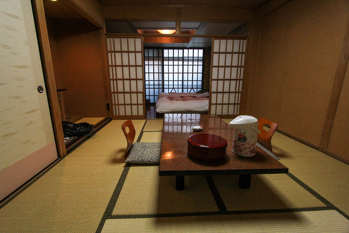
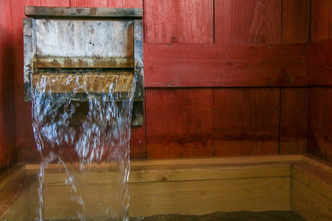
Of course, with volcanoes naturally come hot springs, and dozens of famous onsen sources are located within or nearby the bounds of the park. And perhaps the most rewarding way to enjoy this unique natural experience is by staying at an onsen ryokan, or traditional Japanese inn.
My ryokan for the night, Sujiyu Onsen's Kokonoe Yuyutei, offered a great chance to bath in the town's hot spring water, with several indoor and outdoor baths I could dip in at my leisure--including a small private outdoor bath in my own room!
Day 2: Kuju Mountains
After a relaxing night at a Sujiyu Onsen, I was refreshed and ready to take on a new day's challenge: a hike amongst the peaks of the Kuju Mountains, the tallest mountains in Kyushu.
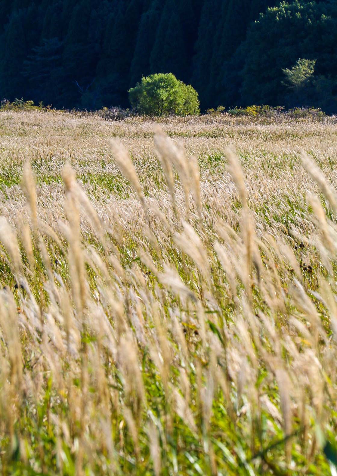
I started my day at the Tadewara Wetlands, just a 15-minute drive away from Sujiyu Onsen. The marshland, lying at the foot of the Kuju Mountains, seemed to be in constant motion as the endless waves of tall susuki grasses here were blowing in the wind and shimmering in the morning light.
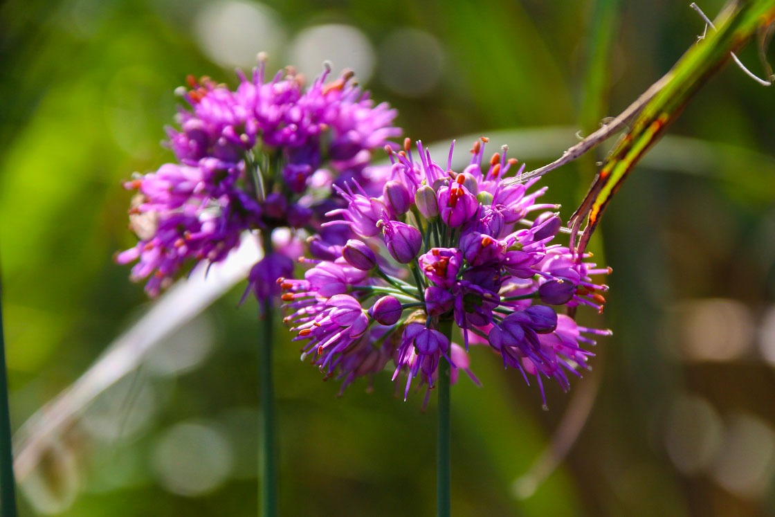
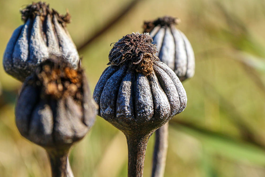
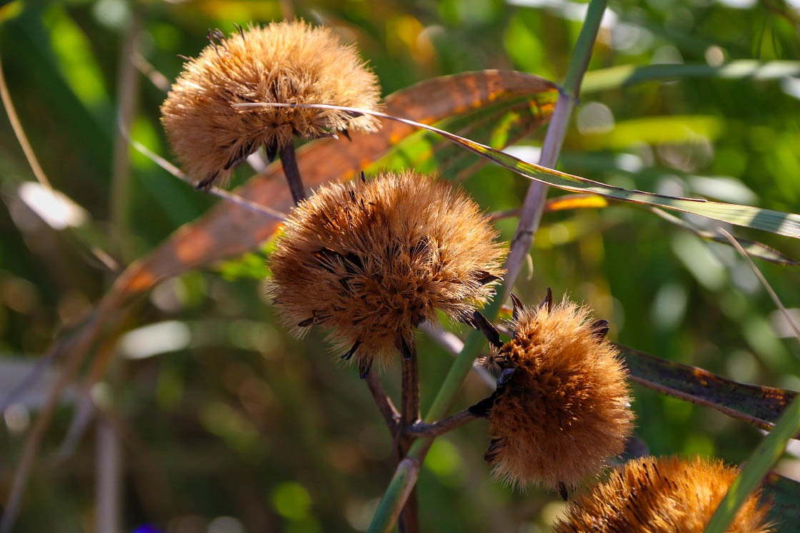
Walking across the convenient boardwalk trails, it was fun to spot other varieties of plants hidden amongst the grasses, too.
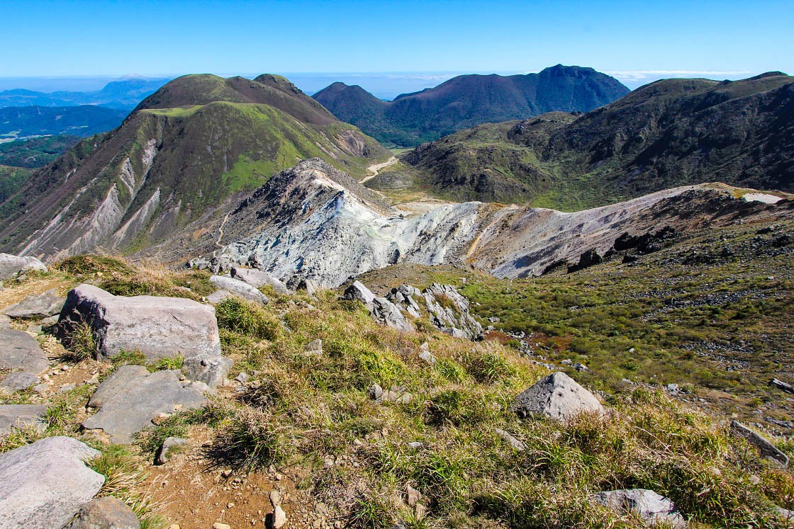
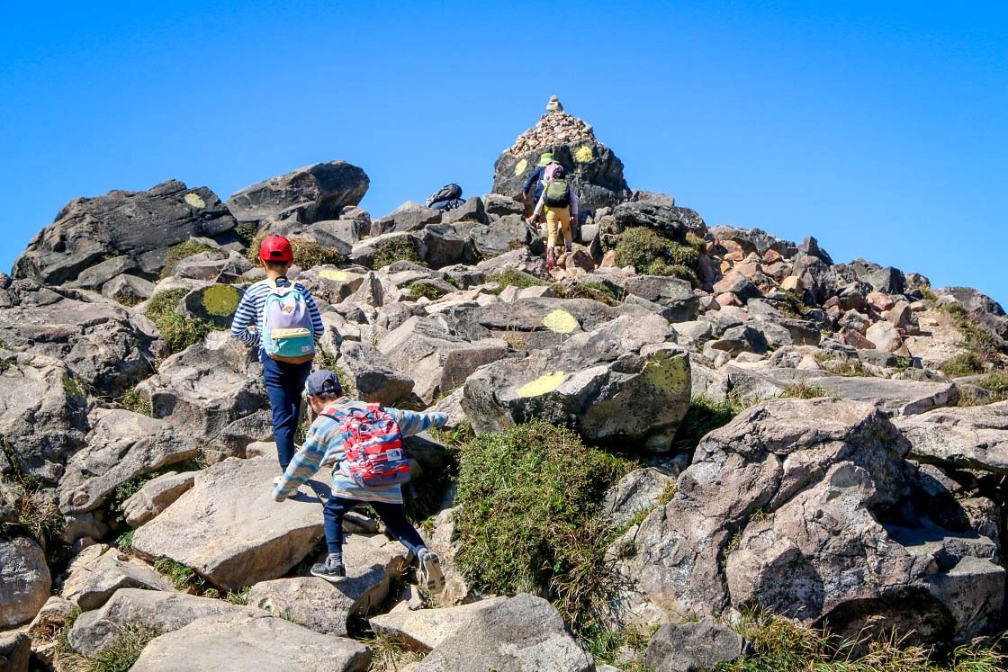
From Tadewara, I drove about 10 minutes south back on the Yamanami Highway to the Makinoto Pass, a convenient trailhead for the tall peaks of the Kuju Mountains. From the trailhead, it wasn't more than about an hour of climbing until I found myself on the top of mountain ridge line.
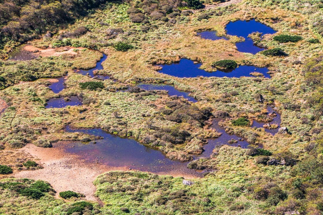
Once on the ridge, the beautiful mountain landscapes rolled out in every direction as I explored the trails amongst the peaks.
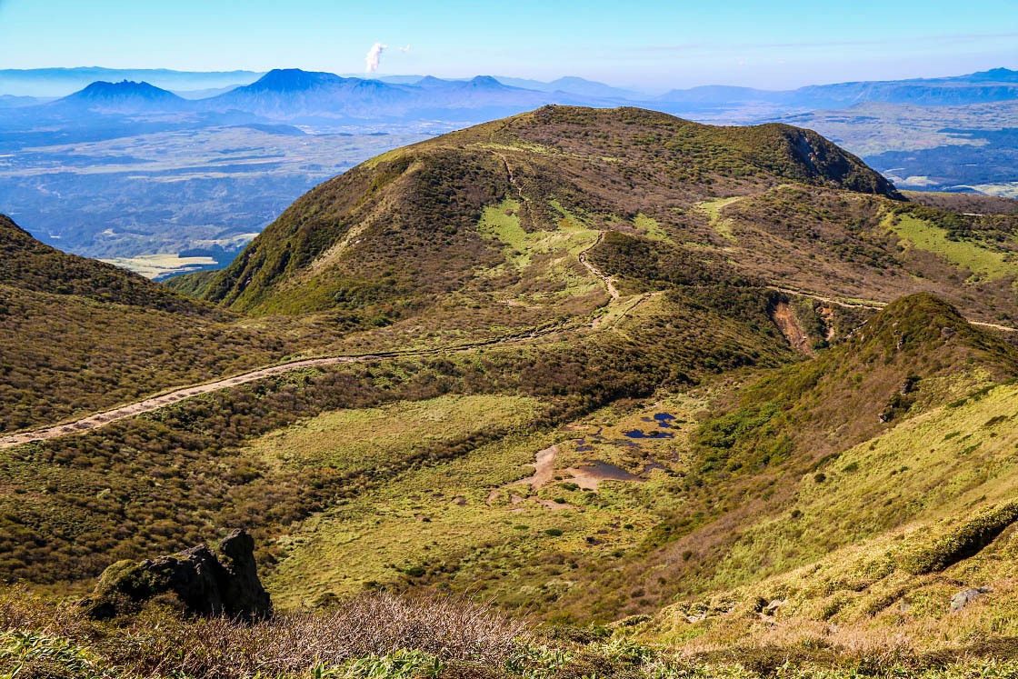
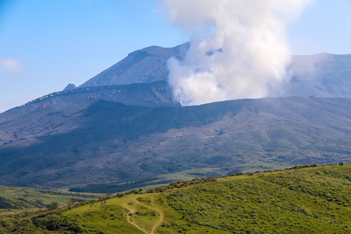
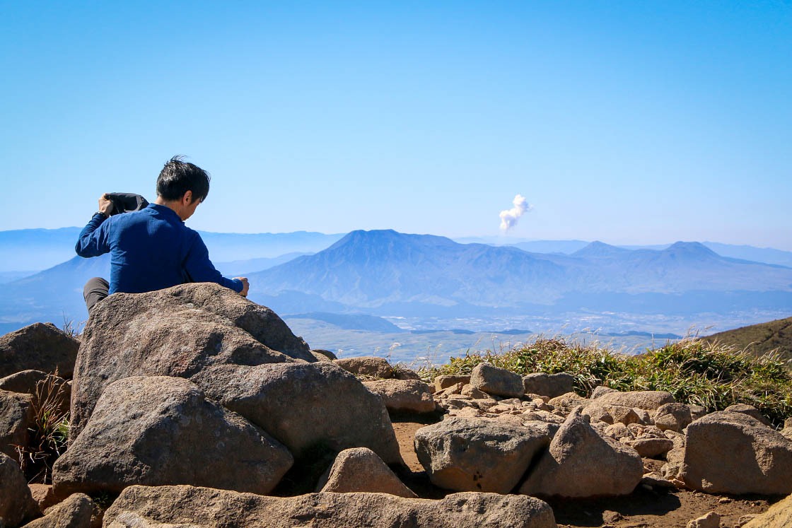
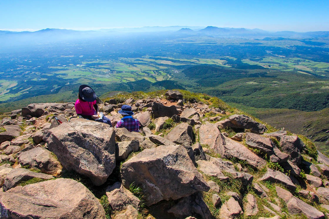
While one could easily spend a full day hiking here (or longer), my time was getting short, so I set my sights on the eponymous Mt. Kuju itself. From the summit, the expansive views south back over the entirety of Aso were breathtaking, with the smoke rising from Aso's Naka-dake still visible nearly 50 kilometers away.
Discover more
- Learn more about Aso-Kuju National Park →
- Learn more about the National Parks of Japan →
- Learn more about the Kumamoto Prefecture →
- Learn more about the Oita Prefecture →